Canazei Ski Map: Decode Sectors, Lifts and Sellaronda Links
Read the Canazei piste map with confidence: Belvedere and Col Rodella sectors, the 3S lift, Sellaronda links and where to pick up a paper map.
On this page
The Canazei piste map can look busy at first glance because it stitches together two villages, two access lifts and a network of linked circuits that runs far beyond the town. Read it as a set of layers rather than a single diagram, and the planning decisions become straightforward: which valley station you start from, which sector you ski first and how far you commit to the linked tours.
This walkthrough covers the Belvedere and Col Rodella sectors in detail, the 3S gondola from Campitello, the Sellaronda links through Passo Pordoi and Passo Sella, and the alternate circuits marked on the map. Separate pages of the Canazei ski guide cover pass products and booking logistics once you know where you want to ski.
What the Canazei Ski Map Actually Covers
The area is best understood as one connected ski domain above two villages: Canazei and Campitello di Fassa. The Belvedere and Col Rodella sectors are joined at altitude by lifts, so you can move between them on snow without returning to the valley floor. Treat them as a single area for planning, but note which side each run returns to. If you enjoy decoding a piste map before you ski, our La Thuile piste map guide offers a useful comparison for reading linked sectors.
Beyond the local sectors, the same map sheet carries the Sella and Pordoi passes, the Sellaronda circuit and the wider Dolomiti Superski network. That is why a Canazei map doubles as a regional planning tool. Before you fix a route, decide whether your day is a local sector day or a long linked-circuit day.
The Val di Fassa Lift winter map is the company's own reference for slopes, lifts and the major tours, and it is available both as a downloadable PDF and as an interactive version. Download the PDF before you travel and keep the interactive version on your phone for the mountain.
The Two Valley Gateways: Canazei–Pecol and Campitello–Col Rodella
Canazei and Campitello each have their own route onto the mountain, and your choice of base changes the first twenty minutes of every ski day. From Canazei village centre, the Canazei–Pecol gondola starts the climb towards Belvedere. Its valley station sits right in town, which makes it the natural choice if you are staying in Canazei rather than driving to a lift.
From Campitello, the 3S cable car climbs to Col Rodella. Val di Fassa Lift describes it as the most modern tri-cable gondola in Italy, with 18 cabins of 30 places making the ascent in about six minutes. That speed matters if you are based in Campitello and want to reach the Sellaronda early.
If you are staying between the two villages or further down the valley, pick the gateway that matches your skiing rather than the shorter drive. Canazei–Pecol puts you on the Belvedere side first, while Campitello–Col Rodella drops you straight into the Col Rodella runs and the 3-Tre. Decide this when choosing accommodation, because it shapes the whole week.
Reading the Altitude Bands on the Map
The map's altitude range is the quickest way to orient yourself. Canazei sits at about 1,460 m, Campitello at roughly 1,440 m, and the lifts climb to Col Rodella at 2,485 m and Col dei Rossi at 2,423 m. Intermediate stations such as Pecol, Pian Frataces and Alba di Canazei break up the ascent and give you bail-out points.
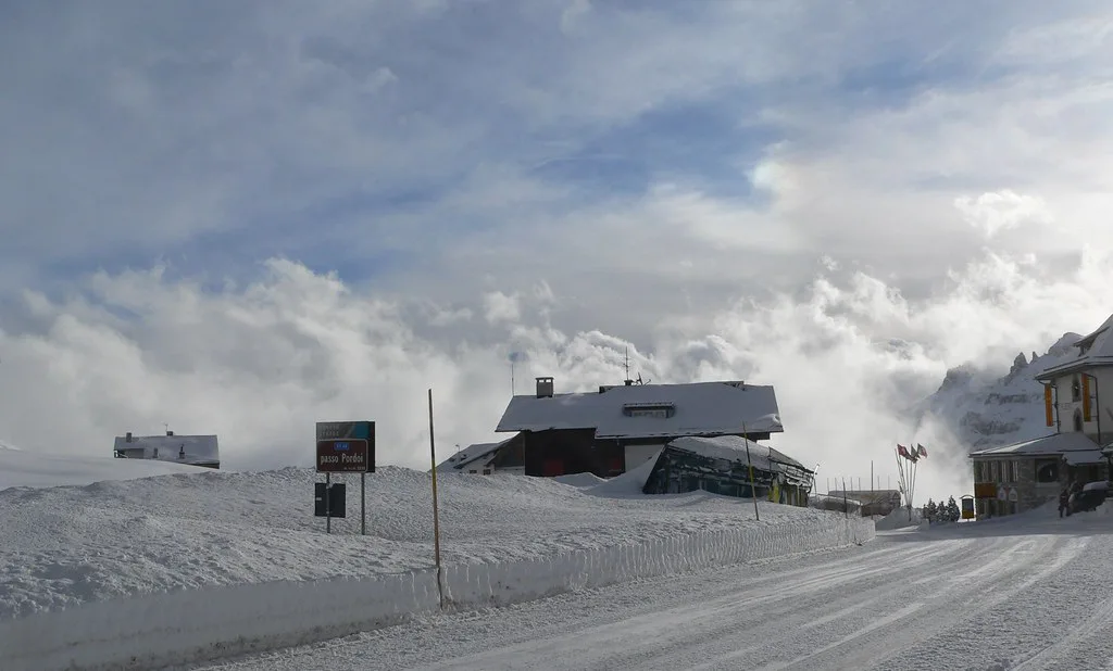
At the top of the range, the Sass Pordoi cable car from Passo Pordoi reaches the Rifugio Maria at 2,950 m, the viewpoint known as the Terrace of the Dolomites. It is a four-minute ascent from Passo Pordoi at 2,239 m. Skis are optional up there; the cable car also carries non-skiers, which makes it a good rest-day objective.
Use the bands to judge how much vertical a run covers and how much time a return to the valley costs. A descent from Col Rodella to Campitello is a full block of vertical, whereas hopping between Pecol, Pian Frataces and Belvedere keeps you in the mid-mountain zone. That distinction is what separates a relaxed cruising day from a circuit day.
Belvedere Side in Detail: Lezuo, Pecol–Col dei Rossi, Sass Becé and Kristiania
On the Belvedere side, the main vertical comes from the Lezuo chairlift, which serves the Belvedere 1 and Belvedere 2 runs above Pecol. From the top of the Belvedere lifts you can traverse across to Col dei Rossi and pick up the red descents towards Pian Frataces. This is the sector where most Canazei-based skiers spend their first morning.
The Sass Becé and Kristiania lifts open up the upper bowls and give access to the black Diego and the timed course. The Vernel, Variante Marmotte and Variante Il Muro runs also start here, so this sector is where stronger skiers gravitate. If you are cruising, the blues and reds back towards Pecol are the friendlier way down.
The Pecol–Col dei Rossi cable car and the Alba–Col dei Rossi cable car are your two direct routes to the 2,400 m ridge, and both are marked as open to non-skiers. That makes them useful for mixed groups where someone wants a mountain lunch rather than a full ski day. Check the live lift status before committing to either route.
Col Rodella Side in Detail: Salei, Rodella–Des Alpes and the 3-Tre
Above Campitello, the Col Rodella sector funnels through the Pradel–Salei gondola and the Salei–Rodella chairlift. From Rodella, the 3-Tre drops all the way to Pian de Frataces, a long descent that the resort markets as a signature run. Plan it as a full block rather than an add-on to another circuit.
The Rodella–Des Alpes chairlift and the Norei–Cinque Dita chairlift add shorter, sharper laps on the Col Rodella flank. The Ciavazes–Grohmann chairlift serves the Salei side, giving you a compact loop when the higher lifts are busy. These short chairs are the practical answer to a crowded morning on the main gondolas.
The sector is also where the ski schools and beginner areas are concentrated. Most runs are red, according to the resort, mixing wide sunny descents with more technical terrain. That mix means you can split a group across the sector without anyone committing to a black run by accident.
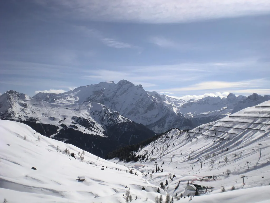
Where the Map Leaves Canazei: Sellaronda, Pordoi, Sella Pass and Arabba
The Sellaronda is the circuit that turns the local map into a regional one. It runs in two directions, marked orange clockwise and green anti-clockwise, and both are shown as status lines on the live page at fassa.com. From Canazei you can join it at Col dei Rossi and carry it towards Passo Pordoi and Arabba or towards Passo Sella and Val Gardena.
The Pordoi side connects to Arabba through the Maria chairlift and the Fodom gondola, so a clockwise loop from Canazei takes you out of Val di Fassa entirely. The Sella Pass side links to Val Gardena along the Col Rodella ridge. Both directions are long days, so start early and watch the return lifts.
Distinguish clearly between the local lift network and the Sellaronda when you plan a pass. The map shows both, but the circuits run through several ski areas, so your pass needs to cover the whole loop rather than just Canazei. The separate guide to Canazei ski passes sets out how the coverage options differ.
Beyond the Sellaronda: Skitour Panorama, Sass Becé Tour and the Rosengarten Ronda
If the full Sellaronda looks like too much commitment, the map marks shorter circuits as alternatives. The Skitour Panorama circles Val di Fassa in two directions, yellow and red, and the Sass Becé Tour runs as its own loop. Both give you a mapped route without the crowds and distance of the big circuit.
The Skitour Panorama area is the one often described by its 70 km of slopes and 38 lifts. That figure covers the wider Val di Fassa network rather than Canazei's Belvedere and Col Rodella alone, so use it as a scale indicator, not as a local count. The Rosengarten Ronda towards Catinaccio is a third option marked on the same sheet.
Each of these circuits works best when you pick one and commit to it. Trying to combine two in a single day tends to leave you racing lifts rather than skiing. Check the live status on each circuit before you set out, because the map shows planned routes, not current conditions.
Which Sectors Suit Which Ability
Beginners are best placed on the lower slopes above Canazei and Campitello, close to the ski school meeting points. The Canazei ski school runs dedicated beginner arrangements and publishes its meeting points and times on its site. The wider green and blue runs around the valley stations are the natural first-day territory.
Intermediate skiers have the widest choice, because most of the Belvedere and Col Rodella runs are red. The long descents from Col dei Rossi and Col Rodella give you full-verticals without the steepness of the blacks. A relaxed plan is to spend the morning on one side and the afternoon on the other.
Advanced skiers should chart the black runs deliberately: Diego at Belvedere and the 3-Tre race line from Col Rodella down to Pian de Frataces. The 3-Tre runs for about 3,303 m, so it is a proper descent rather than a short steep. Add the timed course and the Funcross lines on the same sector for a short, sharp afternoon.
Freeride and Non-Ski Markers on the Map
The map includes markers for things you would otherwise miss: the Sass Pordoi cable car, the Lift & Walk routes, the snowparks and the FunArena. The Lifts for non-skiers and Lift & Walk pages sit on the Val di Fassa tourism site and set out which lifts accept walkers. That makes the map useful for a mixed group planning a shared lunch stop.
Sass Pordoi is the map's freeride anchor, reached on foot or by cable car and known for its high-altitude viewpoint. Treat it as a separate excursion from the piste-lift network rather than a run you tack onto a circuit. Check the cable car and snow conditions first.
Paper vs Digital: Downloading the Val di Fassa/Carezza PDF and Using Live Status
The Val di Fassa/Carezza winter map is the main static reference for planning. It covers the whole valley and Carezza in one sheet, so it gives you the wider picture that a single-resort map cannot. Download it before you travel and zoom in on the Canazei sectors you intend to ski.
The interactive map from Val di Fassa Lift is the digital companion for slope and lift information. The resort's own page for Belvedere and Col Rodella gives live lift status, open slope counts and estimated waiting times at the major stations. Use these alongside the static map rather than instead of it.
Webcams are the final layer and the quickest way to check snow cover before committing to a plan. The resort publishes webcams for Canazei–Belvedere, Pecol, Passo Pordoi and Campitello–Col Rodella. A quick look at the mountain cameras is more useful than any forecast in the valley.
Where to Get a Map in Resort and What to Have on Your Phone
Paper maps are handed out at ticket offices and tourist offices, and the lift stations themselves carry signage for the sectors. If you want a durable copy in your pocket, print the Val di Fassa/Carezza sheet before you fly and keep it folded for the first morning. It doubles as a backup when the phone battery dies.
On your phone, have three things ready before the first lift: the interactive map from Val di Fassa Lift, the live lift and slope status page, and a webcam link for the sector you intend to ski. That combination covers route planning, current conditions and a visual check in one place. The PDF is the offline backup.
Season Dates, Pass Validity and What to Check Before Booking
At the time of writing, the Belvedere and Col Rodella page lists the area as open from 4 December 2026 to 4 April 2027, with individual lifts carrying their own dates. Treat that as the published reference rather than a confirmation for your travel dates, and check the current dates on fassa.com before you book flights.
The Val di Fassa/Carezza ski pass covers Belvedere–Col Rodella, Ciampac–Buffaure, Catinaccio and Carezza, so a single pass works across the valley map. That is the pass to keep in mind if you want flexibility across the sectors on the same sheet. The Canazei ski passes page compares the coverage options in more depth.
Ski hire is straightforward if you plan it before you travel. The shop connected to the resort's online hire platform sits about 100 m from the Belvedere lift on Strada del Piz in Canazei. The separate Canazei Ski hire page goes through collection, fitting and storage in detail.
Plan Your Canazei Ski Day
Read the map from the bottom up. Choose your valley gateway first, pick the sector that matches your ability second, and only then decide whether the Sellaronda or a shorter circuit fits your day. Canazei–Pecol and Campitello–Col Rodella are not interchangeable; each one puts a different part of the map under your skis.
Keep the static map for planning and the live status tools for the morning. Conditions change faster than any printed sheet can reflect, so check the lift status and webcams before you leave the hotel. If you want to compare pass options, hire shops and lesson formats in one place, the Canazei skiing planning page pulls the threads together.
Frequently Asked Questions
What does the Canazei ski map include?
The map covers the Belvedere and Col Rodella sectors above Canazei and Campitello, plus the Sellaronda, the Sella and Pordoi passes and the wider Dolomiti Superski network. It also marks alternate circuits such as the Skitour Panorama and the Sass Becé Tour.
Is Canazei on the Sellaronda?
Yes. Canazei is one of the Sellaronda gateways, joining the circuit from Col dei Rossi towards Passo Pordoi and Arabba, or towards Passo Sella and Val Gardena. Both directions are shown on the live status page.
Which lift takes you from Canazei to the Belvedere slopes?
The Canazei–Pecol gondola starts in the village centre and climbs towards Belvedere. From Pecol, the Lezuo chairlift and the Pecol–Col dei Rossi cable car connect you to the upper slopes.
How do you get from Canazei to Col Rodella?
You can reach the Col Rodella sector from Campitello via the new 3S tri-cable gondola, or traverse across from the Belvedere and Col dei Rossi lifts. The 3S ascent takes about six minutes.
Where are the beginner slopes in Canazei?
Beginner areas sit close to the valley stations above Canazei and Campitello, near the ski school meeting points. The Canazei ski school publishes its meeting points and times on its site.
Can you download a Canazei piste map PDF?
Yes. Val di Fassa Lift publishes a downloadable PDF as well as an interactive map, and the Val di Fassa/Carezza winter sheet covers Canazei, Campitello and the wider valley in one file.
When does the Canazei ski season start and finish?
At the time of writing, the Belvedere and Col Rodella page lists the area as open from 4 December 2026 to 4 April 2027, with some lifts carrying individual dates. Recheck the current schedule on the operator's site before booking.
Sources
- Belvedere - Col Rodella ski area | Val di Fassa Trentino | Dolomiti Superski
- Ski Hire Canazei - Val di Fassa Italy - SKISET
- Val di Fassa/Carezza winter map linked by the tourism area page
- Scuola sci Canazei Marmolada – Scia con noi sulle Dolomiti Patrimonio UNESCO
- Val di Fassa Lift — offered Skitour Panorama ski map PDF
Useful notes for your next ski trip
Optional updates to our Alpine resort guides.
You might also like
Continue reading
More guides you'll find useful