St Moritz Ski Map: Best Areas to Ski and How to Choose
Read the St Moritz piste map properly: Corviglia, Corvatsch and Diavolezza sectors, linked runs, valley runs and how to pick the right base village.
On this page
The first thing a St Moritz piste map teaches you is that this is not a single valley circuit. Corviglia sits above St Moritz itself, Corvatsch and Furtschellas rise on the far side of the Engadin near Silvaplana, and Diavolezza and Lagalb sit up the Bernina road towards Pontresina. Three lift systems, three characters, and no ski-through link between them.
That changes how you plan. A day starts with a decision about which area you are skiing, not which lift you catch first, and the answer usually depends on where your bed is. This guide walks through the map sector by sector, flags the runs worth building a day around, and explains the return logistics that catch people out on the valley runs.
What the St Moritz ski map actually shows: three separate ski areas, not one continuous circuit
Count the lift systems on a St Moritz trail map and you will find three distinct groups. Corviglia is the local mountain directly above St Moritz Dorf and St Moritz Bad, the most compact and the easiest to reach on foot or by funicular. Corvatsch and Furtschellas form a second block on the opposite side of the valley, reached from Silvaplana or Surlej. Diavolezza and Lagalb make up a third, smaller block up the valley towards the Bernina Pass.
The scale differs sharply across the three. Corviglia reports 155 km of piste, Corvatsch and Furtschellas around 120 km with a top lift station at 3,303 m, and Diavolezza and Lagalb about 35 km with a high point of 3,006 m. Treating those numbers as one combined total is the single most common map-reading error, because you cannot ski from one area to another without taking a bus or a car. Resorts with several separate sectors have the same trap, as this Andermatt Piste Map guide explains.
The Engadin bus network is what stitches the three together, and it is the reason a multi-area trip works at all without a car. Plan your base around a bus stop you can walk to in boots rather than around the closest lift, because on a week-long trip you will use the bus more than you expect.
Corviglia at a glance: 155 km of piste, 42 km easy, 79 km intermediate, 34 km difficult
Corviglia is the area most visitors picture when they think of St Moritz skiing, and the difficulty split explains why it suits mixed groups. Of its 155 km of piste, 42 km are rated easy, 79 km intermediate and 34 km difficult, with a further 4.8 km of marked ski routes. The intermediate share is dominant, which is exactly what a resort built around cruising should look like.
The terrain runs from high alpine bowls above the tree line down through larch forest, so a single descent can change character completely. That matters for planning: on a windy or low-visibility day the upper sections are the first to feel exposed, while the wooded lower runs stay readable.
Snow-making covers roughly 80 per cent of the Corviglia slopes, served by a fleet of around 322 snow cannons. The lowest lift station sits near 1,772 m, which is why the valley runs down towards St Moritz and Celerina can thin late in the season while the upper mountain holds up.
The Corviglia sectors: Signal and St Moritz Bad, Chantarella, Corviglia plateau, Marguns and Celerina
Read the Corviglia map from the bottom up and four access points stand out. From St Moritz Bad you climb via Signal, from St Moritz Dorf via Chantarella, and from Celerina via Marguns. All three feed the same central plateau, so the choice of access is mostly about which village you are staying in rather than which terrain you want.
The Corviglia plateau itself is the hub, with wide slopes above the tree line that are genuinely good for carving rather than just marketed that way. Beyond the plateau, Marguns opens the western side towards the Fuorcla Grischa descent, while the Suvretta side offers a quieter alternative with its own valley run back to Suvretta.
St Moritz Dorf and St Moritz Bad both sit within a few hundred metres of their respective lifts, and Celerina is only slightly further away. That short walk matters more than it sounds when you are carrying skis in boots at the end of the day, and it is a reasonable tiebreaker between otherwise similar bases.
Standout Corviglia runs on the map: Fuorcla Grischa to Celerina, Selin, Paradiso and the Champion speed course
The longest marked line is the Fuorcla Grischa descent to Celerina, made up of runs 17, 21 and 25. It covers 6 km and drops 1,200 m, which makes it the natural end-of-day run as well as the one to tick off early while your legs are fresh. Give it a full morning slot rather than squeezing it in at half past three.
Selin, run 24, is the hardest marked descent on Corviglia at 1.7 km with 477 m of vertical, so it belongs on the map as a target rather than a warm-up. Paradiso, run 1, is the opposite proposition: a wide, flowing piste that works for strong intermediates and keeps its shape when the mountain is busy. The Champion course, run 15, carries a free speed measurement setup, which makes it the obvious place to compare times with your group.
Regulars also mark the Moritz standard run and the Schlattain on the map, and both reward an early start before the main plateau gets tracked. The freeride zone around Zöllner, between Las Trais Fluors and Marguns, appears on the map as a designated off-piste descent rather than a piste, so treat it as a separate decision from your cruising plan.
Where Corviglia's valley runs end and how you get back to the lifts
Valley runs leave Corviglia towards Suvretta, St Moritz Bad, Chantarella, the edge of St Moritz Dorf and Celerina. Each returns you to a village with a lift or a short walk, so these are straightforward ways to finish a day. Check which one is open before you commit, because late-season cover varies between them.
The Samedan valley run is the exception and it surprises people every season. It delivers you to Samedan, which has no lift connection back into the ski area, so you need the local bus or a car to return to Celerina and ride the gondola up again. Ski it deliberately, with the bus times in mind, rather than as an accidental last run.
If you are based in a village without a direct valley run, the practical rule is to finish on the piste that lands nearest your accommodation and take the bus for anything else. Building that return leg into the plan avoids the long walk with skis that nobody enjoys at four in the afternoon.
Corvatsch and Furtschellas: the high, snow-sure sector and when to cross the valley for it
Corvatsch and Furtschellas sit across the Engadin from St Moritz and are reached from Silvaplana and Surlej. The area reports roughly 120 km of piste and a top station at 3,303 m, giving it the highest lifted terrain of the three St Moritz areas and the most reliable snow. On a warm spring day or after a dry spell, crossing the valley is often the better call.
The trade-off is time. You will spend part of your morning on a bus or in a car rather than on a chairlift, and the terrain is more exposed in poor weather. Plan Corvatsch as a dedicated day, ideally when the forecast is clearest, rather than as an afternoon add-on after a morning on Corviglia.
Furtschellas suits groups who want a gentler day at altitude, with long blue and red lines that hold snow well. The glacier section above gives the area its snow-sure reputation, and the height means you may be skiing good cover while lower slopes elsewhere are struggling.
Diavolezza and Lagalb: the glacier terrain and what it means for your day plan
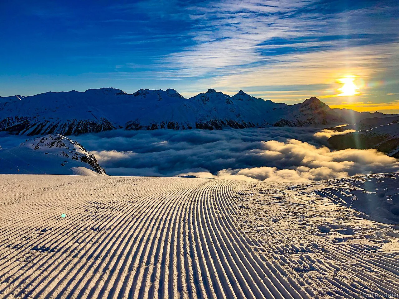
Diavolezza and Lagalb are the smallest of the three blocks, with around 35 km of piste between them and a high point of 3,006 m. They sit up the Bernina road towards Pontresina and are reached by bus or car rather than from St Moritz itself. This is the area to choose when you want big high-mountain views and a quiet mountain rather than a full resort day.
Because the lift systems are separate, Lagalb and Diavolezza work as a half-day each rather than one combined circuit unless you are prepared to move between them. Check what is running before you set out, since the smaller areas are the first to close when wind or snow conditions bite.
The altitude also means the snow season often stretches longer here than on the lower Corviglia valley runs. If you are travelling late in the winter or in early spring, the Diavolezza side is worth keeping in reserve as a fallback day.
Reading the map by ability: beginner zones, cruising sectors and the steepest marked runs
Beginners should start on Corviglia rather than anywhere else. The easy slopes are concentrated there, the plateau is wide and forgiving, and the short lift network means you can repeat a gentle pitch without committing to a long descent. Corvatsch and Diavolezza have their own nursery areas but far less forgiving terrain around them.
Intermediates get the best of the resort. Corviglia's 79 km of intermediate piste is the backbone of most trips, and the Marguns and Suvretta sectors add variety without pushing you into anything uncomfortable. For a step up, Corvatsch offers longer, higher descents that feel more adventurous without being genuinely extreme.
Advanced skiers should mark Selin and the Zöllner freeride descent on the map, plus the high routes around Corvatsch. The marked ski routes, 4.8 km of them on Corviglia, are worth reading carefully because they are not groomed pistes and often appear alongside black runs on the legend.
Snow-making and piste conditions: what the map tells you and what it doesn't
A piste map tells you where the runs go and how steep they are. It cannot tell you whether the snow is soft or scraped, whether a run opened this morning, or whether grooming happened overnight. On Corviglia, roughly 80 per cent of slopes have snow-making, which gives you a fair idea of which runs are the most dependable when natural snow is thin.
The map's other blind spot is aspect and shelter. The wooded lower slopes around St Moritz Dorf and Celerina stay legible in bad weather, while the high plateau is exposed. If the wind is up, choose the run by where it sits rather than by colour, and use a current snow report to confirm what is actually open.
Lifts, funiculars and the Engadin bus network as connectors between the sectors
The corridor between St Moritz Dorf and St Moritz Bad is served by funicular, and on the map it reads as a lift rather than transport. It matters because it links the two village bases to their respective access points without a bus. Timetables change by season, so check the current operating information rather than relying on last winter's memory.
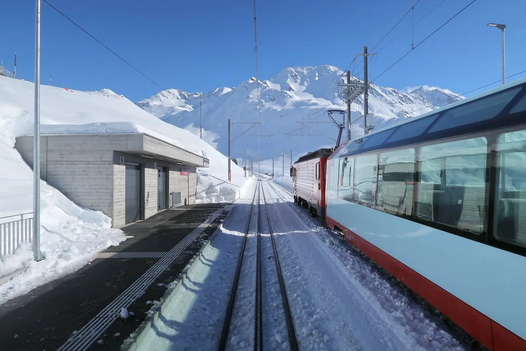
The Engadin bus network is the real connector between the three ski areas, and it is the reason you can ski Corviglia one day and Corvatsch the next without moving hotels. Buses run between St Moritz, Silvaplana, Surlej, Pontresina and the Diavolezza turn-off, and they carry skis and boots as a matter of course.
If you plan a multi-area week, a bus stop outside your door is worth more than a ski-in claim. Compare the flat walks at each end of the day, not just the vertical metres on your doorstep, and factor in the ride to the further areas when you book.
Live status tools: checking open lifts and slopes before you travel
A static map dates instantly. The tool that actually governs your day is the live slope and lift status feed, which lists what is open, the snow depth at the top and base stations, and the current operating lifts for each of the St Moritz areas. Look at that before you decide which sector to ski rather than deciding the night before and hoping.
Weather on the Engadin is often settled and bright, but the areas are high enough to shut for wind, and the upper Corvatsch and Diavolezza lifts feel it first. If your trip is built around one particular descent or a high-altitude day, keep a second-choice area in mind and check the feed on the morning you intend to go.
Which base to pick after reading the map: St Moritz Dorf, St Moritz Bad, Celerina or Silvaplana
St Moritz Dorf puts you in the middle of town with the Chantarella access close by, which suits ski-and-town trips where lunch matters. St Moritz Bad has the Signal access and a shorter walk to the valley run finish, which is often better for families and anyone who wants to keep the commute to a minimum.
Celerina is quieter and gives you the Marguns access on foot, plus a direct route up without the village-centre crowds. Silvaplana and Surlej are the choice for Corvatsch, and they cut your travel time on the area's best snow days while adding a bus ride on days spent on Corviglia. There is no universally right answer, only the right answer for the area you will ski most.
Whichever you choose, book the accommodation and any ski hire before you travel if you are going during a busy week. St Moritz has a limited number of beds relative to the size of the ski area, and the short weeks around New Year fill earliest.
Multi-day strategy: how to sequence the three areas across a trip
A sensible week treats each area as a separate day rather than trying to tick off runs across all three at once. Start on Corviglia to settle into the resort and find your feet, move to Corvatsch on the clearest weather day, and hold Diavolezza and Lagalb for late in the trip or for a day when lower slopes are suffering.
Build in one flexible day at the end for whichever area has the best conditions, and remember that a change in weather can make a plan for Corvatsch irrelevant. With a six-day pass you can afford one exploratory day and still cover the highlights of each sector.
If you are travelling with a group of mixed ability, pick a base area for the beginners and let the stronger skiers take a bus trip to the high terrain on one or two days. That keeps every morning short and avoids the long transfer that sour a shared lesson schedule.
Buy lift passes, find the official map and check current status
Pass products, season dates and the official piste map are published by the lift company and the Engadin tourist board. Prices change by season and by product, and there are multi-day options that cover all three areas. Check the current prices and terms on the official site before you buy, particularly for family tickets and for passes covering Corvatsch and Diavolezza alongside Corviglia.
Use the official Corviglia piste map alongside this guide rather than a screenshot saved to your phone. It shows the current lift layout and any changes to the piste network, and it sits alongside the live status information you need on the morning itself.
Plan Your Visit
The map is only useful once you accept that St Moritz is three resorts sharing a name and a bus network. Plan your base around the area you want most mornings, leave room for one or two transfers, and treat Corviglia as the default and the high terrain as the excursions.
Check live slope and lift status shortly before you travel, confirm pass prices and opening dates with the lift company, and book accommodation early if you are coming in a peak week. That is enough to turn a confusing piste map into a week that runs smoothly.
Frequently Asked Questions
Are the St Moritz ski areas connected by ski lifts?
No. Corviglia, Corvatsch and Furtschellas, and Diavolezza and Lagalb are three separate lift systems without a ski-through connection. You move between them by bus or car, so plan each as its own day rather than a single circuit.
How many kilometres of piste are in St Moritz?
The three areas have different totals. Corviglia has 155 km of piste, Corvatsch and Furtschellas around 120 km, and Diavolezza and Lagalb about 35 km. There is no single combined figure, and adding them up overstates what you can ski in a day.
Which area is best for beginners in St Moritz?
Corviglia is the most forgiving, with 42 km of easy piste and a wide plateau served by short lifts. Corvatsch and Diavolezza have nursery slopes but far more exposed terrain around them, so beginners usually settle quicker above St Moritz itself.
What is the hardest run on the Corviglia map?
Selin, run 24, is the most difficult marked descent at 1.7 km with 477 m of vertical. The Zöllner freeride descent between Las Trais Fluors and Marguns is off-piste terrain rather than a groomed piste, so treat it as a separate decision.
How do I get back if I ski the Samedan valley run?
The Samedan run ends in Samedan without any lift connection back into the ski area. You take the local bus or drive back to Celerina and ride the gondola up again, so check bus times before you set off down it.
Where do I find the official St Moritz piste map?
The lift company and the Engadin tourist board publish the current piste map, covering all three areas and the lift layout. Use the live status feed alongside it to confirm what is actually open on the day you ski.
How much does a St Moritz lift pass cost?
Prices vary by season, by pass length and by whether the product covers all three areas. The lift company publishes current rates for adults, families and multi-day passes, so check there before you buy rather than relying on previous seasons.
How many days do I need to ski all three areas?
Four to six skiing days gives you a fair look at each area without rushing. Corviglia takes two or three days, Corvatsch a full day or two, and Diavolezza and Lagalb one day, with a spare day kept for the best weather.
Sources
Useful notes for your next ski trip
Optional updates to our Alpine resort guides.
You might also like
Continue reading
More guides you'll find useful