La Clusaz Piste Map: How the Five Massifs Fit Together
Use the official La Clusaz piste map to see the five massifs, La Clusaz-Manigod terrain and live slope status, so you pick the right sector before you ski.
On this page
The official La Clusaz piste map is the fastest way to decide where to start your day, because the resort's terrain is not one continuous block but five separate massifs spread across the La Clusaz-Manigod domain. Opening the interactive map settles the basics before you leave your accommodation: which sector suits your ability, which lifts connect, and how far you will travel between them. The map also separates the planning view from the live open-slope view, which matters once snow conditions start changing daily.
The Official Map and the Five Massifs
La Clusaz's own trail-map pages present five massifs: Aiguille, Balme, Beauregard, L'Étale and Manigod. The alpine domain spans 1,100 m to 2,600 m in altitude and contains 85 runs — 8 black, 30 red, 31 blue and 16 green — across 125 km of slopes. Those figures describe the La Clusaz-Manigod area specifically, not the wider Aravis region that includes neighbouring resorts.
Because the sectors sit apart, choosing one before you set out saves wasted lift time. Balme, for example, is the sector the resort schedules for the earliest opening in its 2026/27 plan, while L'Étale and Aiguille/Beauregard follow later. The map's overview panels let you compare how each massif is laid out before you commit to a base or a first lift.
What the Run Grading Tells You About Each Sector
The 85-run split across the domain is dominated by red and blue terrain, with 30 reds and 31 blues against 8 blacks and 16 greens. That balance means intermediate skiers have the widest choice, while true beginners have a smaller pool of green runs to work with and should look carefully at which massif holds them. The map's colour coding helps you match a sector to your group's weakest skier rather than its strongest.
The statistics only describe the domain as a whole, so they do not tell you which massif holds which grade. To find that out, zoom into the interactive map and read the individual run colours on each sector before deciding where to meet. That step matters more than the headline numbers when you are splitting a mixed-ability group.
Planned Sector Opening Periods and Snow Conditions
The La Clusaz ski area page publishes planned 2026/27 opening periods by sector: Balme with an anticipated weekend opening on 5–6 December and continuous operation from 12 December 2026 to 25 April 2027; Aiguille and Beauregard continuously from 12 December 2026 to 11 April 2027; and L'Étale continuously from 19 December 2026 to 4 April 2027. The same page states plainly that sector openings and closures can vary with snow conditions.
Read those dates as a planning framework, not a guarantee that every lift and piste on a given massif will run on day one. A scheduled season can still see individual runs or links held back until cover allows. Check the live map in the days before you travel rather than booking around a fixed assumption that a specific sector will be fully open.
Cross-Country and Backcountry Zones on the Map
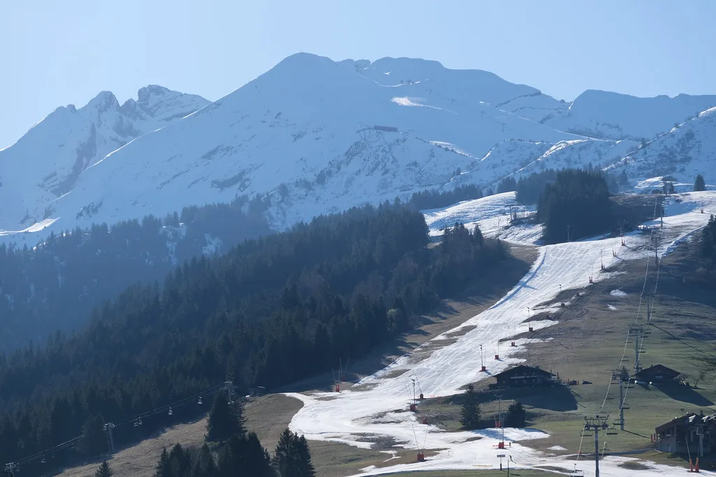
The official trail-map page also covers the resort's non-alpine options, which sit outside the 125 km downhill figure. Les Confins lists 53 km of cross-country trails, including a 7 km link to the Grand-Bornand Nordic area, while the Plateau de Beauregard shows 36 km across eight trails. Both areas appear on the same official resource as the alpine sectors.
The backcountry zones at Beauregard and L'Étale are also identified on the official map, separate from the marked downhill terrain. That distinction matters when you are reading the map at home: a zone shown for backcountry use is not the same as a patrolled piste. Treat these as orientation only and confirm any route decisions locally.
The Aravis Domain and the Le Grand-Bornand Connection
La Clusaz sits within the wider Aravis ski domain alongside Le Grand-Bornand, linked by a free inter-station ski bus with roughly a ten-minute ride between them. Ski Weekender also publishes Aravis Region piste map links, which cover a larger area than the La Clusaz map alone. Check what your lift pass actually covers before you rely on the connection, because the two maps serve different purposes.
If you intend to ski both resorts, check what your lift pass actually covers before you rely on the connection, because the two maps serve different purposes. The La Clusaz map answers where you ski today; the Aravis map answers whether you can range further. Keep the two separate when you plan, and confirm pass scope with the lift company in resort rather than assuming it from the bus link.
Checking Live Slope Status on the Day
The La Clusaz site distinguishes its static piste map from an interactive map of open slopes updated by the slopes service. That live view is the one to open on the morning you ski, because it reflects what is actually running rather than what is planned. Bookmark both: the static map for choosing a sector the night before, the live map for confirming it at breakfast.
A simple sequence works well: pick a massif the evening before using the static map and the sector opening periods, then confirm lift and piste status on the live map each morning. If your first-choice sector is limited, switch to another rather than travelling across the domain on a hunch. The map's massif structure makes that substitution straightforward once you know the layout.
Plan Around the Map, Not the Headlines
The La Clusaz piste map rewards a little preparation. Learn the five massifs, note the planned 2026/27 sector periods with their snow-condition caveat, and treat the live open-slope view as your daily reference. If you want to see how another multi-sector resort lays its terrain out, the Alpe d'Huez Ski Map is a useful comparison. That combination lets you choose a sector deliberately instead of defaulting to whatever lift is nearest.
If you want the wider picture of how La Clusaz fits into the Aravis area, keep the region map separate from the resort map and confirm pass scope directly. For the resort's own terrain and sector planning, the official interactive map remains the reference to start from.
Frequently Asked Questions
Where is the official La Clusaz piste map?
The official map sits on the La Clusaz resort website's trail-map page, which hosts the static plan and an interactive map of open slopes updated by the slopes service. Use the static version for planning the night before and the live version on the morning you ski. The same page also covers the cross-country and backcountry zones.
How many piste sectors does La Clusaz have?
The official trail-map page describes five massifs: Aiguille, Balme, Beauregard, L'Étale and Manigod. They form the La Clusaz-Manigod alpine domain, which spans 1,100 m to 2,600 m and holds 85 runs across 125 km of slopes. Because the massifs are separate, plan which one you want before you leave your accommodation.
What is the difference between the La Clusaz piste map and the Aravis Region piste map?
The La Clusaz map covers the resort's own five massifs and the La Clusaz-Manigod domain. The Aravis Region map covers a wider linked area that includes Le Grand-Bornand, which a third-party operator describes as connected by a free inter-station ski bus. Check what your lift pass covers before you plan to ski across both.
When do the La Clusaz sectors open?
The resort's ski area page lists planned 2026/27 periods: Balme from 12 December 2026 to 25 April 2027, Aiguille and Beauregard from 12 December 2026 to 11 April 2027, and L'Étale from 19 December 2026 to 4 April 2027. Dates can vary with snow conditions; check the live map before you travel.
Sources
Useful notes for your next ski trip
Optional updates to our Alpine resort guides.
You might also like
Continue reading
More guides you'll find useful