Crans-Montana Ski Map: How to Read the Piste Map and Sectors
Read the Crans-Montana piste map with confidence: how Montana, Crans, Cry d'Er, Violettes and the Plaine Morte glacier link, and what to check live.
On this page
Crans-Montana is a long resort, not a compact bowl, and the piste map is the quickest way to understand how its sectors hang together. The Plan des pistes on the resort website and the interactive version beside it show the same ground, but they answer different questions: one helps you plan before you travel, the other tells you what is actually running today. Use both and you will avoid the classic mistake of planning a day around a link that is not operating.
This guide works through the map sector by sector, names the lifts and runs that anchor each one, and explains how to cross-check the picture on paper against the live lift-and-piste status page before you commit. It stays deliberately clear of figures that change with the season — pass prices and exact opening dates belong on the official pages, not on a static plan.
What the Crans-Montana Piste Map Covers
The map shows one ski area strung across a sunny plateau above the Rhône valley, with the resort villages of Montana and Crans as its base and a chain of sectors reaching east and west. Read from the Crans side, you find the Crans-Merbé-Cry d'Er access; in the middle sits Montana with the Arnouva gondola; further along come Barzettes, Marolires and Violettes; and at the top of the system the Plaine Morte glacier crowns the whole thing.
The first thing to notice is how linear it is. Unlike a resort where every lift funnels back to a single base, Crans-Montana's sectors sit side by side along the plateau, each with its own access lift and its own character. That shapes how you ski it: you tend to work a sector in the morning and move on rather than lap the same mountain all day.
The map also labels walking routes, snowshoe trails, cross-country loops and a snowpark, so it doubles as a winter map for non-skiers in your group. Keep that in mind if you are travelling with someone who skis only part of the day.
Finding the Official Map: PDF Versus Interactive
The resort publishes two versions on its piste and lift status page: a downloadable Plan des pistes PDF and an interactive live map. The PDF is the one to study on a train or over breakfast, because it shows the full layout at a glance and you can print it or keep it on your phone offline. It is static, so it reflects the intended layout rather than today's conditions.
The interactive version earns its place once you are in resort, because it is paired with the same page that lists which lifts and runs are open, in preparation or closed. The resort shows this as a simple count at the top and a sector-by-sector list underneath. That list is the honest picture: on a given day many lifts can be shut, especially lower down, so read it before you pick a side of the mountain.
A panorama map from a third-party site can be a useful second opinion on how the ski area is laid out and how the runs are numbered, particularly if you prefer a cleaner graphic. Treat it as orientation only; the resort's own status page is the one that tells you what is moving.
Sector by Sector: Crans-Merbé-Cry d'Er
The Crans-Merbé-Cry d'Er sector is the eastern anchor of the map, reached from Crans by the Crans-Merbé-Cry d'Er cable car. It is the sector closest to the Crans end of the resort and the natural starting point if you are staying in Crans rather than Montana. From the top, a cluster of short lifts spreads across the Cry d'Er shoulder, including the Cry d'Er drag lift, the Chetseron drag and the Merignou drag.
This is the sector to favour on a marginal snow day, because its upper slopes sit higher than the plateau and hold cover better than the runs down toward the villages. The trade-off is that the drag lifts here demand a bit of technique; if you are still finding your feet, look further along the map rather than committing to Cry d'Er first thing.
Montana-Arnouva and the Middle of the Map
Montana sits at the centre of the map and is served by the Montana-Arnouva gondola, the workhorse lift that links the village to the slopes above. From Arnouva the sector opens up along a ridge, with the Arnouva-Cry d'Er chair connecting across to the Cry d'Er side. Several runs feed back down toward Montana, and the map marks the Verdets drag and the Bellalui chair in this part of the mountain.
For a first morning, the Montana-Arnouva sector is the most forgiving place to start: the gondola gives you a big vertical gain without a drag-lift queue, and you can work your way across the ridge before deciding where to commit. If you are staying in Montana, the map makes it obvious that you do not need to travel to Crans at all to reach the slopes.
Barzettes-Marolires-Violettes and the Glacier Access
The western sector is the map's most fragile connection and the one worth understanding before you plan a glacier day. The Barzettes-Marolires-Violettes cable car lifts you from the plateau toward Violettes, and from there the Funitel Violettes-Plaine-Morte makes the final jump to the glacier. Two separate lifts in sequence, and either one can be down: on the day the resort's own status page listed both as closed while the Crans and Montana access lifts were open.
That is the key lesson in reading the Crans-Montana map: the glacier is not simply a high point you can ski to, it is a chain of lifts with a narrow neck. Plan a glacier morning as your first choice, but keep a lower-sector plan in reserve on the same day, and check the status page that morning rather than the evening before. Also note that the map marks the Aminona lifts on the western edge, including the Toula and Tsa chairs, which serve a quieter and more advanced-feeling corner of the area.
Reading the Vertical: Lower Runs and the Glacier Top
The vertical is what makes Crans-Montana feel bigger than its sector count suggests. The map drops all the way down to the plateau villages and then climbs again to the Plaine Morte glacier at the top, so a single day can include both tree-lined lower runs and open high-altitude terrain. That range is the resort's strength, but it also means snow conditions vary enormously between the top and the valley floor.
In practice, plan around the height. Start high and work down if the lower slopes are thin, or do the reverse after a cold night if the valley is crisp and the top is wind-affected. The map's contour lines and lift bases are enough to tell you which runs are worth a detour; the resort's live page tells you which are actually skiable.
Beginner Zones on the Map
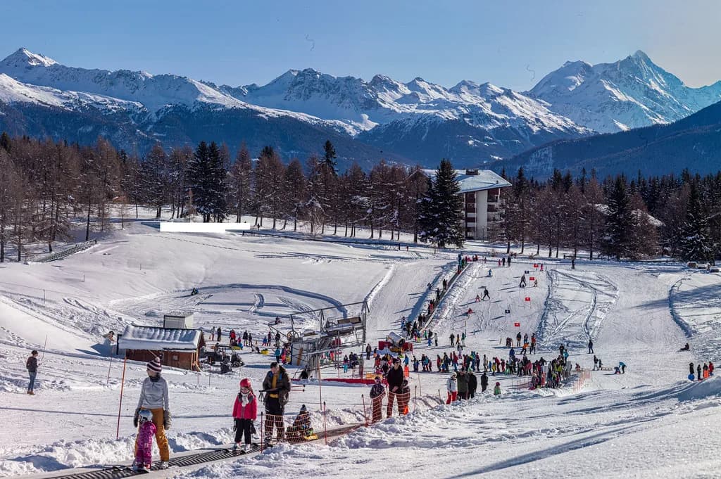
Beginners should look for two labelled areas rather than generic nursery-slope talk. The Snow Island area on the Severiano Ballesteros golf course is a dedicated play and learning zone, with a covered magic carpet and its own drag lifts, marked on the map near the Crans end of the resort. It is the easiest place to start a first day, because the terrain is gentle and separate from through traffic.
The second is the Espace Découverte nursery area at Arnouva, served by its own magic carpet and sitting just above the Montana-Arnouva gondola top station. That makes it convenient for anyone staying in Montana. If you are booking lessons, both zones are well placed for a morning session and a gentle afternoon; group your equipment hire and instruction around whichever is closer to your accommodation.
Lift Links That Matter for Route Planning
Four lift links do most of the work of moving you around the map. The Montana-Arnouva gondola lifts you from Montana onto the ridge; the Crans-Merbé-Cry d'Er cable car does the same on the Crans side; the Barzettes-Marolires-Violettes cable car serves the western sector; and the Violettes-Plaine-Morte Funitel completes the climb to the glacier. Learn these four names and you can read the map almost without looking at the runs.
The practical consequence is that your day is shaped by which of these access lifts is turning. If the Barzettes side is out, the glacier is effectively off the table unless you are prepared to ride the long way round from Arnouva, and the map makes that detour plain if you trace the ridge. Read the access lift status first, then the runs.
Named Runs to Look For
The map names its runs, and a handful are worth seeking out. Mont Lachaux is the long, prominent line on the Crans side, with its own slalom variant marked, and it is the run that gives the sector its character: sustained, pitched and best skied early before the surface softens. The Boulevard offers a gentler, longer descent, useful when you want mileage rather than steepness.
The Nationale Express chair serves a fast, direct line on the middle of the mountain, while the Bellalui chair and the Bellalui runs sit above the Montana-Arnouva sector. The numbered piste layout means you can trace a route from any lift on the map and know roughly how it will flow before you commit to the top station. For snowboarders, the Crans Montana Snowpark and the Easy Snowpark are marked separately, with the Plaine Morte boardercross on the glacier.
Freeride and Glacier Terrain on the Map
The glacier is the map's headline terrain for advanced skiers, with open snowfields above Violettes and the Plaine Morte expanse stretching toward the Tothorn side. The map marks freeride itineraries separately from pistes, and this is where you should read the layout most carefully: some routes descend into terrain that loops away from lifts, so the return line matters more than the drop.
Check the resort's avalanche bulletin before committing to any itinerary, and treat the map's freeride markings as orientation rather than a green light. Route conditions change daily, and the high glacier is exposed to wind and cloud even when the lower slopes are calm.
Cross-Checking With the Live Status Page
The single most useful habit is to open the resort's status page over breakfast and read it as three columns: what is open, what is in preparation and what is closed. The top-line lift count gives you the headline, but the sector-by-sector list underneath is where the detail lives, and it is honest enough to show partial openings and walking sections on itineraries.
The same page carries snowshoe and walking-route status, plus the avalanche risk. It also shows long-term notices: some cross-country trails were marked as definitively closed for a past season, which is a reminder that trail networks on the map can be retired rather than simply closed for the day. Use it for a fast, factual read before you buy a pass or plan a route.
Planning a Short-Trip Day From the Map
With two or three days, the map suggests a natural rhythm. Put the glacier and the high Violettes terrain first, on your freshest morning and the best forecast, then spend an afternoon on the lower Montana-Arnouva runs where the tree cover gives shelter if the weather turns. On the second day, work the Crans-Merbé-Cry d'Er side from the Crans end, which gives you a different village base and a different set of lifts.
If you are staying in Crans, reverse it: start from the Crans cable car, ski the Mont Lachaux side in the morning, and take the gondola from Montana in the afternoon. The map makes shuttle planning easy because the villages are strung along the same plateau, so moving between them on foot or by bus is part of the day rather than a logistical problem.
Map-Reading Mistakes to Avoid
The most common error is assuming the whole ski area opens as one. Crans-Montana's sectors open independently, and the access lifts are the bottleneck. The second is treating the glacier link as permanent: the Barzettes-Marolires-Violettes cable car and the Violettes-Plaine-Morte Funitel are the two you should check first if a glacier day is the plan, because a closure on either strands the upper terrain.
The third is writing off Aminona. It appears remote on the map, but it is one of the ridges that gives the resort its length, and on a clear day it is well worth the traverse. Finally, do not assume the piste numbers run in a logical sequence; they are simply labels, and the panorama map is easier to follow if you like seeing the whole area in one view.
Other Maps Worth Keeping to Hand
Beyond the official plan, an infosnow map of the Crans Montana Aminona area is a handy second graphic for orientation, particularly if you want to see the western terrain in more detail than the resort plan provides. Pair it with a snow-depth report for a sense of what the season has delivered, though exact depths change too quickly to plan around days in advance.
If you are used to reading other Swiss maps, the conventions are broadly similar, and a quick look at how another resort lays out its plan can sharpen your eye for lift symbols and sector boundaries, so the Andermatt piste Map guide is a useful comparison.
Where to Buy Passes and How the Map Helps
The map tells you which access lift you will use most, and that is the best guide to choosing your pass area. If your accommodation is in Crans and you plan to ski the eastern sector, buy locally and start from the Crans cable car; if you are in Montana, the gondola is your gateway. Pass products and prices change each season, so check the resort site for current points of sale before you travel, or buy at the lift station on arrival.
A pass bought on the mountain is also the easiest way to stay flexible when the upper mountain is closed: you can decide on the day whether the glacier is worth the extra cost. That flexibility is worth more than saving a few minutes at the ticket window on a trip where the links can shift.
Plan Your Visit
The Crans-Montana plan is best read as a set of connected sectors rather than a single mountain, with four access lifts doing most of the work of moving you around. Study the PDF before you travel, then check the live status page each morning to see which links are running.
That rhythm — plan the shape of the day on paper, then confirm it against the resort's own list — is what keeps a short trip productive when the glacier link or a lower sector is out. It is also what lets you enjoy the resort's real strength: a long, varied area where you can ski high in the morning and sheltered lower down in the afternoon.
Frequently Asked Questions
Where can I find the Crans-Montana piste map?
The resort publishes a downloadable Plan des pistes PDF and an interactive live map on its piste and lift status page. The PDF is best for planning before you travel; the interactive version is paired with the live open/closed list and is the one to use in resort. Several third-party panorama sites also publish the run layout for a second opinion on orientation.
Which sectors does the Crans-Montana ski area cover?
The map groups the area into the Crans-Merbé-Cry d'Er sector on the Crans side, Montana-Arnouva in the middle, Barzettes-Marolires-Violettes to the west, the Plaine Morte glacier above Violettes, and the quieter Aminona terrain on the western edge. Each has its own access lift, and they do not all open together.
How do you reach the Plaine Morte glacier from the map?
You ride the Barzettes-Marolires-Violettes cable car, then transfer to the Funitel Violettes-Plaine-Morte for the final climb to the glacier. Because it is two lifts in sequence with a narrow neck, check both are running before committing to a glacier day and keep a lower-sector plan in reserve.
Are the beginner slopes marked on the piste map?
Yes. The map labels the Snow Island area on the Severiano Ballesteros golf course near Crans, with its own magic carpet and drag lifts, and the Espace Découverte nursery area at Arnouva above the Montana gondola top station. Both are self-contained learning zones rather than ordinary pistes.
Is there an interactive Crans-Montana ski map?
The resort site offers an interactive live version alongside the downloadable PDF. It is paired with a sector-by-sector list showing which lifts and runs are open, in preparation or closed, which is the most reliable way to see what is actually running on a given day.
How much is a ski pass in Crans-Montana?
Prices change each season and are set by the lift company rather than the tourist office, so check the resort's official pages for current pass products and points of sale. A pass bought on the mountain keeps you flexible if the upper lifts are closed.
What is the highest point of the Crans-Montana ski area?
The Plaine Morte glacier is the highest terrain shown on the map, reached by the funitel from Violettes. Exact summit altitude varies with the source you read, so the resort plan and the resort's own pages are the place to confirm the figure before you plan a glacier day.
What should I check before committing to a sector?
Open the resort's live status page in the morning and read the sector-by-sector list first, starting with the access lift that serves your planned sector: the Crans cable car, the Montana-Arnouva gondola, the Barzettes-Violettes cable car or the glacier funitel. The avalanche risk and any long-term trail notices sit on the same page.
Sources
Useful notes for your next ski trip
Optional updates to our Alpine resort guides.
You might also like
Continue reading
More guides you'll find useful