Valmeinier Piste Map: Galibier-Thabor Sectors and Lifts
Read the Valmeinier piste map with confidence: the Gros Crey and Crey du Quart sectors, the Valloire link, key lifts and where each ability band should ski.
On this page
The sheet you pick up in Valmeinier is not a Valmeinier-only plan: it is one half of the Galibier-Thabor domain, shared with Valloire and covering 160 km of runs across 91 pistes and 30 lifts. Getting your bearings before you leave the apartment saves a morning of squinting at lift stations with your gloves on.
This guide walks through the four zones the printed plan is split into, the lifts worth locating first, the named runs that repay the effort, and the pass and season details that change what the map actually means on any given day. It sticks to layout and decision-making, not turn-by-turn route advice.
Why the Valmeinier Piste Map Is Really a Galibier-Thabor Map
SEMVAL, the lift company behind Valmeinier, counts the linked area at 160 km of slopes, with 91 runs served by 30 lifts and a grading of 17 green, 32 blue, 34 red and 8 black pistes. That is the whole Galibier-Thabor figure, so the map in your hand covers terrain on both sides of the valley rather than a compact village hill.
The tourist office gives the same 160 km total but lists 33 red runs rather than 34, so treat the exact red count as approximate and use the map's own labels instead. The area takes its name from two peaks rising above 3,000 m, which explains why the top of the plan looks so much higher than the villages it serves.
Practically, this means you plan a day by sector rather than by village. Skiing from Valmeinier to Valloire and back is a full outing, not a lap, and the return leg should be built into your afternoon rather than left to chance. The [Valmeinier ski guide](/valmeinier-ski-guide) covers the wider resort picture if you want the planning context around the map.
The Four Map Zones at a Glance
The printed plan is divided into four labelled blocks: Valmeinier Gros Crey, Valmeinier Crey du Quart, Valloire Crey du Quart and Valloire Sétaz. Each block carries its own lift symbols and piste colours, so the quickest way to orient yourself is to find the zone name first and the lifts second.
Valmeinier's two zones sit on either side of the resort, with Gros Crey on one flank and Crey du Quart on the other, and the two Valloire zones continue the domain beyond the ridge. A descent that starts in one block can finish in another, which is why the zone labels matter more than the village names printed at the bottom.
If you only have a short break, pick one block per morning and resist crossing the whole domain on day one. Reading the zone names aloud at the lift base is a small habit that prevents the classic mistake of boarding a lift heading away from your intended sector.
Valmeinier's Own Sectors: 1800, Villages and the Drop Between
Valmeinier 1800 is the upper resort base, while Valmeinier Villages sits lower down the valley, and the map shows the vertical difference between them clearly once you trace the runs that connect the two. First-timers consistently underestimate that drop, then find themselves committed to a long descent at the end of the day.
The tourist office notes a 1,250 m vertical descent available from the top of the Sandonière chairlift down to Valmeinier Villages via the blue Saule. That figure is the single most useful number on the plan: it tells you the Villages return is a proper run, not a quick drop-off.
Plan the Villages leg for when your legs are freshest, or check whether a lift back up runs late enough to make the descent comfortable. Treat the return as a deliberate part of the day rather than an afterthought once the lifts start closing.
Piste Grading: What the Run Mix Means for Your Week
A domain of 17 green, 32 blue, 34 red and 8 black runs is weighted towards intermediate skiing, with greens concentrated around the resort bases and blacks in a small, selective group. If your group spans abilities, the blues are where you will spend most of your shared time, and the reds are where stronger skiers peel off.
The map's legend uses the standard four-colour scale, with green marked easy, blue medium, red difficult and black very difficult, alongside symbols distinguishing gondolas, detachable and fixed chairs, drag lifts and magic carpets. Learning those symbols takes a minute and tells you instantly whether a sector is chair-served or drag-served, which matters for snowboarders and families with small children.
A sensible split for a mixed group is a blue-and-green morning on one side of the resort and a red-focused afternoon on the other, meeting at a named lift base for lunch. That pattern uses the grading rather than fighting it.
Key Lifts to Locate on the Map
The Sandonière chairlift is the marker to find first, because it reaches the highest point of the ski area at 2,750 m and unlocks the panoramic upper terrain. From the summit the tourist office lists two red options, Moorine and Carline, with the blue Rhodes leading back towards the resort centre.
For first turns, locate the Jeux chairlift, which gives access to the green Slates run, a gentle and reasonably long slope suited to warming up, and can be extended to Valmeinier Villages on blue terrain. Beginners should treat the Jeux area as their base camp and only graduate to linking runs once Slates feels controlled.
On the Crey du Quart side, the blue Armera is the long, wide descent with forest sections that makes a good confidence run. Mark these three lift bases on your phone's copy of the map before the first morning and you will spend your time skiing rather than navigating.
Named Runs Worth Finding
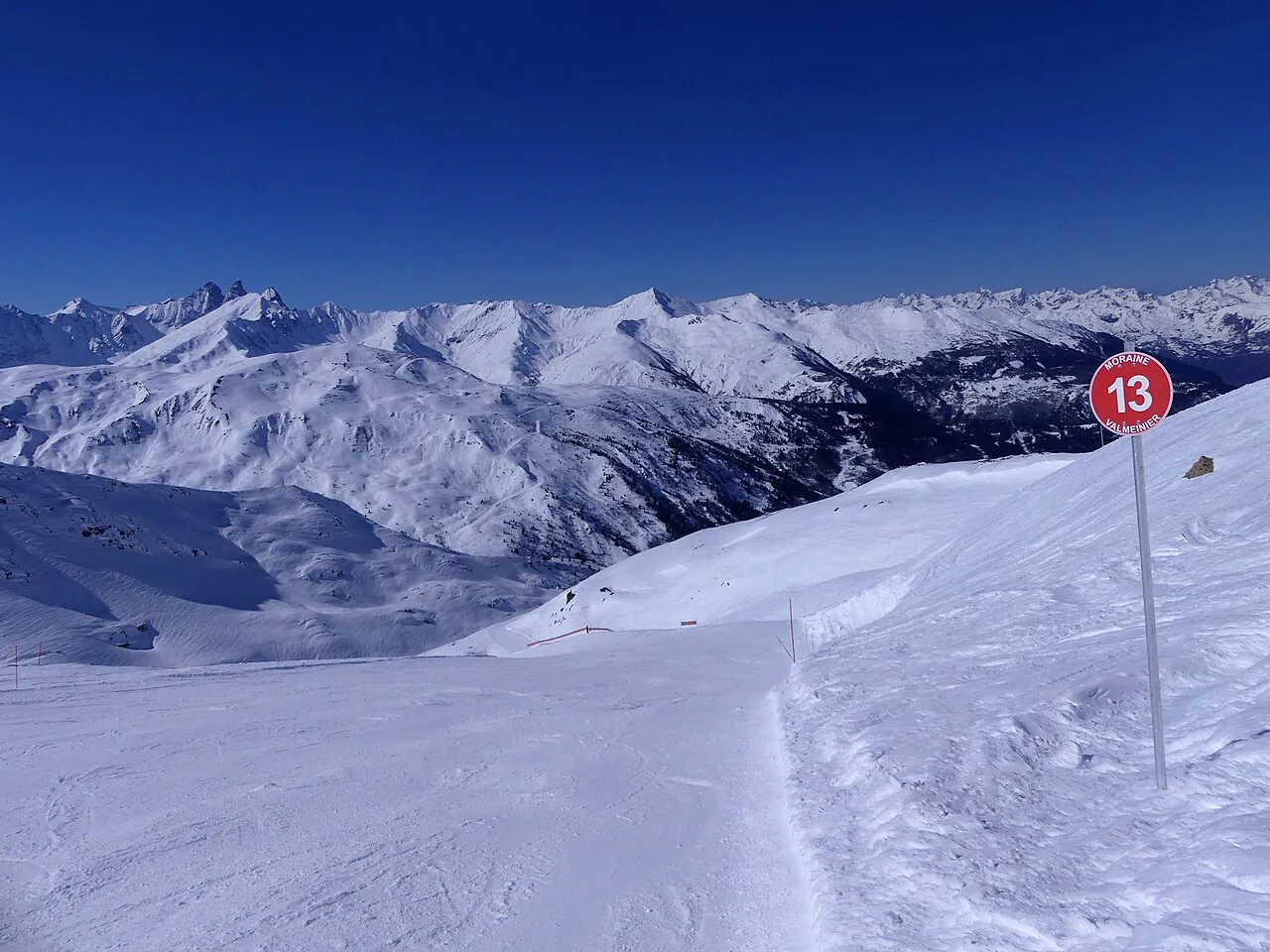
Beyond the upper mountain, the red Genepi is popular for its wide track and views from Gros Crey, and it links down towards the village at 1,500 m via the red Eglantine. Strong intermediates can build a satisfying loop around those two without touching the blacks.
For scenery, the blue Combe Orsière from the Grand Plateau gives a superb panorama of the resort and makes an obvious photo stop. Beginners extending their range should look at the blue Saule, which also serves as the long link towards Valmeinier Villages.
The map labels these runs by name at the top of each piste line, so the practical habit is to pick two named targets per session and find the lifts that feed them. That is more reliable than trying to memorise the whole sheet at once.
Linking to Valloire: What the Map Shows and What It Does Not
The plan shows the Valloire zones as continuous terrain with Valmeinier's, and the Valmeinier Tourist Office describes Galibier-Thabor as connected with Valloire across the shared 160 km. What the map cannot tell you is how long the crossing takes on the day or whether the linking lifts are running, so check status before committing to the traverse.
The interactive plan is the better tool for that decision because it shows lift and piste openings rather than a static picture. Use the printed sheet for orientation and the interactive version for the morning go or no-go call.
On the pre-opening week, the picture is different again: the pass is valid only in the Valmeinier Gros Crey sector, so this is a restricted, local patch of terrain rather than the full domain. That detail is easy to miss and changes the whole shape of a December day.
Beginner Zones and the Green-to-Blue Progression
Beginners should anchor on the Jeux chairlift and the green Slates run, then progress to the blue Saule extension once turns are reliable. The tourist office points to Slates as a good length for getting started and warming up, which makes it a better learning slope than a short nursery strip.
Group and private instruction in skiing and snowboarding is available through ESF Valmeinier, including off-piste and cross-country outings for those who want them. Booking lessons before you travel is easier than queuing at the resort, and the [Valmeinier ski lessons](/valmeinier-ski-lessons) comparison sets out the programme options.
Hire is the other thing to sort early, because boot fit and pick-up times shape your first morning. The [Valmeinier Ski hire](/valmeinier-ski-hire) guide covers stores, kit and handover so you are not fitting skis while the rest of your group is already on the lift.
Freestyle and Play Areas on the Plan
The map and the tourist office both flag a snowpark plus two boardercross courses and the Valkid area, alongside picnic tables at Inversins, Les Grandes Drozes, Les Jeux and Moneul. These are free features rather than ticketed attractions, which makes them easy to slot into a family day.
Freestyle areas can close depending on conditions, so the interactive plan is the place to confirm whether the park is running before promising it to a teenager. Picnic tables are a cheaper lunch option and worth marking on your own copy if you are skiing with children.
Reading the Map Against the Season
For 2026/27 SEMVAL lists the season as 19 December 2026 to 9 April 2027, preceded by a restricted pre-opening week from 12 to 18 December 2026 using the Valmeinier Gros Crey sector only. That restriction is the key map-reading fact for early-season trips: your skiing will be confined to one zone.
Pre-opening prices are published separately from main-season rates, with adult one-day passes at 38.40 euros, six consecutive days at 194.95 euros and a four-hour option at 34.15 euros, plus children under five and adults 75 and over skiing free on production of valid ID. Carré Neige insurance is listed at 3.50 euros per person per day.
Main-season products on the SEMVAL site include a six-day adult pass at 278.50 euros and a family pack from 959 euros for four or more people across six to eight consecutive days, with a web-only Saturday discount on single-day passes shown on the site. Those are time-limited offers, so confirm the current rate and conditions when you buy rather than assuming the figure you saw will hold.
Live Status and Pass Choices
Use the interactive plan for live lift and piste openings and keep the printed sheet for orientation. That division of labour stops you from planning a route onto terrain that is not running.
Pass products mirror the map: a local Valmeinier option for short stays and a Galibier-Thabor pass for those crossing to Valloire. Match the pass to your actual plans rather than defaulting to the larger domain, and check the [Valmeinier ski pass](/valmeinier-ski-pass) breakdown for categories and purchase points.
A loaded hands-free card is required to pass the lift gates, so budget time to collect or reload it before your first ride. Multi-day passes that overlap promotional periods are recalculated pro rata by SEMVAL, the lift company that runs the Valmeinier ski lifts, which is worth knowing if your dates straddle the early season.
Map-Reading Habits for Your First Morning
Start at the lift base nearest your accommodation and find that point on the four-zone plan before you clip in. Then pick one named run and one backup, and ski them before widening your radius.
Keep the interactive map open on your phone for status checks and the printed sheet in your pocket for orientation, and note the last lift down for the sector you are skiing. If you are comparing resorts, the [Alpe d'Huez Ski Map](/alpe-d-huez-piste-map-guide) and [Avoriaz piste map guide](/avoriaz-piste-map-guide) follow similar logic for their own domains. Both work best when you read the sector names first, just as you would here.
Plan Your Visit
The Valmeinier piste map rewards a few minutes of study before you travel: four labelled zones, one shared 160 km domain, and a vertical drop to the Villages that catches people out. Pick your sectors by ability, note the key lifts and named runs, and check live openings each morning rather than trusting a printed sheet.
Buy passes and book lessons and hire ahead of arrival where you can, and confirm the current price and season dates on the official operator site before committing. That is the difference between a smooth first morning and one spent queueing.
Frequently Asked Questions
How many kilometres of piste are on the Valmeinier piste map?
The map covers the Galibier-Thabor domain, listed at 160 km with 91 runs and 30 lifts. That figure is shared with Valloire, so it is larger than Valmeinier's own local terrain.
Which sectors make up the Galibier-Thabor ski area?
The printed plan is divided into four labelled zones: Valmeinier Gros Crey, Valmeinier Crey du Quart, Valloire Crey du Quart and Valloire Sétaz. Valmeinier's two sectors sit on either side of the resort, with the Valloire blocks continuing the domain beyond.
Is Valmeinier linked to Valloire by ski lift?
Yes, the two resorts form one connected domain for the main season. During the December pre-opening week, however, the pass is valid in the Valloire sector only without piste or lift connection, so travel between sectors must be done by your own means.
Which runs suit beginners in Valmeinier?
Start on the green Slates run reached via the Jeux chairlift, then extend onto the blue Saule once turns are reliable. The blue Armera on the Crey du Quart side is a good next step for a long, wide descent.
How high does the Sandonière chairlift go?
The Sandonière chairlift reaches the highest point of the ski area at 2,750 m. From there you can descend over 1,000 m of vertical, and 1,250 m in total if you continue to Valmeinier Villages.
When does the Valmeinier ski season open and close?
For 2026/27 the season runs from 19 December 2026 to 9 April 2027, with a restricted pre-opening week from 12 to 18 December 2026 in the Gros Crey sector. Check current details on the official site before booking travel.
Where can I check live piste and lift openings in Valmeinier?
The tourist office hosts an interactive piste map showing lift and piste openings. Use it for morning status checks and keep the printed plan for orientation.
Sources
Useful notes for your next ski trip
Optional updates to our Alpine resort guides.
You might also like
Continue reading
More guides you'll find useful