Valloire Piste Map: How to Read the Galibier-Thabor Ski Area
Read the Valloire piste map properly: Sétaz and Crey du Quart sectors, links to Valmeinier, beginner zones, altitude range and live lift status.
On this page
The Valloire piste map is not a single-resort diagram. It shows Valloire's own slopes above the village and the terrain it shares with Valmeinier in the Galibier-Thabor ski area, which changes how you plan a day: you are choosing sectors and a return route, not working through one tidy bowl.
Treat the printed or downloaded map as your sector guide and the live tools as your morning check. The map tells you which lift base serves which terrain; the interactive version tells you what is actually turning when you clip in.
What the Valloire Piste Map Actually Covers
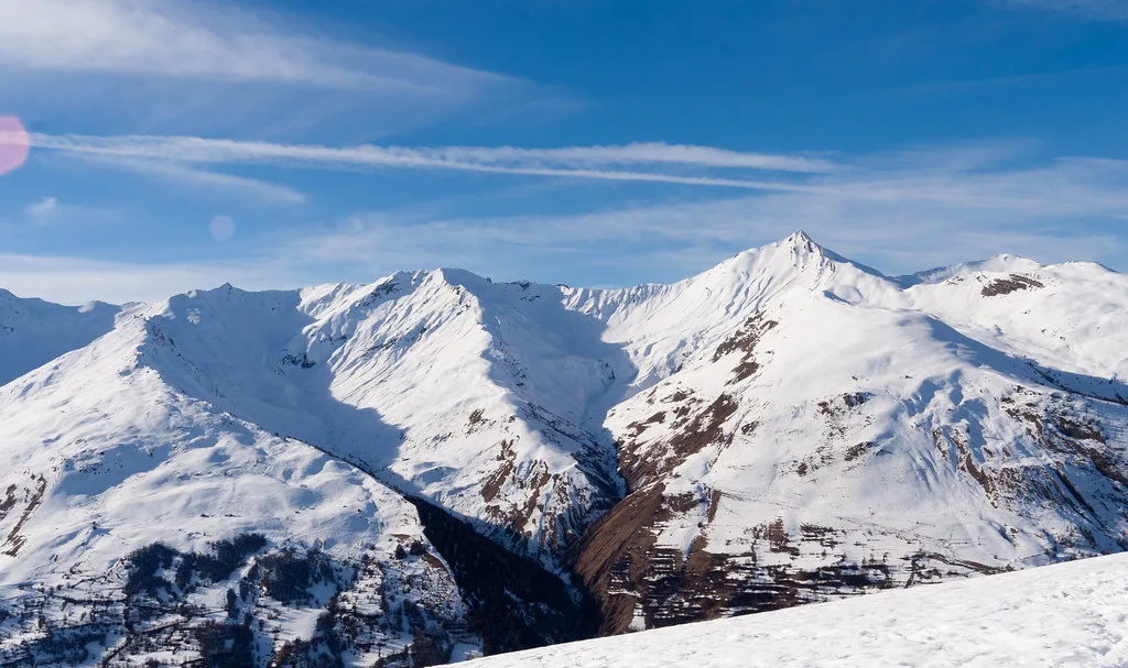
Valloire sits in the Maurienne in Savoie, on the Route des Grandes Alpes between the Col du Télégraphe and the Col du Galibier, with the village at the western end of the ski terrain. The map therefore reads as a long traverse eastwards rather than a compact circuit, and the far side belongs to Valmeinier.
The linked map graphic splits the area into labelled sectors: Sétaz and Crey du Quart above Valloire, then Crey du Quart and Gros Crey on the Valmeinier side. That naming is your first orientation tool, because every run decision on the map is really a sector decision.
One lift pass covers the whole Galibier-Thabor domain, so crossing to Valmeinier is a matter of time and snow conditions rather than a separate ticket. Plan the crossing as a full-day outing and keep the return leg in mind from the moment you head east.
Scale of the Area at a Glance
The Galibier-Thabor domain shared by Valloire and Valmeinier totals 89 pistes across 160 km, with slopes running between 1430 m and 2925 m. Roughly 70 per cent of that terrain sits above 2000 m, which is why the resort can hold a season from mid-December to mid-April.
For map reading, the altitude band matters more than the headline kilometres. The lower runs back to the village are the ones most exposed to mild spells and rain, while the upper terrain above 2000 m is where you go when the valley is softening.
Treat the 160 km as a two-resort figure, not a Valloire-only number. If you are in Valloire for two days, skiing every kilometre on the map is not a realistic target, so pick sectors rather than chasing distance. If you are weighing up a different French resort for a future trip, the Alpe d'Huez piste map guide shows how another large linked area is laid out.
The Four Map Starting Points in the Village
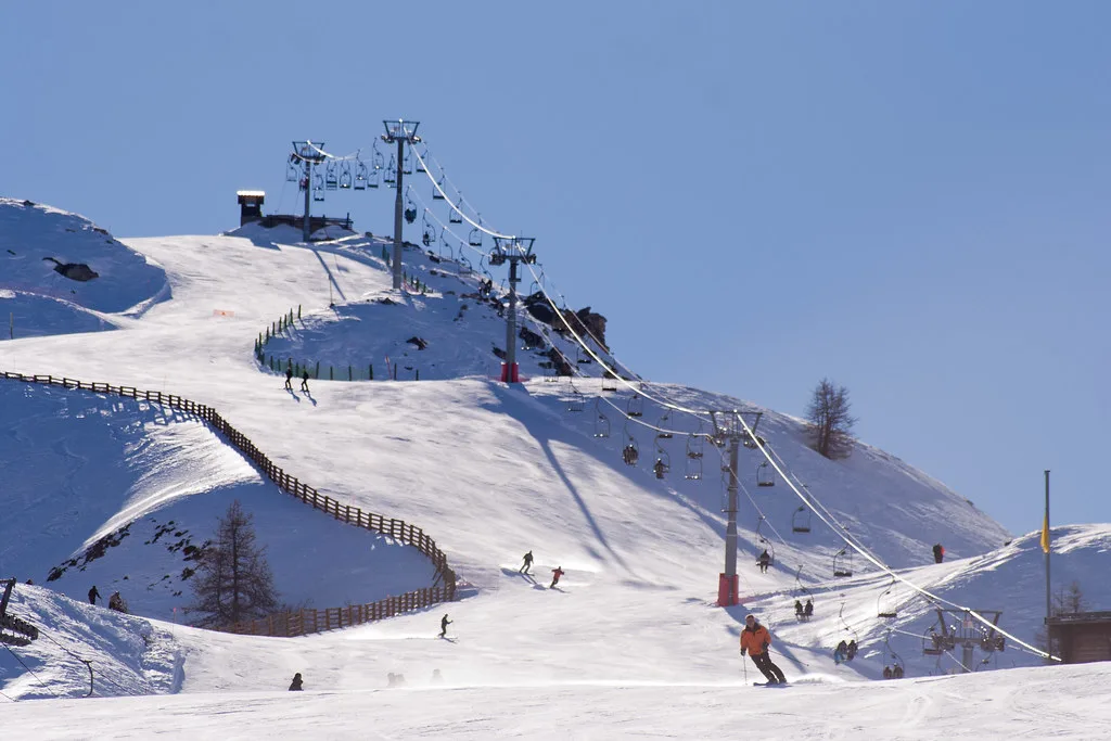
The village has four lift departure points marked on the map, each with illuminated information boards showing piste openings and snow conditions in real time: the Brive gondola, the Sétaz gondola, the Moulin Benjamin chairlift and the Verneys chairlift. Knowing which base you are leaving from is the single most useful thing to settle before your first morning.
Brive and Sétaz are the two gondola bases and carry most of the early traffic, while Moulin Benjamin and Verneys are chairlift starts that suit skiers staying at that end of the village. Where you sleep should decide your base, because criss-crossing the valley on foot with skis in the morning wastes the best hour of the day.
Valloire's Two Home Sectors: Sétaz and Crey du Quart
Sétaz and Crey du Quart are the two sectors on the Valloire side of the map. Sétaz rises from the Sétaz gondola and is where you find the Espace Thimel beginner zone at the top station, plus the DVA Park used for avalanche-transceiver practice near the top of the massif.
Crey du Quart is the sector that bridges Valloire and Valmeinier, so it appears twice on the map labels. Use it as your transit corridor: it carries you towards the Valmeinier side and back again, and it is the sector to watch late in the day when the return leg matters.
The Crey du Quart side also holds the terrain parks and the Easy Park with small bumps and banked turns. If you are skiing with teenagers who want features rather than kilometres, that is the sector to base the day around.
Crossing to Valmeinier: Plan the Return Leg First
The map runs Valloire, Crey du Quart and Gros Crey into Valmeinier in a continuous band, so you can ski across and back within a day. The trap is timing: once you commit to the far side, you are dependent on the linking lifts being open and on leaving enough margin to get home before they close.
Work backwards from the last lift rather than forwards from breakfast. Decide the hour you must be back in the Crey du Quart corridor, then build the Valmeinier side around that, which usually means crossing early and turning around after lunch.
Valloire's published lift hours are 9:00 to 16:15 before the French February school holidays and 9:00 to 16:45 from those holidays onwards. Confirm the current hours at your lift base before relying on the later finish.
Beginner Zones Marked on the Map
Three beginner areas are marked on the Valloire side: Espace Thimel at the top of the Sétaz gondola, served by a carpet; the Séa area above the Brive gondola with a small beginner drag lift; and the Verneys drag lift at the hamlet, deliberately away from the crowds.
For a first morning, Espace Thimel is the easiest to reach from the main village base, since the gondola does the climbing for you and the carpet removes the drag-lift learning curve. The Séa area is the alternative above Brive, and Verneys is the quietest choice if your group wants space over convenience.
Children under 1.25 m must ride chairlifts accompanied by an adult across the area, and sledges are not allowed on pistes. If your group includes small children, factor the chairlift rule into which beginner zone you choose, since drag lifts and carpets avoid the issue entirely.
Matching Sectors to Ability and Trip Length
For a first day, stay on the Valloire side and use Sétaz: the beginner zone sits at the top station, the DVA Park is nearby for skills practice, and you avoid any dependence on the Valmeinier link. That gives you a self-contained day with a simple gondola descent at the end.
A mixed-ability group is best served by basing itself near Brive or Sétaz, where stronger skiers can lap the home sectors while beginners work the marked zones, then meet at the same lift base. The Valloire Ski guide sets out how these pieces fit with passes and lessons.
A short-trip skier chasing mileage should go straight for the Crey du Quart corridor and the Valmeinier crossing on day one, because that is where the map's length translates into distance. Keep day two local to Sétaz and Brive so a tired group is not dependent on a long return.
Long Runs Worth Tracing on the Map
The Selles blue is the run to build a day around: it starts at 2410 m and finishes at 1725 m, giving 6.8 km of descent with views towards the Aiguille Noire valley. It suits families and confident intermediates, and it is the clearest example on the map of why the vertical range matters more than the number of lifts.
The area also has six marked ski-touring ascent routes, ranging from 2 km to 3.8 km with 370 m to 630 m of climb, finishing with a secured descent back towards the resort. They are worth tracing on the map if you want a touring day, but they need the right kit and a check on conditions.
Map Colours and Lift Symbols Decoded
The map legend uses the standard French four-colour scale: green for easy pistes, blue for medium difficulty, red for difficult and black for very difficult. Read it literally for a group of mixed ability, because a blue on the Valloire side can be long enough to tire a beginner.
Lift symbols distinguish gondolas, detachable chairlifts, fixed-grip chairlifts, drag lifts and carpets. The practical translation is speed and comfort: gondolas and detachable chairs move a group quickly and carry beginners well, fixed chairs and drags are slower and demand a bit more confidence.
Carpets only appear where beginners are learning, so a cluster of carpet symbols on the map identifies a learning zone without needing to read the piste colours. Use them to plan where to meet family members after a lesson.
Live Status: Interactive Map, Webcams and App
The official interactive piste map shows real-time piste and lift openings, with layers for groomed runs, connections and webcams. The resort publishes that the map is updated continuously through the December-to-April season, with corrections made promptly if something fails.
The resort app, Valloire Galibier Experiences, repeats the live openings and adds weather, snow conditions and webcams, which is useful when you are deciding over breakfast whether to head east. Webcams are the fast sanity check on cloud, wind and how busy the lift queues look.
Information boards at Brive, Sétaz, Moulin Benjamin and Verneys repeat the same live data at the lift bases, so you do not need a phone signal to change plan at the bottom station.
Practical Layout Notes: Lockers and Avoiding Criss-Crossing
Ski lockers sit at the lift bases, including at the Sétaz cable car and Dry Box lockers at the foot of each Valloire gondola, with heated storage for boots and skis. Leaving gear at your base rather than carrying it across the village is the simplest way to keep the morning efficient.
The valley runs roughly east to west, so a day that starts at Verneys and ends at Brive means a walk back with skis. Fix one base per day, use the map's sector labels to choose it, and only move bases when you switch to the Valmeinier corridor.
Season Shape and How Snow-Sure the Upper Terrain Is
The published schedule for 2026-27 runs from 12 December 2026 to 10 April 2027, with the lifts closing on 9 April 2027. These are the tourist office's published dates rather than a snow guarantee, so treat early December and mid-April as shoulder weeks.
Because around 70 per cent of the terrain sits above 2000 m, the upper sectors hold snow far better than the runs back to the village. When the valley is bare, the gondolas still get you to altitude; when it is mild, plan to finish higher and descend at the end of the day.
Reading the Map with Ski School and Hire in Mind
Lessons meet at the lift bases, so the map's four departure points double as meeting points. Book before you travel if you want a specific morning slot, and check whether the school uses the Sétaz or Brive base so your accommodation choice matches.
Collecting hire gear takes time out of the first morning, so choose a shop at or near your chosen base and pick up the evening before if the store allows it. Compare what each store includes, because boot quality and fitting time vary more than the headline price, as the Valloire Ski hire comparison sets out.
Prices for passes, lessons and hire are not published in the sources here, so check the current figures on the official site and the individual school or shop pages when you book.
A Two- or Three-Day Map Itinerary
Day one stays local: Sétaz gondola for the beginner zone or the upper runs, a look at the DVA Park if you are heading off-piste later, and a return to the same base. Day two takes the Crey du Quart corridor across to Valmeinier, with an early crossing and a fixed turnaround time after lunch.
If you have a third day, use Brive and the Séa area for a relaxed start, then trace the Selles blue from 2410 m to 1725 m as the centrepiece of the afternoon. That gives you one learning day, one mileage day and one long-cruise day without repeating sectors.
The same structure works for a family group: put the mixed-ability day in the middle, when everyone has found their feet, and keep the Valmeinier crossing for the day with the best weather window.
Plan Your Visit
Read the Valloire piste map as a two-resort area with four village starting points, then choose sectors for the day rather than chasing every run. Pick your base by where you are staying, keep the Crey du Quart corridor in mind for the Valmeinier crossing, and build the day around the Selles blue if you want one long descent.
Before you travel, download the interactive map and app, confirm the published season dates and lift hours, and check current pass, lesson and hire prices directly with the resort and the operators. The Valloire ski pass comparison is the place to weigh up pass products before you commit.
Frequently Asked Questions
How many kilometres of piste are on the Valloire piste map?
The Galibier-Thabor domain shared by Valloire and Valmeinier totals 160 km of piste across 89 runs, stretching between 1430 m and 2925 m. That figure covers both resorts, so treat it as the whole map rather than the Valloire side alone.
Does the Valloire piste map include Valmeinier?
Yes. The map covers the linked Galibier-Thabor area, with Valloire's Sétaz and Crey du Quart sectors connected to Valmeinier's Crey du Quart and Gros Crey terrain. One pass covers the whole area, so plan the crossing and the return leg before you head east.
Which lifts leave from the village of Valloire?
There are four departure points: the Brive gondola, the Sétaz gondola, the Moulin Benjamin chairlift and the Verneys chairlift. Each has live information boards showing piste and lift openings, so pick the base closest to your accommodation.
Where are the beginner areas in Valloire?
Beginners have three marked areas: Espace Thimel at the top of the Sétaz gondola with a carpet, the Séa area above the Brive gondola with a small drag lift, and the Verneys drag lift at the hamlet. Espace Thimel is the easiest to reach from the main village base.
What is the longest piste in Valloire?
The Selles blue runs 6.8 km from 2410 m down to 1725 m, with views towards the Aiguille Noire valley. It is a family-friendly descent and the clearest single run to build a day around.
How do I check which Valloire pistes are open?
Use the official interactive piste map, which shows real-time piste and lift openings with layers for groomed runs and connections. The Valloire Galibier Experiences app and the webcams repeat that information, and the boards at the four lift bases show it on the ground.
What do the colours on the Valloire piste map mean?
Green marks easy pistes, blue medium difficulty, red difficult and black very difficult. The legend also separates gondolas, detachable chairs, fixed chairs, drag lifts and carpets, which tells you how quickly a sector moves and how beginner-friendly it is.
When does the Valloire ski season start and finish?
The published 2026-27 schedule runs from 12 December 2026 to 10 April 2027, with lifts closing on 9 April 2027. Those are published dates rather than a snow guarantee, so check the current schedule before booking shoulder weeks.
Sources
Useful notes for your next ski trip
Optional updates to our Alpine resort guides.
You might also like
Continue reading
More guides you'll find useful