Les Arcs Ski Map: Sectors, Lifts and Paradiski Links
Read the Les Arcs piste map with confidence: the four Arc villages, Peisey-Vallandry and Villaroger sectors, key lifts, the Vanoise Express and live map tools.
On this page
The Les Arcs ski map rewards a few minutes of study before you book accommodation, because the resort is a ladder of villages rather than a single base. Your choice of Arc 1600, 1800, 1950 or 2000, or Peisey-Vallandry across the valley, decides which pistes you can lap without long traverses. This guide explains what the official map shows, which lifts to locate first, and how the Paradiski extension changes a day out.
Figures give the scale: the Les Arcs and Peisey-Vallandry area covers 200 km of trails, and the linked Paradiski domain with La Plagne covers 425 km with 258 runs. For the wider trip picture, from schools to booking checks, our Les Arcs Ski guide covers the groundwork.
What the Les Arcs Piste Map Actually Covers
There are two maps to hold in your head at once. The inner one is Les Arcs and Peisey-Vallandry, 200 km of trails served by 52 lifts and topped by the 3,226 m Aiguille Rouge. The outer one is Paradiski, the 425 km, 258-run domain that adds La Plagne through the Vanoise Express cable car.
On paper the map reads as a long band running from Villaroger in the lower Vanoise up to the glacier terrain above Arc 2000. Piste colour counts vary between published sources, so treat any breakdown as a guide to character rather than an exact audit. One independent resort profile counts 137 pistes on the Les Arcs side, including 63 blues and 45 reds, which matches the impression the map gives: this is a blue-and-red mountain with a hard high-altitude edge.
The map's vertical span is the detail worth noticing first. Resort level sits around 1,600 m and the highest lift reaches 3,226 m, so the top sections stay cold and snow-retentive while the lower tree runs are the fallback in poor visibility. Expect a genuine altitude difference between the villages, not just a change of postcode.
Reading the Village Ladder: 1600, 1800, 1950 and 2000
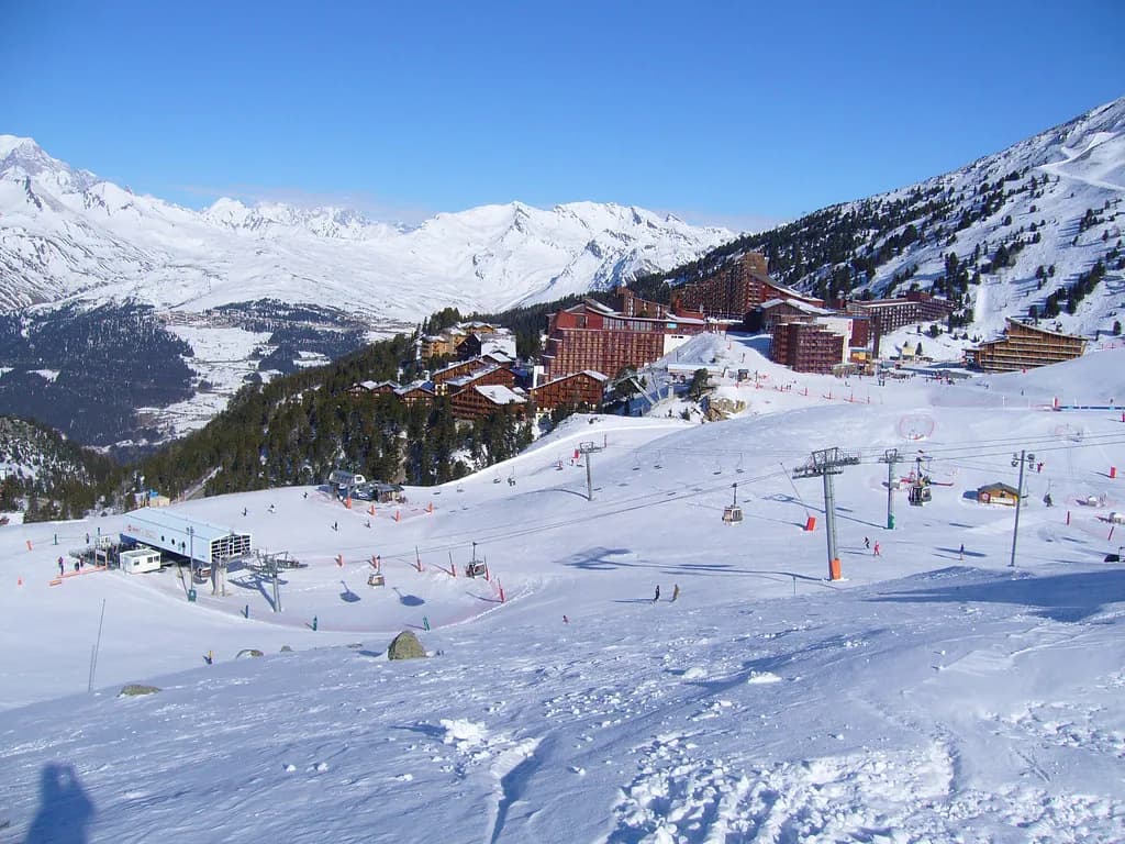
Arc 1600 sits lowest and southwest-facing, with tree-lined skiing and reliable snowmaking to keep the return run open; on the map it is the sector where descents spill down towards the valley villages. Arc 1800 straddles the tree line, and the map shows why it suits first-week skiers: around 90 per cent of the runs back into the village are graded blue. Arc 1950, built as a ski-in, ski-out base, sits directly above and gives quick access to the steeper terrain around Arc 2000.
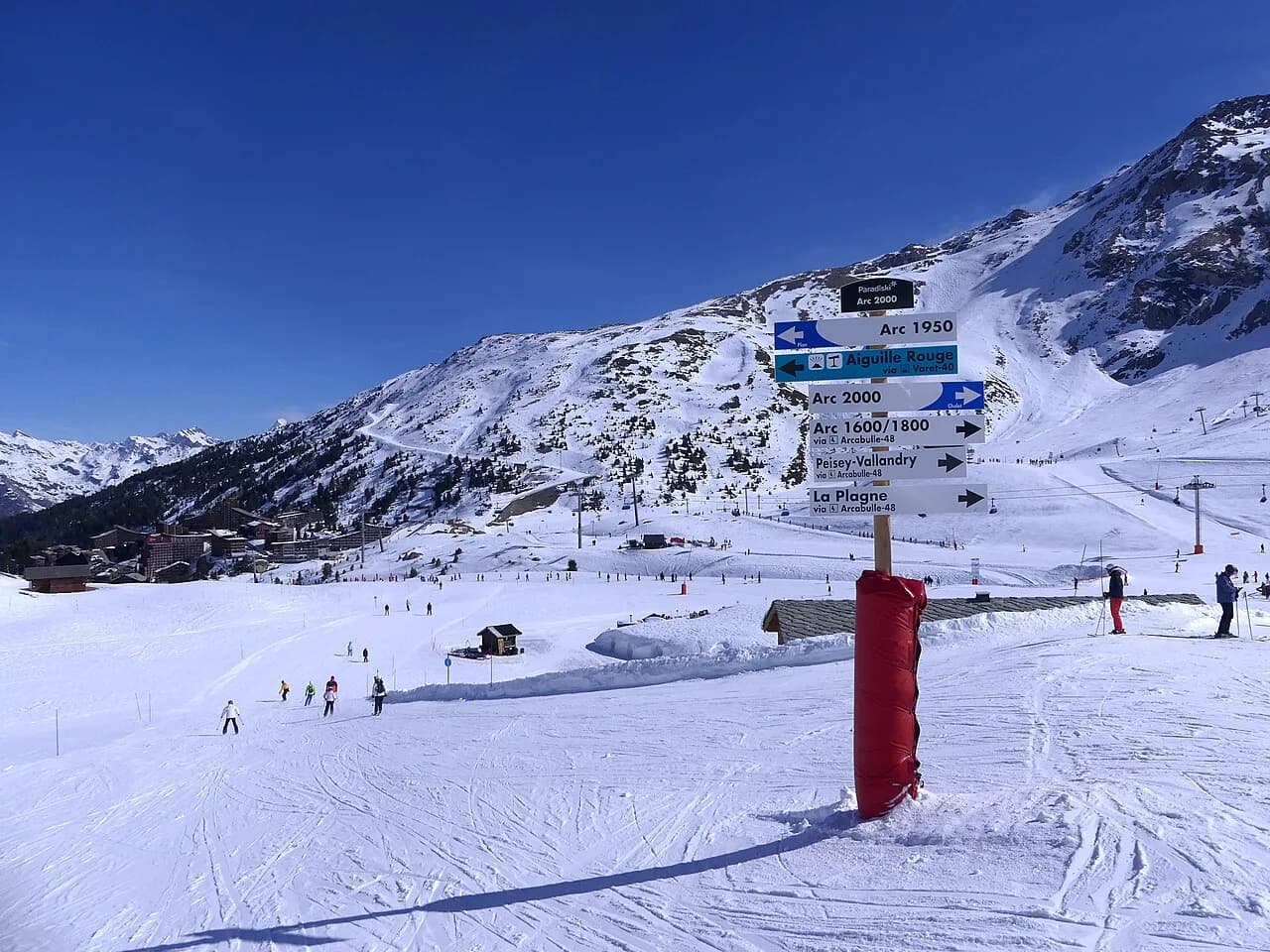
Arc 2000 is the high, red-and-black sector, and its position at the foot of the Aiguille Rouge cable car is the reason many strong skiers base themselves there. Peisey-Vallandry, on the far side of the valley, reads on the map as a quieter, heavily treed sector with a good mix of blues and reds and the Vanoise Express at its edge. Villaroger is the outlier: a low edge-of-map sector reached by a long descent, with lift access back that returns you only to Villaroger.
If you want the full picture of how the villages compare for beds, schools and access, the Les Arcs Ski guide walks through each base. For the map, the practical rule is simple: the lower villages trade altitude for trees and convenience, and the higher villages trade shelter for short transfers to the top lifts.
Key Lifts to Locate Before You Ski
Find the Transarc first. It climbs out of Arc 1800 in two stages and is the main artery towards Arc 2000, and the intermediate station matters because the bottom of the Maïtaz, Villards and Charmettoger runs converge there in an often busy, icy funnel. Riding up from the mid-station is the calmer way to move across to the 2,000 m terrain.
On the Arc 2000 side, look for the Arcabulle, Varet and Bois de l'Ours lifts and the Aiguille Rouge cable car, which the resort lists among its pedestrian-accessible lifts alongside Arcabulle and Varet. In Peisey-Vallandry the names to trace are Peisey, Vallandry, Grizzly and Derby, the group that gives access to the tree runs and the link towards La Plagne. The official lift page lists the full inventory sector by sector, which is the quickest way to confirm a name before you commit it to a plan.
Arc 1600 has its own short list: the funicular, the Cachette and Vezaille lifts for the nursery and blue terrain, and the Arpette, Mont Blanc and Combettes chairs that carry you towards the bigger circuit. Knowing these names stops the map looking like a thicket of lines and turns it into a set of decisions.
Beginner Zones on the Map: Mille8 and the Nursery Areas
Mille8 is the zone to highlight at Arc 1800: a ski area with nursery slopes, tree-lined easy runs and the ski school meeting points, reached by the Carreley and Villards chairs. On the map it is compact and clearly bounded, which makes it a good base for a family whose first mornings will be spent in one small area. The Carreley and Villards gondolas also appear in the resort's list of express lanes for pass holders, so lift queues are a lesser worry here.
Elsewhere the beginner geography is straightforward. Arc 1600's tree-lined blues suit the step up from nursery to real runs, Arc 2000 has rolling blues such as Plan Vert and Cascades that are shallower than the sector's reputation suggests, and Villaroger offers short blue laps off the Replat chair. Peisey-Vallandry adds gentle tree-lined blues from the Peisey and Vallandry lifts.
Booking ski school early is more important than map-reading once the zone is chosen, because meeting points are fixed and popular weeks fill. Our Les Arcs Ski lessons page sets out the school formats and the questions worth asking before you pay a deposit.
The Signature Descent: Aiguille Rouge to Villaroger
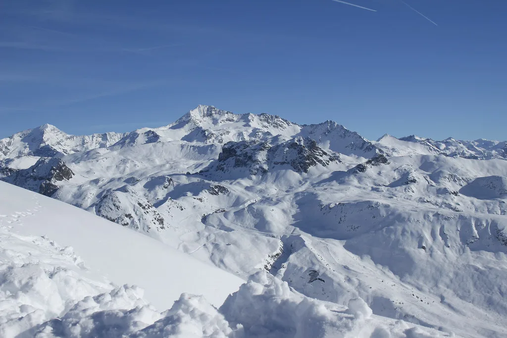
The longest run in the area is the 7 km descent from the Aiguille Rouge down to Villaroger, dropping more than 2,000 m of vertical. On the map it draws as a single long line to the western edge, and that shape is the warning: the run commits you to a low-altitude finish with lift access back only towards Villaroger. Check the return lift's status before you set off, because ending low with a closed connection is a long day.
The Aiguille Rouge cable car also opens the high glacier terrain and the Kilometre Lancé speed piste, and it is one of the lifts the resort lists as pedestrian-accessible, so non-skiing companions can ride up for the view. If your group splits, agree a meeting point at the top station rather than at the bottom, where the runs disperse.
Crossing to La Plagne on the Vanoise Express
The Vanoise Express is the single cable car that ties Les Arcs, Peisey-Vallandry and La Plagne into one domain, and on the map it sits at the Peisey-Vallandry end of the Les Arcs band. Crossing it is a half-day decision rather than a quick detour: La Plagne spreads across multiple villages with its own long cruising runs, several snowparks and a half-pipe.
Treat the crossing as a day plan, not a lap. Go early, choose a return time, and remember the last connection back runs on the express's own calendar rather than the wider lift schedule. The Vanoise Express closes for the season on 17 April 2027 even though the Les Arcs lifts run to 24 April, so a late-April trip loses the La Plagne option.
If you are weighing whether the crossing is worth it, the Les Arcs Ski guide puts the linked domain in the context of a full week. A shorter break is usually better spent learning one side of the valley well.
Snowparks and Extras Marked on the Map
Two freestyle zones appear on the Les Arcs map. The Apocalypse snowpark, with a boardercross, sits between Arc 1600 and Arc 1800 beside its own lift; the Mille8 snow zone at Arc 1800 has lights, a sound system and screens that tag your photos, and entry is included in the lift pass. The resort also describes its snowpark as 7.5 hectares of terrain with features for all levels.
Off the snow, the map points to sledging runs at Arc 1800 and Arc 2000 and to the Aiguille Rouge zip line, which appears as a discounted extra on the higher-tier passes. These matter when you are planning a mixed-ability group day, because they give non-skiers a marked destination on the same map.
Piste Map Versus Lift Pass Map: Classic, Essential and Premium
The map you can actually ski depends on the pass you buy. The Classic pass covers the Les Arcs and Peisey-Vallandry area plus the funicular, while the Essential and Premium passes open the whole Paradiski domain including La Plagne, with the Essential recommended for most visitors. The pass page sets out the inclusions, including discounted and free activities such as the zip line, sledging and pool access, but leaves the tariffs to the online shop.
Two calendar features are worth mapping onto your week: an early-season discount applies to the first week of the season on the Classic and Essential passes from 12 to 18 December 2026, and a late-season discount applies to the final week on the Classic pass from 17 to 24 April 2027. In both cases the discount is 15 per cent off ski passes. Our Les Arcs Ski Pass page explains the product tiers and what to check before booking.
Children under five ski free, and reduced rates for other age bands require proof of age at purchase. A separate beginner pass is sold on site only, which is worth knowing if you are buying online in advance and want the smallest possible product for a first-timer.
Live Status Instead of a Paper Map
The YUGE app is the resort's own tool: an interactive map, lift waiting times, webcams, geolocated shuttles, trail conditions and lift-pass purchase in one place. More than 700,000 users have downloaded it, and it is the fastest way to check whether a lift or piste is running before you leave the apartment.
The official lift page mirrors this with a live count of open lifts and pistes by colour, plus each lift's opening times sector by sector. That is the page to refresh on a windy morning, when the Aiguille Rouge cable car or the Vanoise Express may be the first things to stop. The trail map itself can be downloaded from the same site rather than reproduced elsewhere.
If you like comparing map conventions between resorts, our Alpe d Huez piste map guide covers a different layout logic. For Les Arcs, the app and the live lift page are enough.
Season Dates to Pencil In
For winter 2026-27 the Les Arcs lifts run from 12 December 2026 to 24 April 2027, and the Vanoise Express runs from 12 December 2026 to 17 April 2027. The resort's own activity pages give a Paradiski window ending 17 April and a full-season window ending 24 April, so check the calendar for the specific week you book rather than assuming one end date for everything.
The funicular connects Bourg Saint Maurice with Arc 1600, and return travel is free on presentation of a train ticket to Bourg Saint Maurice for the season. That makes a train-based trip genuinely practical, with the funicular acting as your transfer and the lift pass covering it on the Classic tier and above.
For a week-by-week view of how the calendars line up across the linked areas, our Les Arcs Ski season dates page tracks the local and Paradiski windows. Book around confirmed dates and snow reliability rather than the earliest advertised opening.
Getting the Map in Hand
Download the official trail map from the resort's lift page before you travel and store it offline, then treat the paper version as a backup for cold fingers and flat batteries. Paper copies are usually available at lift ticket offices and the tourist office in each village, and your accommodation often has one at reception.
Ski hire shops are another reliable source, and picking up the map when you collect equipment means you can mark your meeting points before the first morning. Our Les Arcs Ski hire page covers the named branches and the booking channels worth using.
If you plan to print at home, print in colour and at A3 if you can; the map's value is in the colour coding of pistes and the fine detail around the village funnels, both of which disappear on a greyscale A4 sheet.
Planning a Day by Sector
For a first day, base yourself at Arc 1800 and stay in the Mille8 and Transarc area: warm-up blues, the nursery if needed, and an easy route home. For an intermediate day, ride Transarc to Arc 2000, sample the rolling blues and the Varet sector, then return via the Villards side rather than the crowded convergence at the bottom.
For an expert day, start early at the Aiguille Rouge cable car, ski the long descent to Villaroger while the snow is still firm, then work back through Arc 2000's blacks and the Grand Col off-piste. If the link to La Plagne is open, give it a full day of its own rather than bolting it onto a Les Arcs circuit.
Whichever plan you choose, check the current lift status and any pass prices on the official site before you commit, since these change with the calendar and the week. Two checks, one before booking and one the day before you ski, are usually enough.
Plan Your Visit
The Les Arcs piste map is best used as a filter: decide which village you are sleeping in, which pass you are buying, and which two or three sectors you want to ski properly, then let the rest of the 425 km go. A week is not long enough to know Paradiski well, but it is plenty to know one side of the valley.
Check the dates that matter for your week, confirm your pass inclusions, and download the map and the YUGE app before you travel. The rest of the planning, from lessons to hire, sits in our Les Arcs Ski guide.
Frequently Asked Questions
How many kilometres of piste are in Les Arcs?
The Les Arcs and Peisey-Vallandry area covers 200 km of trails, and the linked Paradiski domain including La Plagne covers 425 km with 258 runs. The Les Arcs side alone is served by 52 lifts and topped by the 3,226 m Aiguille Rouge.
Where is the Vanoise Express on the Les Arcs ski map?
It sits at the Peisey-Vallandry end of the Les Arcs band, connecting that sector with La Plagne. Crossing it takes a meaningful part of a day, so plan a return time rather than treating it as a quick lap.
Which Les Arcs village is best placed for beginners?
Arc 1800 is the easiest base for first-week skiers, with around 90 per cent of runs back into the village graded blue and the Mille8 nursery zone reached by the Carreley and Villards lifts. Arc 1600's tree-lined blues and Arc 2000's rolling blues also work well.
What is the longest run in Les Arcs?
The 7 km descent from the Aiguille Rouge down to Villaroger drops more than 2,000 m of vertical. Note that the lift access at the bottom returns you only towards Villaroger, so check the connection before you set off.
Do I need a Paradiski pass to ski La Plagne from Les Arcs?
Yes. The Classic pass covers Les Arcs and Peisey-Vallandry plus the funicular, while the Essential and Premium passes add the full Paradiski domain including La Plagne.
Is there a Les Arcs ski map PDF or app?
The official Les Arcs site offers a downloadable trail map, and the YUGE app carries an interactive map, lift waiting times, webcams and trail conditions in one place. Both are worth having offline before you travel.
When do the Les Arcs lifts open and close for winter 2026-27?
The lifts run from 12 December 2026 to 24 April 2027, while the Vanoise Express runs from 12 December 2026 to 17 April 2027. Check the calendar for your specific week, as the two do not share the same end date.
Sources
Useful notes for your next ski trip
Optional updates to our Alpine resort guides.
You might also like
Continue reading
More guides you'll find useful