La Plagne Ski Map: How to Read the Pistes and Plan Your Days
Use the La Plagne piste map to plan your ski days: six resort villages, 225 km of runs, the Paradiski link and how to check live lift and slope status.
On this page
The La Plagne piste map rewards a few minutes of study before you book anything. It shows one ski area hanging above six separate resort villages, each with its own base station and character, all wired together by lifts and a free local transport network. Read it as a picture of how your week will work rather than a list of runs, and decisions about where to sleep, which pass to buy and where to meet for lunch become much easier.
This guide walks through what the map covers, how to decode the French lift abbreviations printed on it, which sectors suit which standard of skier, and how the Paradiski link changes the picture. It also covers the winter maps beyond downhill skiing and the live tools La Plagne Tourisme runs so you are not relying on a static PDF in the morning.
What the La Plagne Piste Map Covers
The map describes a single ski area above six resort villages, with 139 downhill runs and 77 lifts adding up to 225 km of piste. That figure is the La Plagne total only; the linked Paradiski area is a separate, larger number shown on a second map. Knowing which map you are holding matters, because a run that looks like the far edge of one document may be the middle of the other.
La Plagne Tourisme publishes the La Plagne ski area map and the Paradiski area map as separate downloads, alongside village-level resort plans showing accommodation, shops and services. Start with the ski area map for terrain and the village plan for the walk from your chalet to the nearest lift. If you want the wider planning context first, the La Plagne ski guide sets out the resorts and sectors before you open any map.
One practical quirk: the six villages are linked by a free public transport system, so a base that sits away from a main lift hub is not the penalty it might look on paper. Check the resort plans for where the shuttle stops sit relative to your accommodation before you commit.
The Headline Numbers on the Map
The numbers to hold in your head are 225 km of runs, 139 pistes and 77 lifts for La Plagne itself. The breakdown is unusually generous to improvers: 78 blue runs against 52 red and black runs combined, with greens filling out the village bases. That ratio is a strong signal about who the area is built for.
Altitude is the second number set worth noting. The area tops out at 3080 m at the Glaciers 2 gondola, and more than 70% of the runs sit above 2000 m. On the map, that means the upper half is where snow reliability lives, while the lower village runs are the ones most exposed to a mild spell.
Beyond the piste count, the same document marks snowparks, boardercross courses, family fun runs and pedestrian-accessible lifts. Those matter for mixed groups: a non-skiing partner can ride up to a high-altitude restaurant and meet you for lunch rather than waiting in the village.
How the Map Is Laid Out: Sectors and Village Bases
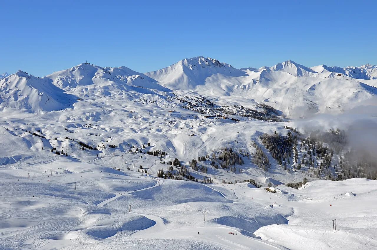
The villages read left to right across the map as Champagny-en-Vanoise, Montalbert, Montchavin-les-Coches, then the high cluster of Plagne Centre, Plagne Bellecôte, Belle Plagne, Plagne Villages and Plagne Soleil. The high group functions as one interconnected hub; the outlying villages are quieter bases with their own lift access into the system. Where you stay decides which sector you ski first each morning.
The named summits anchor the sectors: La Roche de Mio at 2739 m, Grande Rochette at 2508 m and Les Verdons at 2500 m, with the glacier beyond. Blue and red runs fan down from these points, so the map effectively divides into a Belle Plagne and Roche de Mio side, a Plagne Centre and Grande Rochette side, and the lower forest villages.
Access lifts shape the flow: the Roche de Mio and Glaciers gondolas leave from Belle Plagne, and the Grande Rochette funicular climbs from Plagne Centre. Planning a day around one of these access points saves a lot of traversing. Your choice of base camp should sit on the side of the map you expect to ski most.
Altitude on the Map: From 1250 m Villages to the 3080 m Glacier
The vertical range on the map runs from around 1250 m at Montchavin-les-Coches to 3080 m at the top of the Glaciers gondola. That is a large spread, and it explains the two-season feel of the area: reliable high-altitude terrain above, and lower forest runs that come and go with conditions. When you read the map, trace the altitude of each sector rather than just its distance from your hotel.
The map also shows a mix of north- and south-facing exposures, which is why spring skiing here involves following the sun around the mountain rather than staying put. The high runs above 2000 m hold up best late in the day and late in the season, while the lower village runs soften first.
For non-skiers, the map marks pedestrian-accessible lifts including the La Roche de Mio and Glaciers gondolas from Belle Plagne and the Grande Rochette funicular from Plagne Centre. These are genuine meeting points at altitude, not just viewing platforms. If your group splits by ability, use them to set a lunch rendezvous.
Which Sectors Suit Which Ability
Beginners are best placed in the village beginner zones, where gentle slopes and dedicated learning areas keep speeds low. The map marks these safe learning areas clearly, and 16 lifts in the beginners' areas are free, which lets you try the sport before committing to a pass. Start at the base nearest your accommodation rather than travelling across the area to find a green.
Intermediates have the run of the place, with 78 blue runs across every sector. These are the map's real strength: long, confidence-building descents that let a group of mixed-standard skiers move around the whole area together. Red and black skiers head for the steeper terrain off the summits, where 52 red and black runs in La Plagne provide the challenge.
Family groups should note the Funslope, reached by the Arpette chairlift from Plagne Bellecôte, and the Buffalo Park and Buffalo Kids fun runs off the Colorado chairlift at Plagne Centre. Marking those on your map turns a ski day into something children will actually ask for. If anyone needs instruction, sorting La Plagne ski lessons before you travel keeps the mornings free for skiing.
Reading the Lift Symbols on the Map
Lifts are drawn as straight black lines and labelled with French abbreviations: TK for téléski (drag lift), TS for télésiege (chairlift), TC for télécabine (gondola) and TPH for téléphérique (cable car). Anything marked Express is a fast six-person chair. Learning these four codes takes a minute and stops you planning a route around a lift you would rather avoid.
Drag lifts are worth spotting if you or your children are new to them; they are less forgiving than a chair and can be tiring on a long traverse. The map lets you build a route that uses chairs and gondolas primarily, with drags only on short sections. For snowboarders and nervous beginners, that is a meaningful planning filter.
Gondolas and the cable car move pedestrians as well as skiers, so they appear on both the piste map and the pedestrian-lift notes. The Vanoise Express, the cable car linking La Plagne with Les Arcs, is the single most consequential line on the map for anyone considering a Paradiski pass.
Beginner Zones and Free Lifts
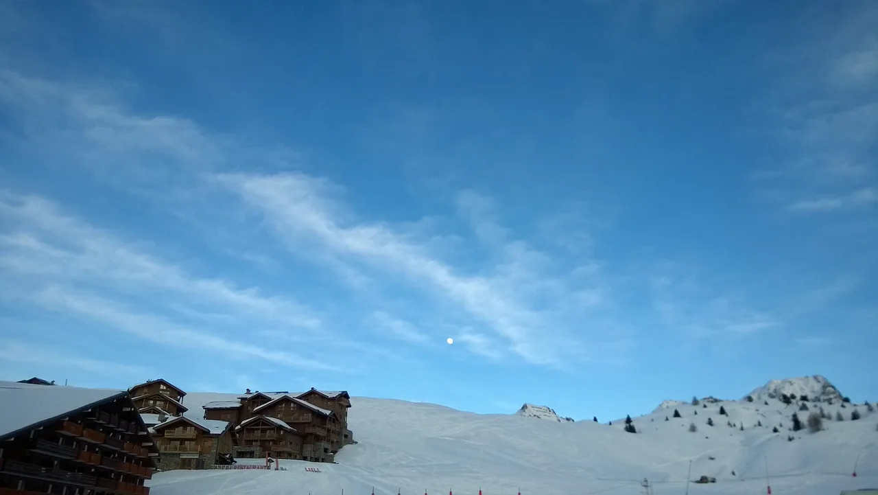
The beginner zones are the first thing to find on the map if anyone in your group is learning. Sixteen lifts in these areas are free, so first-timers can ride and slide without buying a full pass on day one. That makes the village bases genuinely attractive as a first-day location, even if the group later moves higher.
Once a beginner is making linked turns, the Cool Ski package gives access to safe, beginner-friendly itineraries across a broader patch of the map. It sits between the free-lift experience and a full area pass, and it is worth asking about when you buy. Compare coverage and conditions in the La Plagne ski pass guide before you commit.
Ski schools operate across La Plagne and its villages, and booking a block of group or private lessons early in the week pays off because instructors can then point you at the right sectors on the map. Equipment can be sorted in resort; arranging La Plagne ski hire ahead of arrival saves a morning queue.
The Paradiski Link: Vanoise Express and 425 km
The Vanoise Express cable car links La Plagne with Les Arcs and Peisey-Vallandry, opening up a combined Paradiski area of 425 km of runs and 129 lifts. On the map, the link appears at the western edge, and the scale of what lies beyond is easy to underestimate. Decide before you travel whether you want that extra terrain, because it changes which pass you buy.
Paradiski adds up to 19 green, 128 blue, 77 red and 34 black runs. For strong intermediates and above, a day or two across the link is a real highlight, with the transparent floor of the Vanoise Express above a 380 m drop a memorable part of the crossing. For a family of beginners, the La Plagne side alone is plenty.
You have two ways to buy into it: a Paradiski pass by the day or week, or a Paradiski extension added to a valid La Plagne pass whenever you like. The extension is the flexible option for a group that only wants one or two days over the link. Work out the number of Paradiski days you realistically want before you choose.
Low-Resort Skiing at Montalbert and Montchavin-les-Coches
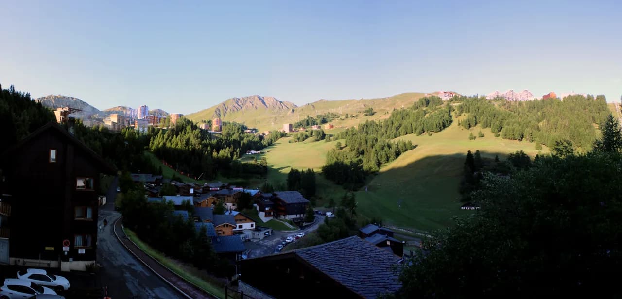
Montalbert at 1350 m and Montchavin-les-Coches between 1250 and 1450 m are where the map turns green and wooded. The skiing here is forest-based rather than high-alpine, which makes it a pleasure on snowy days when visibility up top is poor. The runs typically operate from the Christmas holidays until early to mid-April.
If you are staying in one of these villages and skiing mostly locally, the village ski pass is the sensible product, and it is sold on the same principle as the full-area pass. The trade-off is clear: you save on the pass, but you limit yourself to the lower lifts. Check the current comparison on the La Plagne Ski Pass Guide before deciding.
These villages are also the first to close as spring arrives, so if your trip falls in mid-April, plan to ski higher up and treat the forest runs as a bonus. The map makes the altitude difference obvious once you look at the contours rather than the piste colours.
Beyond Downhill: Cross-Country, Ski Touring and Walking Maps
La Plagne has 55 km of cross-country trails, concentrated on the Nordic areas of Champagny-le-Haut with 23 km, Montchavin-les-Coches with 16 km and the Versant du Soleil at Granier and La Côte d'Aime with 8 km and 12 km respectively. Most itineraries are free to use and need no lift, though Champagny is the exception. Those routes appear on separate winter maps rather than the downhill piste map.
Seven marked ski touring trails start from Plagne Bellecôte, Plagne Centre, La Roche, Montalbert, Montchavin, Les Coches and Champagny-en-Vanoise, and access is free with no pass required. Descents follow the downhill pistes, which keeps things simple for anyone new to touring. Hire shops can advise on touring boots and skis if the equipment is unfamiliar.
Snowshoeing and winter walking routes are published as their own maps for Champagny-en-Vanoise, Montchavin-les-Coches and Montalbert. Download the one that matches your village rather than relying on the downhill piste map, which does not show walking trails.
Live Status, Webcams and the App
The piste map is available as a live, interactive version during the season, showing lift and slope openings and closures in real time. Outside operating hours it reverts to scheduled openings, so a morning check before you leave your accommodation is the reliable habit. La Plagne Tourisme also runs mobile links for the live map in French and English.
Webcams are published alongside the map and give a quick read on visibility, snow cover and crowds before you commit to a sector. Use them together with the live map: a lift may be open while the run beneath it is not, particularly after wind or a warm night.
The brochures and downloads page hosts the current season piste maps as PDFs, plus village plans. Save the PDF to your phone before travelling, since mountain connectivity is patchy, and use the interactive version on the day.
Getting the Map: Downloads, PDFs and Printed Plans
The official downloads page is the cleanest source for the La Plagne ski area piste map and the separate Paradiski area map, both as PDFs, along with village resort plans for Belle Plagne, Plagne Villages and Soleil, Montalbert, Plagne Bellecôte and Plagne Centre. Printing the relevant village plan before you travel is genuinely useful for finding your accommodation on arrival.
An independent resort site also collects piste maps, town maps, snowshoeing and ski touring maps and cross-country maps in one place, which is handy if you want everything on one page. It confirms that lifts are shown with the same French abbreviations as the official maps, so the two are consistent.
Printed piste maps are usually available at lift stations and tourist offices once you arrive, but do not count on getting one before you have planned your first morning. Download the PDF at home, and treat the printed version as a backup.
Season Shape: Mid-December to April
The La Plagne ski area opens from mid-December and runs through to April, with the pre-Christmas week often offering special-rate passes. The low-altitude villages of Montchavin-les-Coches and Montalbert close first, typically in mid-April, before the high-altitude terrain follows. This matters most if you are booking a late-season trip and want to ski the lower forest runs.
The high-altitude concentration, with more than 70% of runs above 2000 m, is why the area can stay open into spring when lower resorts are finished. Book late-season trips with that in mind and expect to ski mostly the upper sectors. Exact opening and closing dates vary by season, so check the current La Plagne Ski season dates before booking.
How to Plan a Day on the Map
Start with a base camp: identify the nearest lift to your accommodation on the village plan, then trace the quickest route to the sector you want. From Belle Plagne, the Roche de Mio and Glaciers gondolas give fast access to the high terrain; from Plagne Centre, the Grande Rochette funicular does the same. Building your day around one access lift keeps you skiing rather than traversing.
Plan lunch as a map decision, not an afterthought. The map marks high-altitude restaurants and picnic rooms, and pedestrian-accessible lifts let non-skiers join you. A table reserved at a mid-mountain restaurant saves the scramble, and the map shows which runs you can ski afterwards without dropping back to the village. Check current opening dates and prices with La Plagne Tourisme before you travel.
Finally, plan the route home. On the map, choose the lift or run that returns you to your village at the end of the day, and note its closing time. For a broader view of how the sectors fit together across a week, the La Plagne Skiing Guide is a useful companion to the map.
Plan Your Visit
A La Plagne piste map does more than show runs: it reveals a two-tier ski area of high-altitude terrain and low forest villages, six resort bases that behave very differently, and a link into Paradiski that changes what a pass is worth to you. Read the lift symbols, note the altitudes and decide early whether you want the Paradiski extension.
Download the current PDFs, check live lift and slope status on the morning of skiing and use the webcams to read conditions. If you are comparing resorts elsewhere, the Alpe d Huez piste map guide shows how a different French area is laid out.
Frequently Asked Questions
How many kilometres of piste are in La Plagne?
La Plagne has 139 downhill runs and 77 lifts covering 225 km of piste, with 78 blue runs and 52 red and black runs combined. The linked Paradiski area, which includes Les Arcs and Peisey-Vallandry, takes the total to 425 km.
Where can I download the La Plagne piste map?
The official La Plagne site publishes the ski area piste map and the separate Paradiski area map as PDFs, alongside village resort plans. Download them before travelling, as mountain connectivity is patchy.
Is La Plagne good for beginners?
Yes. The ski area devotes a large proportion of its runs to blues and has safe learning areas at the village bases, with 16 free beginner lifts. The Cool Ski package suits skiers progressing from their first turns.
Which La Plagne resort is best for my base?
Plagne Centre and Belle Plagne give the fastest access to high terrain via the Grande Rochette funicular and the Roche de Mio and Glaciers gondolas. Montalbert and Montchavin-les-Coches offer quieter forest skiing in low villages.
Does the La Plagne piste map include the Paradiski link?
The La Plagne map shows the Vanoise Express cable car link to Les Arcs, but Paradiski operates on a separate larger map. You need either a Paradiski pass or a Paradiski extension to ski the linked area.
Can I check live lift and piste openings?
Yes. During the season the official piste map is interactive and shows real-time lift and slope openings and closures, with webcams for conditions. Outside operating hours it shows scheduled openings.
Sources
Useful notes for your next ski trip
Optional updates to our Alpine resort guides.
You might also like
Continue reading
More guides you'll find useful