Tignes Ski Map: Reading the Pistes, Sectors and Glacier
Read the Tignes piste map with confidence: the Val d'Isère link, five resort bases, Grande Motte glacier and live lift status before you set out.
On this page
The Tignes piste map does two jobs at once. It shows you where the runs go, and it tells you which of the resort's five bases you should start from on any given morning. Get comfortable with it before you arrive and your days on snow get noticeably simpler.
This guide explains what the official map covers, how the Tignes sectors connect to Val d'Isère, where beginners fit, and which live-status channels are worth checking on the day. It is about reading the map, not replacing it: the official versions are the ones to carry.
What the Tignes Piste Map Actually Covers
The map in your hand covers the Tignes–Val d'Isère ski area, a single high-mountain domain shared by two resorts. The official Tignes map presents it as 300 kilometres of trails and 153 runs running from green to black, so the paper folds out to a genuinely large area rather than a village hill.
That scale is the first thing to internalise. A run that looks short on the fold-out can take most of a morning once you add the lifts back up, and linking the far ends of the domain is a project rather than a detour. Plan two or three sectors per day and leave the rest for the next visit.
For the wider picture of how the villages, terrain and booking decisions fit together, the Tignes ski guide is the natural companion to the map. Read it alongside the piste plan so you know which base matches your ability before you start tracing lifts.
The Five Tignes Bases on the Map
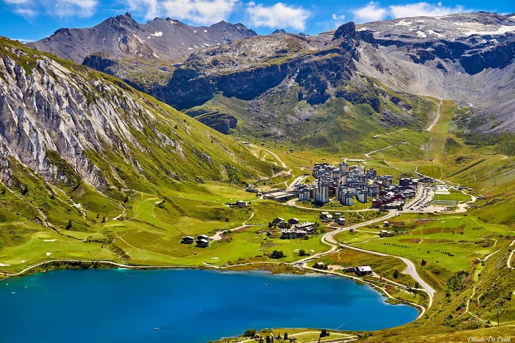
Tignes is not one village but a chain of them, and the map shows each base with its own lift access to the slopes. Val Claret sits highest and closest to the glacier; Le Lac is the central, liveliest base; Lavachet fills the gap between them; Les Boisses and Les Brévières sit lower down the valley and reach the ski area by lift.
Choosing a base is really choosing a starting lift. Val Claret and Le Lac put you on the upper mountain quickly, which matters on powder mornings; the lower villages trade altitude for quiet and valley atmosphere. Neither is wrong, but the map makes the trade-off visible: count the lift rides between your bed and the first run you care about.
Les Brévières and Les Boisses are the bases people forget when they picture Tignes. On the map they anchor the western end of the resort and give access upward via their own lifts, so a day there can still reach the main domain without a bus ride. If you are staying low, learn those connections first.
Sector by Sector: Glacier, Val Claret, Tichot and Grattalu
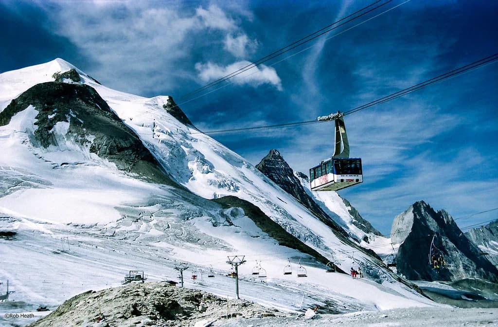
The Grande Motte glacier crowns the map and is the reason Tignes holds snow when lower resorts struggle. Its lifts and runs sit above Val Claret, and the sector is the one to watch on the live map because wind and visibility change the picture quickly. Treat it as a morning objective rather than an afterthought.
Below the glacier, the Val Claret and Tichot sectors form the busy heart of the Tignes side, with a dense web of lifts that lets you lap a favourite pitch without crossing the whole resort. Grattalu and the Aiguille Percée area spread the traffic further east and offer longer, quieter descents when the central lifts queue up.
The Double M link is the map feature worth studying before you commit to a route. It ties the Tignes side toward the Val d'Isère sectors, so a wrong turn late in the day can mean a long return. Decide before you drop in whether you are skiing Tignes only or crossing over, and time the crossing with the lifts still running. If you are weighing a base on the other side of the link, the Alpe d Huez piste map guide is a useful example of how a large linked domain is broken into sectors.
The Val d'Isère Connection: Solaise and Bellevarde
Val d'Isère is not a separate trip bolted onto Tignes; the two resorts share one lift pass and one map. The Val d'Isère side is usually read through two big sectors, Solaise and Bellevarde, both reachable from the village and both linked across to the Tignes terrain. Knowing which side of the map you are on prevents a lot of wasted traversing.
The official Val d'Isère map page notes that the Solaise gondola and the Olympique cable car at the top of Bellevarde give families and beginners a quick, safe way down to the foot of the slopes in the village centre. That is a layout point rather than a ranking, and it is useful when you are deciding where to end a day with tired legs.
Crossing between the two resorts takes real time, so build it into the plan rather than squeezing it in at four o'clock. If you are staying in Tignes, a Val d'Isère day is best started early and finished on the Tignes side of the link. The same logic applies in reverse for anyone based in Val d'Isère.
Where Beginners Fit on the Map
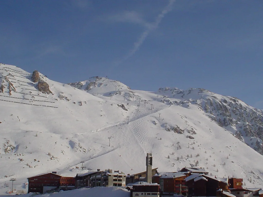
Most Tignes bases have nursery slopes and gentle runs close to the lifts, which is why the map looks beginner-friendly at village level. The trick is to learn which lifts serve those easy pitches so you are not accidentally loading onto a cable car that unloads you on a steep, busy shoulder.
On the map, look for the greens and blues that fan out from each base and note where they converge. Busy junctions near the main lift stations are the places to be cautious with a class of first-timers. The quieter beginner zones tend to sit slightly away from the central Val Claret hub.
If you are booking instruction, match your meeting point on the map to your accommodation before you choose a school. A lesson that starts two bases away adds a bus or a lift ride to every morning. Confirm meeting details with the school directly when you book.
Reading the Grande Motte Glacier Map
The Grande Motte glacier has its own map, and it behaves differently from the rest of the resort. In winter it is part of the live interactive picture; in summer, skiing continues on the glacier but the summer piste map is not interactive, so you study the lift layout and open slopes before you set out.
For summer sessions, plan around the lifts that access the glacier and check what is running on the day rather than assuming winter coverage. Weather at that altitude can close things fast. The Tignes tourist office site is the place to check what the glacier sector is offering in the season you are travelling.
Glacier terrain is not the place to learn the mountain. Even confident skiers should treat the marked runs as the day's target and take local advice on conditions. The map tells you where the marked routes are; it does not tell you whether the snow is stable that morning.
Live Status: Interactive Map, App and Information Panels
The interactive piste map is the most useful version of the map once you are in resort. It shows real-time opening of pistes and ski lifts, weather and snow conditions, sectors to choose according to your level, and fun zones, pedestrian itineraries and viewpoints. It works on mobile, and the Tignes app carries the same map.
Val d'Isère publishes its own live channels for slope openings and closures: the valdisere.com site, a mobile app, information panels, the tourist office, and Radio Val d'Isère on 96.10 FM with a detailed daily report. Panels at the bottom of the main lifts in the resort centre and the Daille sector show a map with dots for open and closed runs.
Build a quick morning routine: check the map, check the weather, then decide your base. A sector that is open but wind-scoured is not the same as a good ski day, and the live tools help you tell the difference before you queue.
Paper Maps, Downloads and Using the Map Off-Piste
Digital is convenient, but a paper map still earns its place in a jacket pocket when the phone battery dies or the gloves are too thick for a touchscreen. You can pick up a classic paper piste map from any Maison de Tignes tourist office, and the same page lets you download a version to study in advance.
Study the map the night before rather than at the lift queue. Pick two or three sectors, note the connecting lifts and identify the bail-out route back to your base. That simple habit is what separates a smooth day from one spent traversing.
Beyond the marked runs, the map is a boundary reference, not a guide. Stay on the piste network unless you are with a qualified guide who knows the area, and take local advice on conditions. The mapped runs are the part of the mountain you can plan around with confidence.
Planning a Day Without Criss-Crossing the Resort
A good Tignes day follows a line across the map rather than a pinball pattern. Start high and work outward, or start on the far side and work back toward your base, so the last run of the day ends near your village rather than a bus stop.
If the glacier is on your list, take it first while the lifts are quiet and the light is good, then drop into the Val Claret and Tichot sectors below. Save the Val d'Isère crossing for a dedicated day, or for the middle of a long stay when you have already learned the Tignes side.
Sort your lift pass, ski school and hire before you travel so the map is the only thing you have to read on day one. The Tignes ski Pass page covers the products and how to buy them, and it is worth reading before you decide how many days to commit to the full area.
Read the Map, Then Book With Confidence
Treat the Tignes piste map as the planning document for your whole trip. Learn the five bases, the glacier, the Double M link and the Val d'Isère sectors before you pack, and the first morning will feel like a return visit rather than a puzzle.
The Tignes Skiing Guide covers the wider booking decisions, and the official map pages give you the live picture on the day. That combination is all you need to ski Tignes well.
Frequently Asked Questions
How many kilometres of piste are in the Tignes ski area?
The official Tignes map describes the Tignes–Val d'Isère ski area as 300 kilometres of trails and 153 runs, from green to black. That figure covers the whole shared domain, not just the Tignes side.
Is Val d'Isère part of the Tignes ski area?
The two resorts share one high-mountain ski area and one map, so you can ski between them on the same pass. They remain separate villages with their own lift companies and tourist offices, and the crossing takes real time, so plan it as a day rather than a detour.
Can you ski on the Grande Motte glacier in summer?
Summer skiing continues on the Grande Motte glacier. The summer glacier map is not interactive, so check the official site before travelling to see what is running and what the weather is doing at altitude.
Where can I get a paper Tignes piste map?
You can pick up a classic paper piste map from any Maison de Tignes tourist office, and the official site lets you download one to study in advance. Panels at the bottom of the main lifts also display a map with open and closed runs marked.
How do I check which Tignes lifts and pistes are open?
Use the interactive piste map or the Tignes app, which show real-time lift and piste openings plus weather and snow conditions. In Val d'Isère, check valdisere.com, the app or information panels, or listen to Radio Val d'Isère on 96.10 FM for the daily run report.
Which Tignes sector is best for beginners?
Each Tignes base has gentle terrain near the lifts, but the quietest learning zones sit slightly away from the busy Val Claret hub. Choose a base with easy runs at its doorstep and note the lesson meeting points upfront.
Sources
Useful notes for your next ski trip
Optional updates to our Alpine resort guides.
You might also like
Continue reading
More guides you'll find useful