Schladming Ski Map: Reading the Piste Map by Sector
Use the Schladming piste map to see how the 4-Mountain core, Fageralm, Galsterberg and Ramsau sectors fit together, and which live tools show what is open.
On this page
The Schladming ski map looks like a single winter playground, but it is really a cluster of ski mountains drawn on one sheet. Reading it properly tells you where to sleep, which pass to buy and how much mountain you can realistically cross in a day. That matters more here than in a compact resort, because the map mixes linked sectors with standalone areas.
This guide treats the map as a planning tool rather than a turn-by-turn route: which sectors connect by lift, which need their own ticket, how the lift and piste symbols read at region scale, and where the graphic stops and live status begins. Slope-by-slope navigation and technique advice belong on the hill, not on the paper.
Why the Schladming ski map matters before you buy a pass
The region's own tourism board describes nine ski mountains, 222 kilometres of slopes and 99 lifts, with the four-mountain core of Hauser Kaibling, Planai, Hochwurzen and Reiteralm at its heart. Seven of those mountains sit in the Ski amadé network and two more belong to the Schneebären Card, so the map is really a ticket map as much as a terrain map.
The practical consequence is that your accommodation choice quietly decides your default sector. Base in Schladming and Planai is on your doorstep with Hochwurzen a short hop away; base towards Haus and Hauser Kaibling becomes the natural first lift; base near Reiteralm or Pichl and you start on the western side of the core. None of those is wrong, but each shapes how much of the map you ski in a normal day.
Before you commit to a base or a multi-day product, work out whether you are buying the linked core, a smaller family sector or the wider network. That decision is easier with the sector breakdown in the Schladming Ski Pass Guide than with the map alone, because the graphic shows terrain while the pass pages show what each product actually covers.
The 4-Mountain core: Planai, Hauser Kaibling, Hochwurzen and Reiteralm
On the map, Planai, Hauser Kaibling, Hochwurzen and Reiteralm read as the linked heart of the region, drawn as one continuous block of pistes and lifts. The destination describes them as offering seamless skiing across the four mountains, which is the single most useful thing the map tells you: you can plan a day that starts on one and finishes on another without repacking the car.
Treat the links as the map's plan rather than a promise. Connections between the four sectors depend on which lifts and pistes the lift companies have running, and in early or late season that can be a shorter list than the drawing suggests. Check the day's open facilities before you set out to cross the whole core.
A sensible way to use the core is to pick one sector per morning and let the map show you the return options. Planai and Hauser Kaibling sit on the eastern side of the group, Hochwurzen and Reiteralm on the western side, so a full traverse is a proper day out rather than a casual loop. If you are new to the area, the beginner-specific guidance in the Hauser Kaibling and Planai children's zones is a better starting point than trying to see the whole block on day one.
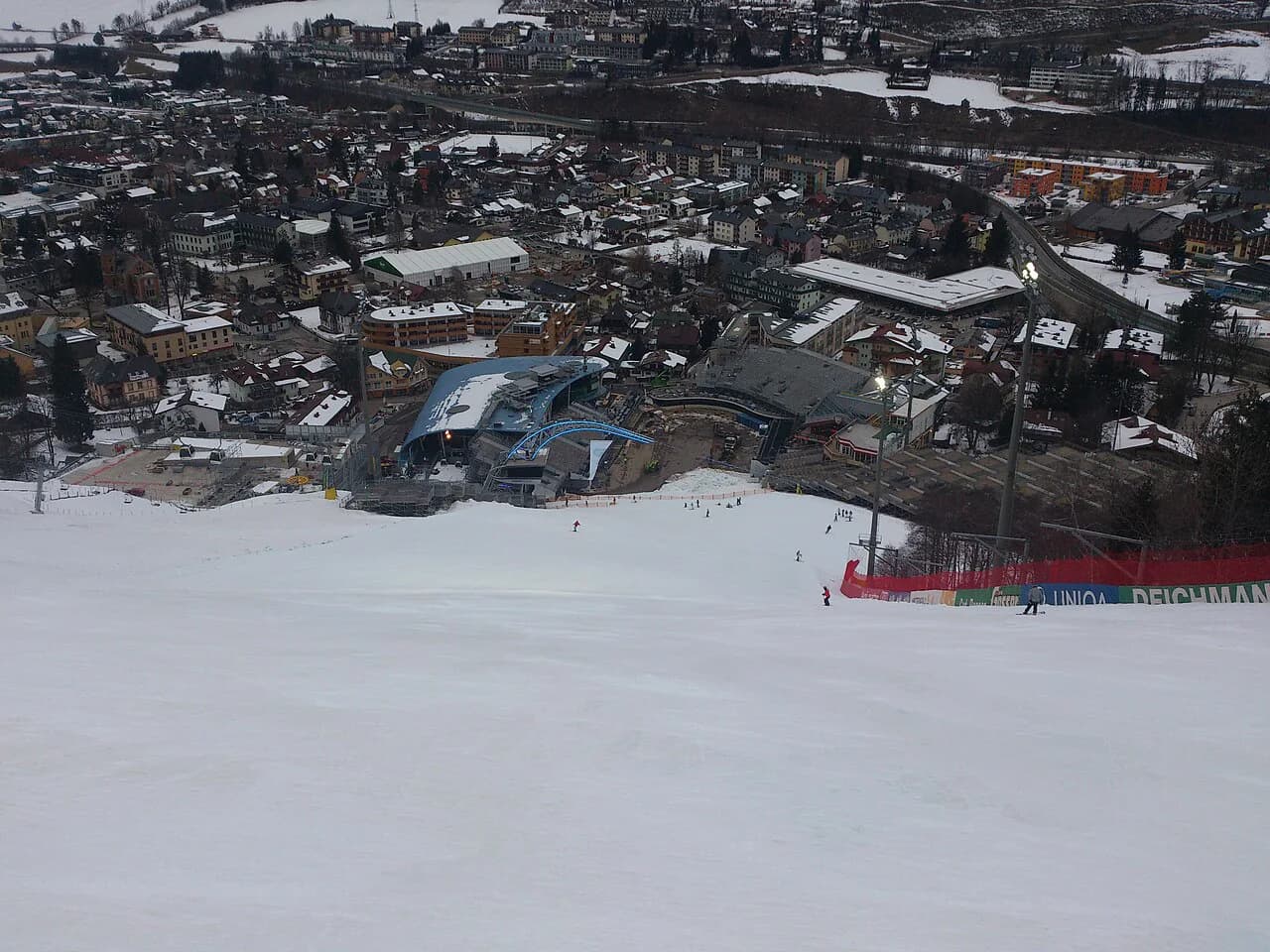
The map also shows the night-skiing slope on Hochwurzen, which is lit and operates on its own evening ticket; holders of a valid Planai and Hochwurzen ski pass get a 20% discount on that ticket. Plan your evening around it only after confirming the current season's operating nights with the Planai and Hochwurzen lift company.
The outlying sectors: Fageralm, Galsterberg and Ramsau/Rittisberg
Beyond the core, the same map carries Fageralm, Galsterberg and the Ramsau am Dachstein area around Rittisberg. These are drawn as smaller, separate patches rather than extensions of the four-mountain block, and the destination pitches them at families, beginners and anyone who prefers a more manageable ski area.
Their separate status on the map is the important detail. Fageralm, Galsterberg and Rittisberg appear in the destination's Ski amadé listing but carry their own day-ticket pricing, so a pass bought for the core is not automatically the right product for a day on one of these hills. Read the ticket tab on the official prices page for the specific mountain you plan to ski.
Two more mountains, Riesneralm and Planneralm, belong to the Schneebären Card rather than the main network. Riesneralm markets itself as a children's ski area with a family atmosphere, while Planneralm sits between roughly 1,600 and 2,200 metres and is known for natural snow and freeride terrain. On the map they sit apart from the Schladming core, and that distance is the honest signal that they are day trips rather than sectors you tack onto an afternoon.
Ramsau also holds the Kaliland children's area directly at the valley station, one of three public kids' zones the destination lists alongside Wollis Kids Park at Hauser Kaibling and the Riesneralm children's area. If you are travelling with first-timers, those valley-level zones are the ones to mark on the map before you look at anything higher.
Reading lift and piste symbols at region scale
At region scale the symbols are best read as proportions rather than routes. The destination counts 99 lifts in total: 24 chairlifts, 15 cable cars and 60 T-bar and practice lifts. That last group is the one to notice, because a large share of surface and practice lifts means a lot of the map's gentle lower ground is served by drags rather than chairs.
The piste split tells a similar story. Of 222 kilometres, 92 are blue, 115 red and 15 black, so the region is overwhelmingly built for easy and intermediate skiing with a thin layer of expert terrain. Seen on the map, that translates into wide, well-distributed blue and red ribbons across every sector and black lines concentrated in a few places rather than spread evenly.
Use those totals to choose a sector, not to navigate one. A group of mixed ability is usually better off in a sector with plenty of blue and red rather than one chosen for its headline steep run, and the map's colour coding lets you see at a glance which patches are mostly one shade. For a snowboarder's view of where the terrain flows best, the snowboarding notes are a useful companion to the graphic.
The same reading habit transfers to other resorts, which is worth knowing if you ski across the Alps. The Ischgl Ski Map Guide explains a comparable approach to sector-by-sector map reading, and the logic of matching base, pass and terrain carries over intact. For a cluster of linked sectors drawn on one sheet, the Kaprun Piste Map offers another worked example.
Map versus live status: what is actually running
The map shows what exists; live tools show what is running. The Schladming-Dachstein tourist office publishes open facilities, a lifts-and-slopes count and webcams, and the Ski amadé region page carries its own live figure for open lifts and pistes. Get into the habit of checking one of them over breakfast rather than trusting the drawing from the night before.
Webcams do a job the map cannot, because they show snow cover and visibility on the ground rather than the existence of a piste. The destination lists cameras across the core sectors, and a quick look at two or three of them in different sectors is often more informative than a single resort-wide snow report.
Season timing is the other reason to pair map with live status. The destination gives expected starts by mountain, with Hauser Kaibling listed from 28 November 2026 and Hochwurzen, Galsterberg, Ramsau/Rittisberg and Planneralm from 4 December 2026, while Planai and Reiteralm are given as snow-dependent. Treat all of those as expected rather than fixed, and the season-dates overview sets out the full pattern.
A piste map is also a poor place to look for logistics. Ski depots appear at Planet Planai, Planai West on Hochwurzen, Hauser Kaibling and Reiteralm, which is the sort of detail the lift companies publish separately from the graphic. Check the facilities pages when you are deciding where to leave kit overnight.
What the map cannot tell you: pass boundaries and conflicting totals
Two official sources give different sizes for the region, and neither is wrong so much as counting differently. The destination states 222 kilometres of slopes and 99 lifts, while the Ski amadé region listing says around 171 kilometres of pistes and 82 lift facilities. The gap most likely reflects the boundary of what each page counts rather than a change on the ground, so quote whichever figure matches the question you are asking.
Pass validity is set by the lift companies, not drawn on the graphic. A Ski amadé pass opens more than 760 kilometres of slopes and 270 lifts across five regions, which is far more than the Schladming map shows, and the Schneebären Card covers a different pair of mountains again. Read the ticket terms for the product you are buying before you assume the whole drawing is included.
Online early booking is the other thing the map will never show. The destination sells day and multi-day passes through an online shop with an early-booking saving, and you can load a ticket onto an existing KeyCard or collect it from a pickup machine in the ski area. If you want the saving, buy ahead; if you want flexibility, ticket-office prices are the fallback.
Third-party map pages can help you get your bearings before you arrive, but treat their orientation notes as interpretation rather than gospel. One Italian mapping page describes Hauser Kaibling and Galsterbergalm to one side of Planai and Hochwurzen, Reiteralm and Fageralm to the other, which is a reasonable way to picture the layout but not the official Schladming-Dachstein wording. Check anything you plan to rely on against the official map and live status.
Plan Your Trip Around the Map
Read the Schladming piste map in three passes: find the four-mountain core and decide which sector suits your base, mark the outlying areas that need their own ticket or a separate day, then check what is running on the Schladming-Dachstein and Ski amadé live pages before you commit. That order keeps the graphic in its proper role as a planning tool.
If you are still choosing between sectors, start with the wider schladming skiing overview and narrow down from there. The map will make far more sense once you know which mountain you are likely to call home for the week.
Frequently Asked Questions
How many kilometres of slopes and lifts are in Schladming-Dachstein?
The destination tourism board gives 222 kilometres of slopes and 99 lifts for the region, split into 92 kilometres blue, 115 red and 15 black. The Ski amadé region listing states around 171 kilometres of pistes and 82 lift facilities, which appears to reflect a different counting boundary. Use the destination figure for a region-wide picture and the network figure when comparing Ski amadé areas.
Which mountains are linked in the Schladming 4-Mountain Ski Area?
Hauser Kaibling, Planai, Hochwurzen and Reiteralm form the linked core, drawn on the map as one continuous block. The destination describes them as offering seamless skiing across the four. Actual connections depend on which lifts and pistes are open, so check live status before planning a full traverse.
Are Fageralm, Galsterberg and Rittisberg part of the same ski area?
They appear on the same regional map but as separate, smaller patches rather than extensions of the four-mountain block. They are pitched at families and beginners, and they carry their own day-ticket pricing. Check the ticket for the specific mountain before assuming a core pass covers it.
What about Riesneralm and Planneralm?
These two mountains belong to the Schneebären Card rather than the main Ski amadé network. Riesneralm is family-oriented with a dedicated children's ski area, while Planneralm sits between roughly 1,600 and 2,200 metres and is known for natural snow and freeride terrain. Their position away from the core makes them day trips rather than add-on sectors.
How many lifts and what kind are they?
The destination counts 99 lifts: 24 chairlifts, 15 cable cars and 60 T-bar and practice lifts. The large share of surface and practice lifts means much of the gentler lower terrain is served by drags rather than chairs, which is worth knowing if anyone in your group prefers chairlifts.
Where can I check what is open on the day?
Use the destination's open facilities page and webcams, plus the Ski amadé region page's lifts-and-slopes count. These show what is running on the day, whereas the piste map shows what exists. Check them in the morning.
When does the season start on each mountain?
Expected starts differ by sector. The destination lists Hauser Kaibling and Riesneralm from 28 November 2026, and Hochwurzen, Galsterberg, Ramsau/Rittisberg and Planneralm from 4 December 2026, with Fageralm later and Planai and Reiteralm given as snow-dependent. These are expected dates; check current details.
Are there ski depots on the map?
Ski depots are listed at Planet Planai, Planai West on Hochwurzen, Hauser Kaibling and Reiteralm. They are a facilities detail rather than something the piste graphic conveys, so see the facilities pages when deciding where to leave equipment overnight.
Sources
Useful notes for your next ski trip
Optional updates to our Alpine resort guides.
You might also like
Continue reading
More guides you'll find useful