Kaprun Ski Map: Read the Kitzsteinhorn & Maiskogel Sectors
Use the Kaprun ski map to plan across the Kitzsteinhorn, Maiskogel and Lechnerberg sectors, with lift links, last-ascent times and live status tools explained.
On this page
Kaprun's piste map is often misread as a single resort blob. In practice it shows three distinct sectors: the Kitzsteinhorn glacier, the Maiskogel family mountain and the small Lechnerberg nursery slope, each with its own base station and lift network. The sectors are linked, but only through specific lifts, and knowing where those links sit changes how you plan a day.
Start with the Kitzsteinhorn's official piste plan and status page rather than a third-party image, because lift times and open runs change with weather and snow. The printed panorama is useful for orientation, while the interactive plan shows what is running today. Use the Kaprun Ski guide for the wider trip-planning picture once you understand the map's layout.
What the Kaprun ski map actually covers
The map spans three sectors in one lift network. The Kitzsteinhorn sector climbs from a valley station at 911 m to the Top of Salzburg at 3,029 m. The Maiskogel sector has its own valley station at 768 m and a main hub at 1,570 m, while the Lechnerberg lifts sit near the village as a small beginner area.
These are not one continuous ski circuit. The Kitzsteinhorn is reached by its own cable car chain from Kaprun, and Maiskogel has a separate access lift from a different base. The 3K K-onnection is the strategic link between Maiskogel and the glacier side, and when it is not running the two sectors operate as independent days out.
Read the map in two passes. First find the three base stations and the lifts that leave them, then trace which pistes radiate from each hub. This stops you from assuming you can ski back to your starting car park from anywhere on the map.
Kitzsteinhorn: the glacier core from 911 m to 3,029 m
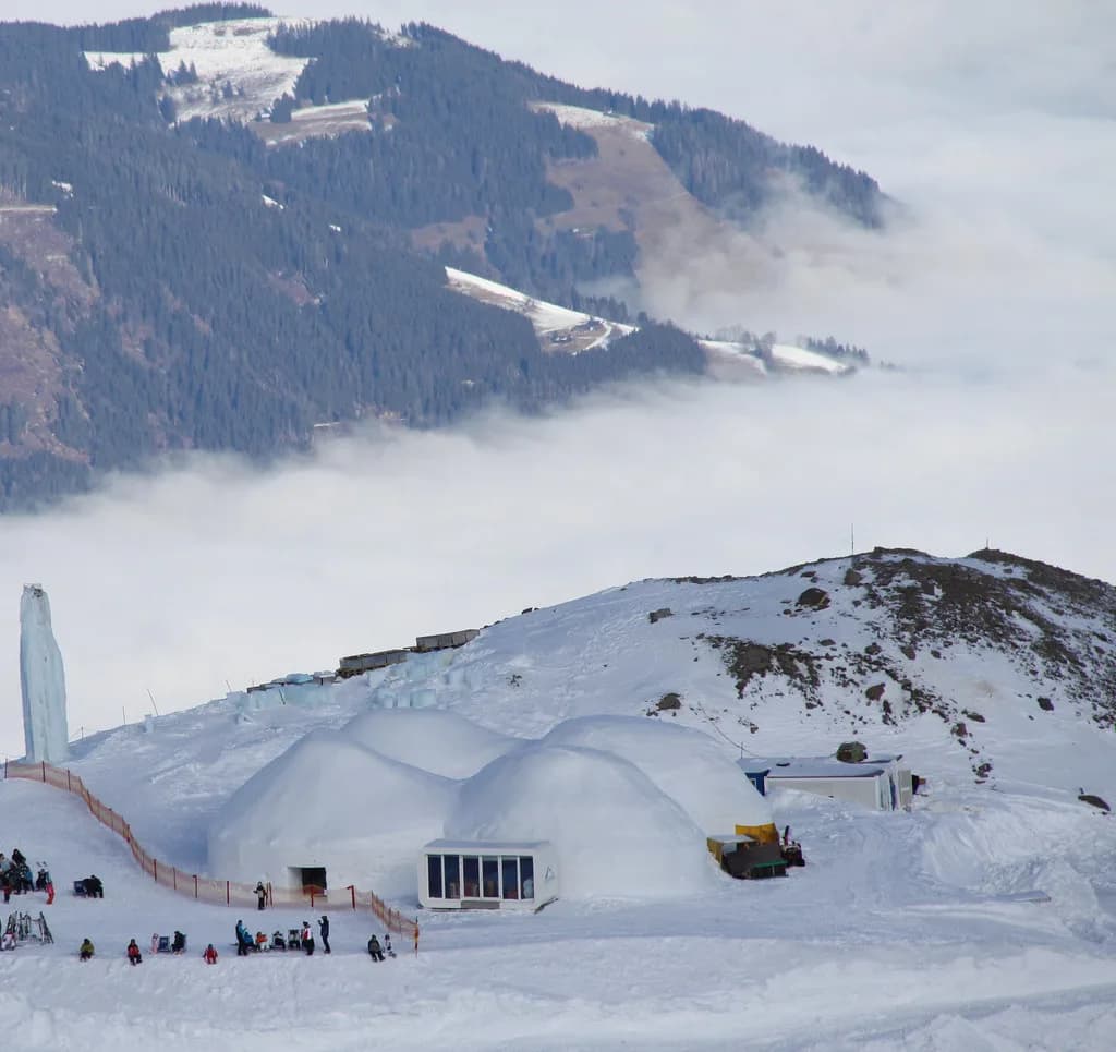
The Kitzsteinhorn sector is the high-altitude core of the Kaprun map. Its base station sits at 911 m, and the lift chain climbs through Langwied at 1,976 m and Alpincenter at 2,450 m to the Top of Salzburg panorama platforms at 3,029 m. The summit station is a sightseeing destination as well as a ski access point, so expect foot passengers in the lift queues.
In late October the Kitzsteinhorn status page showed skiing down to Gletscherjet 3/4 Mitte, with the run to Alpincenter opening from the Friday. That staged opening is typical of the glacier's autumn programme: the upper mountain runs first, and lower sections follow as snow allows. Plan early-season trips around the top of the map, not the valley runs.
The sector's layout means the descent to the base is a long, multi-stage affair. The map shows the Gletscherjet chain, the Panoramabahn and the Gipfelbahn as the main upward arteries, with the Alpincenter as the mid-mountain interchange where several pistes converge. Treat Alpincenter as your regrouping point if your group spreads out.
The Gletscherjet chain and how the stages stack up
The Gletscherjet lifts are numbered 1 to 4, and the map reads them as a staircase up the mountain. Gletscherjet 1 leaves the 911 m base, Gletscherjet 2 continues the climb, and Gletscherjet 3 and 4 serve the upper glacier zone. A separate Langwiedbahn chairs from Langwiedboden to Alpincenter when Gletscherjet 2 is closed.
The Kitzsteinhorn publishes individual operating times for each stage. On a recent status page Gletscherjet 1 ran 08:15 to 16:45 with a last ascent at 15:30, Gletscherjet 3 ran 09:00 to 15:45 with a last skier ascent at 15:15, and Gletscherjet 4's last skier ascent was 15:20. These times shift with conditions, so plan around the day you travel.
Because the stages close in sequence from the top down, a late start on the glacier costs you the summit. If your goal is the Top of Salzburg, be on the first or second Gletscherjet ascent of the morning. If you are cruising the mid-mountain pistes, the Alpincenter area gives you more slack because the lower lifts run later.
Maiskogel: the lower, family-facing sector
Maiskogel occupies the lower, gentler part of the map. Its valley station is at 768 m, the MK Maiskogelbahn climbs to the 1,570 m hub, and the sector has its own restaurant base at Maisi Alm. The map marks a family and leisure park here, along with the Maisi Flitzer alpine coaster, which tells you this side is built for mixed groups and non-skiing companions.
The Maiskogelbahn does not run on the same schedule as the glacier lifts. In late October the Kitzsteinhorn listed it as daily from 24 October to 1 November with a 09:00 to 16:00 window and a last ascent at 15:30. Outside those dates, the operating calendar decides whether it can anchor a day.
Maiskogel is where the map rewards a different read. Instead of chasing vertical, look at the loops around the 1,570 m hub: short lifts, wide pistes and easy return options. That makes it the natural base for beginner and improver groups, with the option of a sightseeing ascent for anyone who would rather ride than ski.
Lechnerberg: the beginner nursery ground
Lechnerberg is the smallest piece of the Kaprun map. It sits near the village and is served by its own lifts, separate from the Gletscherjet and Maiskogelbahnen. The map lists Lechnerberg-Lifte as a distinct group, which is the clue that this is the nursery zone rather than a through-route to anywhere else.
Use Lechnerberg for first-morning lessons and warm-ups. Because it is detached from the main lift chain, you can drop beginners there without committing the whole group to the glacier's early start. The trade-off is that you will need to move between bases by road or bus if part of the group wants to ski the upper mountain.
The 3K K-onnection and whether it links Maiskogel to the glacier
The 3K K-onnection is the map's critical joint. It is shown as a link between the Maiskogel and Kitzsteinhorn sides, letting you move between the lower family sector and the glacier without returning to the valley. That single lift determines whether the Kaprun map is one big circuit or two separate mountains.
It does not always run. The Kitzsteinhorn status page listed the 3K K-onnection as closed in October and returning in December 2026, with a 09:00 to 16:15 operating window when it does run. Build a plan that works without it: ski Maiskogel in the morning and drive or bus to the Kitzsteinhorn base in the afternoon, or pick one sector per day.
Reading the piste grading key
The map uses the standard three-grade key: easy, intermediate and expert runs, plus marked freeride routes and ski touring routes on the glacier side. The legend also marks winter hiking trails, which matters because it flags where walkers share the mountain with skiers. Learn the key before you trace a route, not after.
As a rule, the Maiskogel and Lechnerberg sectors carry the easy grades, the Kitzsteinhorn mid-mountain carries the intermediate pistes, and the upper glacier holds the harder lines and freeride terrain. The day's status page gives the specific piste numbers, and a run being drawn on the map does not mean it is open.
Which sectors suit which ability level
Beginners and families should default to Maiskogel and Lechnerberg. The lower altitude, shorter lifts and dedicated family infrastructure make the day easier to manage, and non-skiers have the coaster and restaurants as a fallback. Confident skiers should spend their time on the Kitzsteinhorn, where the vertical and the glacier terrain sit.
Mixed-ability groups face a genuine trade-off. If you base everyone at Maiskogel, the strong skiers lose the glacier. If you base at the Kitzsteinhorn, beginners have little to do beyond the Alpincenter area. The cleanest solution is a sector split with a lunch rendezvous, or two separate days if the 3K K-onnection is not running.
Foot passengers, non-skiers and sightseeing on the map
The map marks the cable cars as open to foot passengers, and the Top of Salzburg platforms at 3,029 m are a sightseeing draw in their own right. The panorama includes a cinema and national park gallery at the summit, plus a summit restaurant. That makes the Kitzsteinhorn a viable day out for a non-skiing companion.
For walkers, the map shows winter hiking trails separate from the piste network, particularly around Langwied and the Alpincenter. Read those trail markings as carefully as the piste grades, because sharing the mountain means choosing routes that do not put you on a ski line. The Kaprun Ski Season page is the place to check how the walking and skiing offerings line up across the winter.
Lift hours and last ascent times: building a realistic circuit
The map is a static picture; the timetable is what turns it into a day. Work backwards from the last ascent of the lift you need for your final run. If you plan to finish on the glacier and return to the 911 m base, your effective cut-off is the last Gletscherjet 3 or 4 skier ascent, not the later valley lift closing time.
The Kitzsteinhorn publishes these times per lift, and they follow weather, snow and operating conditions. A recent example: Gletscherjet 2 ran 08:30 to 16:30 with a 16:00 last ascent, while the Gipfelbahn ran 09:00 to 16:00 with a 15:30 last ascent. Build a 30-minute buffer into any plan that depends on a specific return lift.
Live status tools: checking before you travel
The Kitzsteinhorn runs a live piste plan that shows open and closed lifts, pistes, restaurants and highlights. It also flags lift-by-lift operating windows and notes when a lift is in preparation rather than running. This is the tool to open on the morning of your ski day, not a week in advance.
The regional snow report gives the other half of the picture. It reports snow depths at 3,000 m on the Kitzsteinhorn, at 2,000 m on Schmittenhöhe, at 1,500 m on Maiskogel and in the valley at 750 m. Comparing those figures tells you which sector has the cover and whether the lower mountain is worth planning around.
Where to buy passes and pick up the printed map
Ticket offices on the map are at the Gletscherjet 1 and Panoramabahn base, and at the Kaprun Center. The Gletscherjet 1 ticket office is listed as open 08:00 to 16:30 daily, and the Kaprun Center office 08:30 to 17:00 daily. An info service at Alpincenter runs 08:15 to 16:00 for on-mountain questions.
For pass products and what each one covers, the Kaprun Ski pass page sets out the options; the Kitzsteinhorn's own site is where you check current prices, since these change and the map does not list them. Pick up the printed panorama at a ticket office if you like a paper copy in your pocket, and use the interactive plan for live status.
Getting to the valley stations and moving between them
The three sectors have separate bases, and that shapes your transport plan. The Kitzsteinhorn valley station is at 911 m, the Maiskogel valley station at 768 m, and the Lechnerberg lifts sit near the village. The map marks bus stops and electric charging points at the bases, and free parking at Maiskogel.
If you are staying in Kaprun, the village centre puts you within reach of all three access points. If you plan to ski both Maiskogel and the Kitzsteinhorn in one day, the 3K K-onnection is the only lift link, so when it is closed you need road transport between the bases. Check the bus timetable locally rather than relying on the map alone.
Map-reading mistakes that cost Kaprun skiers time
The most common error is treating the map as one interconnected circuit. It is not: the Kitzsteinhorn and Maiskogel bases are separate, and the 3K K-onnection is the only lift link between the sectors. Plan each sector as its own day unless you have confirmed the link is running.
The second error is ignoring last-ascent times. The upper Gletscherjet stages close their skier access well before the valley lifts shut, so a late-afternoon summit plan can leave you downloading rather than skiing. The third is assuming the Maiskogelbahn runs all winter on the same schedule; in October it ran only from 24 October to 1 November, so check the calendar before you build a family day around it.
Finally, use the right map for the job. The printed panorama is for orientation and understanding the sectors; the interactive piste plan is for the day's open lifts, runs and restaurant hours. If you are comparing resorts, the Mayrhofen Piste Map guide shows how another Austrian area presents its sectors, which helps you benchmark what Kaprun's map is telling you.
Plan Your Kaprun Ski Day
Read the Kaprun map as three sectors with one critical link. Decide first whether you are skiing the glacier, the family mountain or the nursery slope, then check the live status page for open lifts and last ascents before you commit. If the 3K K-onnection is closed, plan two separate days rather than one ambitious circuit.
For the wider trip picture, including equipment and pass decisions, the Kaprun Ski guide ties the map back to the planning choices that matter. And if you are travelling with a snowboarder, the Kaprun Snowboarding page covers the park and equipment angle that the piste map only hints at.
Frequently Asked Questions
What altitude is Kaprun, Austria?
The village and valley stations sit low: the Maiskogel base is at 768 m and the Kitzsteinhorn base at 911 m. Above them the Kitzsteinhorn ski area climbs through Langwied at 1,976 m and Alpincenter at 2,450 m to the Top of Salzburg platforms at 3,029 m.
What is Kaprun like as a ski resort?
Kaprun is split into distinct sectors rather than one continuous circuit. The Kitzsteinhorn offers high glacier terrain and sightseeing, Maiskogel is the lower family-focused mountain, and Lechnerberg is a small beginner area near the village. You plan around which sector suits your group.
Is Kitzsteinhorn open for skiing?
The Kitzsteinhorn runs year-round for sightseeing, and ski operations follow the weather, snow and operating plan. The live piste plan shows which lifts and runs are open on any given day, including which Gletscherjet stages are serving skiers.
Can you ski from Zell am See to Kaprun?
Not directly on skis. Zell am See's Schmittenhöhe and Kaprun's Kitzsteinhorn and Maiskogel are separate ski areas with separate lift networks. The regional snow report lists them side by side, which reflects that they are distinct mountains rather than one linked circuit.
Are Kitzsteinhorn and Maiskogel connected by lift?
They are linked by the 3K K-onnection, which connects the Maiskogel side to the Kitzsteinhorn side. It does not run all year: it was listed as returning in December 2026 after an autumn closure. When it is closed, you travel between the two bases by road.
How do you read the Kaprun ski map?
Start by locating the three base stations: the Kitzsteinhorn base at 911 m, the Maiskogel base at 768 m and the Lechnerberg lifts near the village. Then trace the lift chains upward from each base and note which runs radiate from the hubs at Alpincenter and the Maiskogel 1,570 m station. Check the live status page for which of those lifts are actually running.
Sources
Useful notes for your next ski trip
Optional updates to our Alpine resort guides.
You might also like
Continue reading
More guides you'll find useful