Obergurgl Ski Map: Sectors, Lifts and Piste Guide
Read the Obergurgl piste map with confidence: how Obergurgl and Hochgurgl link via Top Express, where the high sectors sit, and how to check live lifts.
On this page
The Obergurgl ski map looks straightforward until you notice it covers two villages, not one. Obergurgl and Hochgurgl sit at the head of the Ötztal and are marketed together as Gurgl, with the two halves joined by the Top Express gondola. Planning around that single link is the difference between a relaxed week and a lot of unnecessary laps.
Use the map for three jobs: choosing where to base yourself, deciding which sector to ski on a given day, and checking how you get home. Everything else, from lift status to snow depth, comes from live tools rather than a printed sheet. This guide walks the sectors in the order you will meet them on the map and flags what the drawing cannot tell you.
What the Gurgl piste map actually covers
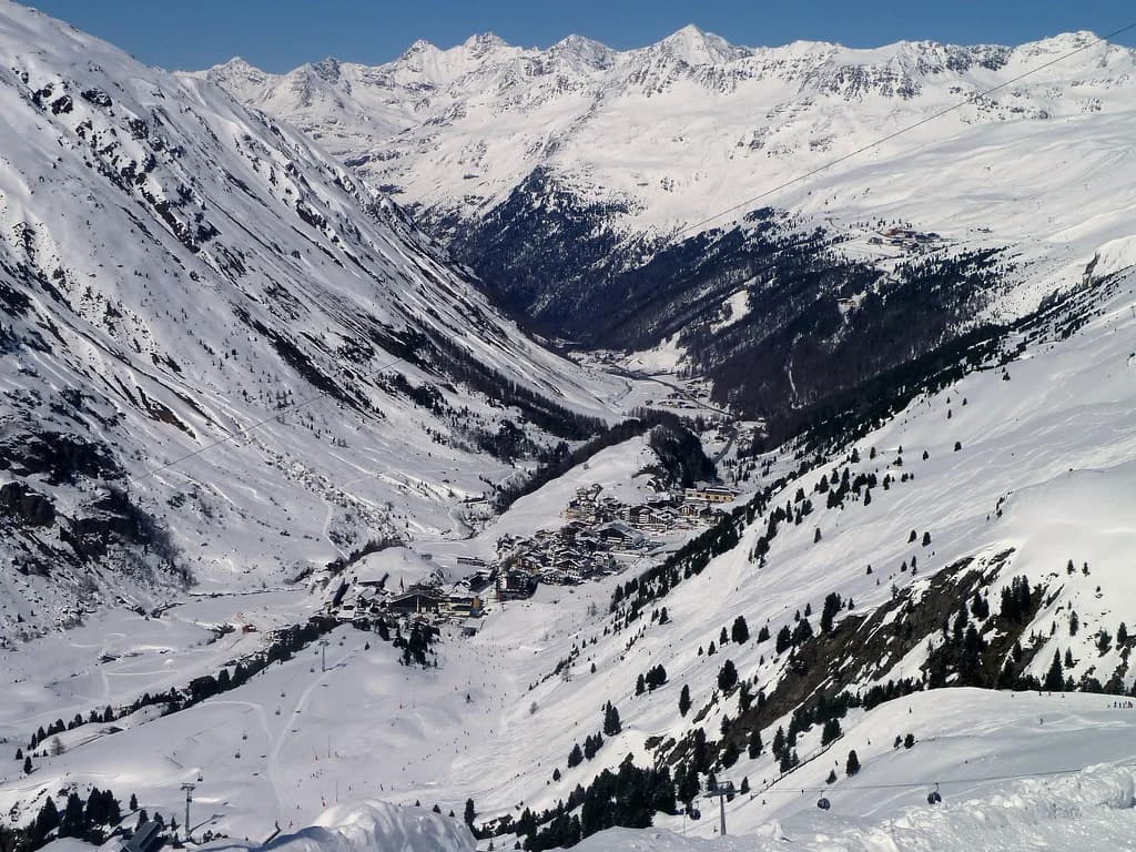
The map shows a single ski area built from two resort halves. Hochgurgl and Obergurgl are connected by the Top Express gondola, and together they form the Gurgl ski resort with 112 kilometres of pistes and 25 lifts. Reading the map as two separate base areas joined by one lift corridor is more useful than treating it as a seamless circuit.
The vertical spread runs from 1,800 metres up to 3,030 metres. That range is why the map has such a tall shape: the villages sit low, the upper sectors stack up above them, and several runs take you all the way back to valley level. When you trace a descent, check the number at the top and the number at the bottom before committing.
For a broader picture of how the sectors, passes and season fit together, the Obergurgl Skiing guide covers the resort beyond the map itself. Skiers who have never visited often overlay the two villages in their heads and assume you can loop between them freely. You can, but only by using the link lift, so build it into the plan rather than discovering it at the bottom of a run.
Altitude bands and what they mean on paper
Altitude is the map's quiet organising principle. The 1,800 metre base and the 3,030 metre summit appear as the bottom and top edges of the drawing, and almost everything else sits between them. Runs that start high and finish high hold snow better late in the season, which matters if you travel in April.
The resort publishes skiing from November to April, with mid-November starts typical for this non-glacier area and the high-altitude finish stretching to the end of April. That season shape shows up on the map as terrain that stays in play when lower resorts have closed. Early-season coverage concentrates on the upper sectors, so expect the map's lower runs to come into their own later in the winter.
Snowmaking backs up the altitude: more than 90 per cent of the slopes are covered by the snowmaking system, fed by five reservoirs and powered by certified green electricity. On the map this is not drawn as a layer, but it explains why the marked runs generally hold up through the season. Treat the printed lines as the intended skiing, then check live reports for what is actually open.
The Obergurgl side: Festkogl, Rosskarbahn and the village fan
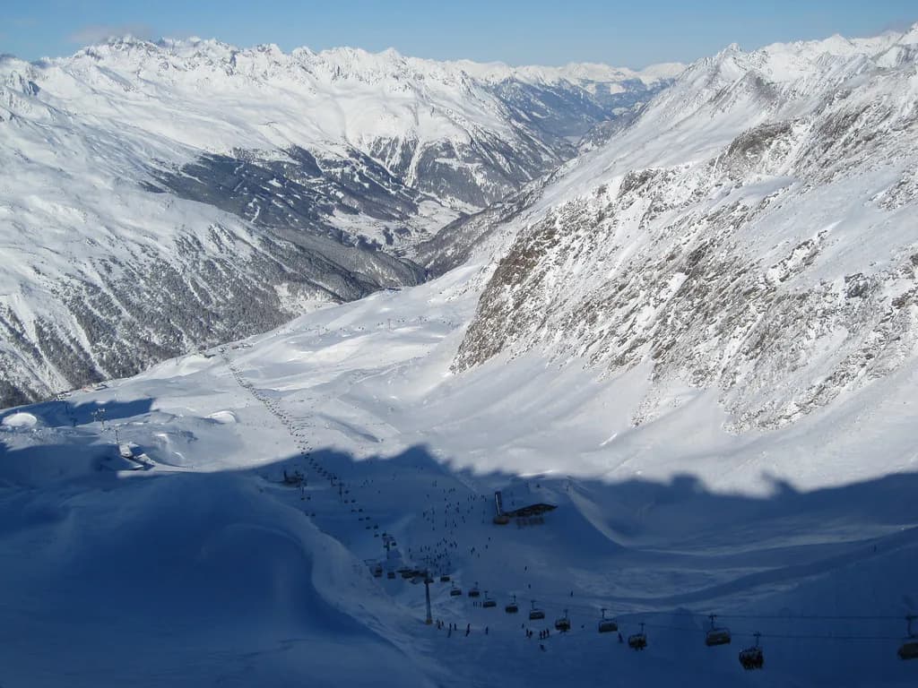
Obergurgl's base-station cluster is the first thing to locate on the map. Lifts leave from near the village and spread skiers onto the slopes above, with Festkogl and the Rosskarbahn both marked on the upper mountain. Runs fan back down towards the village, so most descents on this side end where you started, which makes Obergurgl the easier half for mixed-ability groups to regroup.
Above the village, the Festkogl sector is where the map shows a broad spread of intermediate terrain plus the Festkogl umbrella bar at the top station. That bar is a natural meeting point on the drawing, and it becomes relevant in the evening as well, when the Rosskarbahn runs for night skiing and the Festkogl bar stays open for music. Plan any evening session around that part of the map rather than the far side of the resort.
The Rosskarbahn operates on Monday evenings from 18:30 to 22:00 during the published 2026/27 window, with the last ascent at 21:30. Night rides are included in a normal ski pass, and an evening ticket covers anyone without one. If your hotel is on the Obergurgl side, this is the sector to keep clear in your plan.
The Hochgurgl side and the 3,030 metre top
Hochgurgl's map sector centres on the Hochgurglbahn and climbs to the highest ground in the resort, including the Top Mountain Star panorama bar at 3,030 metres. That height makes this the map's late-season stronghold and the place to head on warm spring afternoons. The descent back down to Hochgurgl is long enough that you should read the grading before dropping in with tired legs.
Thursday evenings shift the night-skiing focus here: the Hochgurglbahn runs from 18:30 to 21:30 during the published 2026/27 period, with the last ascent at 21:00 and the Donwhill Grill open for food. The same rule applies as in Obergurgl, with night rides included in your ski pass and evening tickets available for those without. Check the current winter's published schedule before you build an evening around it.
Hochgurgl also holds the Top Mountain Motorcycle Experience, Europe's highest motorcycle museum, right beside the slopes. It is a useful non-skiing option for a flat day or a mixed group, and it sits within the area the map already shows. Pair it with a short morning on the upper runs rather than a full day away from the snow.
For a printable version to study on the train, an archived piste map PDF still shows the layout and lift names clearly, though it predates the current season. Use it for orientation only and rely on the official interactive map for anything current. A third-party map listing is handy for a rough sense of where the resort sits relative to neighbours such as Vent. If you are comparing how another Austrian resort draws its sectors and lift links, this Kaprun Piste Map guide is a useful counterpoint.
The Top Express link and why the drawing flatters it
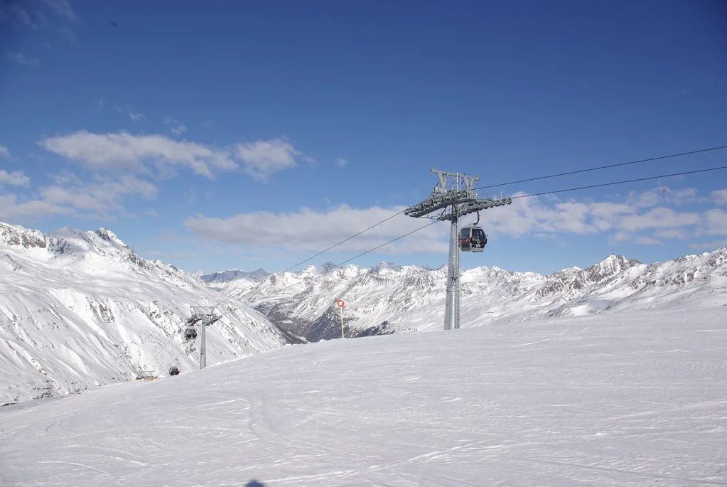
On paper the Top Express is one clean line joining the two halves, and that is exactly how you should treat it: as a corridor, not a slope. Crossing from one village to the other means riding the gondola rather than skiing across, so the transfer costs time even though the map makes it look instantaneous. Build crossings into the start or end of a session, not the middle of a short morning.
The practical consequence is that you pick a side for the day. Base yourself in Obergurgl and ski the Festkogl and Rosskarbahn terrain, or stay in Hochgurgl for the high runs and the panorama top station, and use the Top Express when you genuinely want the other half. Groups with mixed abilities often find one crossing per day is plenty.
Reading the piste gradings and picking a sector
Gradings on the Gurgl map follow the standard blue, red and black convention, and the spread is deliberately broad across 112 kilometres of piste. Broad, wide descents make up much of the marked terrain, which suits skiers building confidence on reds. The steepest and most demanding lines cluster on the upper mountain, where the map's black markings sit closest to the top stations.
Match your sector to your group rather than to the whole map. Intermediate-heavy parties can spend a whole week between the Festkogl area and the Hochgurgl upper runs without repeating themselves, while strong skiers will want to concentrate on the high, steep ground. Beginners should stay low and follow the nursery zones marked near each village.
If you are booking instruction, the way schools group skiers by level tends to mirror these sectors, and the ski lessons page explains how courses are organised across the two villages. Booking lessons before arrival also settles the meeting-point question, which is the part of the map beginners most often misread.
Beginner zones, ski schools and the peak-time squeeze
Each village has its own beginner ground, and the map marks them close to the valley stations where ski schools meet. That proximity is convenient but creates a morning bottleneck: at peak holiday weeks the nursery areas fill quickly with classes and first-timers. Arriving a little before the lesson start, or skiing the beginner slopes in the afternoon, spreads the load.
Use the map to see which village your meeting point belongs to before the first morning. Obergurgl and Hochgurgl are a gondola ride apart, so a family split across two meeting points will lose an hour untangling it. Confirm the exact assembly spot when you book, since school arrangements change between winters.
Lift count, capacity and queue-free planning
The resort operates 25 lifts with a stated capacity of more than 43,000 people per hour, and it markets a no-waiting experience. Those numbers are the map's hidden asset: capacity is spread across both villages and their separate base stations, so pressure on one side does not automatically mean queues. When Obergurgl's base looks busy, the Hochgurgl lifts are often the calmer alternative.
Six lifts run from valley level into the ski area, which is why the map shows several entry points rather than a single bottleneck. If you are staying ski-in, ski-out, more than 90 per cent of beds are within 250 metres of the slopes, so your nearest lift is likely a short walk or a glide from the door.
A free ski bus links the villages and the outlying accommodation, which matters if your hotel sits away from a base station. The map shows the bus routes alongside the pistes, so check the nearest stop before deciding you need a car. Ski hire can be arranged in both villages, and picking up gear near your base station saves hauling it across the area.
Passes, prices and what lies beyond the printed map
Pass validity changes what the map means. One- and two-day tickets work only within the Obergurgl-Hochgurgl area, while passes of three to 14 days are valid across all open ski resorts in the Ötztal under the Ötztal Super Skipass. If you plan day trips down the valley, buy the longer pass and treat the printed Gurgl map as one panel of a larger picture.
Prices follow season bands rather than a single rate. In the published 2026/27 peak season a one-day adult ticket at the cash desk starts at €75.50, and a six-day adult Ötztal pass starts at €478.50. Booking online ahead of travel is where the savings sit, since Gurgl's lift company discounts early purchases through its online ski ticket shop.
The Ötztal Super Skipass opens up six ski resorts, around 90 mountain lifts and more than 360 kilometres of slopes across the valley. That is the argument for longer passes over daily tickets if you have a car or use the valley buses. Compare the full range before you commit, since the Obergurgl Ski Pass Guide breaks down the products and season bands in more detail.
Paper map, app or interactive map: which to carry
For planning at home, the operator's interactive map is the most reliable tool: it shows the 112 kilometres of piste, every lift, the mountain huts and the ski bus routes in one view. Study it on a laptop rather than a phone so you can see both villages at once. That single session will do more for your week than any amount of reading.
On the mountain, a folded paper map still wins in cold weather: no battery, no gloves off, no scrolling. Collect one from a lift station or the tourist office on arrival. Keep the phone for live status and for checking the time of the last descent rather than for route-finding mid-run.
The official piste map is available from the resort's own ski area pages, which also carry the lift and slope status updates. Download a copy before you travel if you like to annotate a plan in advance.
Live status and evening operations
No printed map tells you what is running today, and that is the one thing worth checking each morning. The resort publishes live information on lift and slope status alongside webcams and weather. Look at it over breakfast and let it tip your sector choice, especially after a warm night or a windy forecast.
Evening operations follow a published pattern rather than a nightly service: Obergurgl on Mondays and Hochgurgl on Thursdays, each with its own start and end window and a last ascent roughly half an hour before closing. Bad weather moves the Obergurgl session to the Tuesday. Check the dates for your winter before planning dinner around a night ski.
Plan Your Visit
Start with the official interactive map to fix the two villages and the Top Express in your head, then look up passes and prices for your dates. For the wider resort picture, the Obergurgl Skiing guide covers terrain, season and logistics in one place.
If lessons or equipment are part of the trip, sort those before you arrive; the ski lessons guide explains how the schools are organised, and ski hire is best booked ahead in peak weeks. Night skiing dates and the pass-validity window are the two details most worth confirming on the organiser's site before you travel, since both shift with the winter calendar.
Frequently Asked Questions
What is the difference between the Obergurgl and Hochgurgl ski maps?
They are halves of one Gurgl piste map. Obergurgl sits on one side with the Festkogl and Rosskarbahn sectors and runs fanning back to the village, while Hochgurgl holds the highest ground up to 3,030 metres and the Hochgurglbahn. The interactive map shows both together, which is the version to use when planning.
How do you get between Obergurgl and Hochgurgl on skis?
You cross by riding the Top Express gondola rather than skiing across. Treat it as a transfer corridor: choose one side for the morning, ride across when you actually want the other half, and allow time for the lift rather than expecting a quick ski-through.
Where are the beginner slopes on the Obergurgl piste map?
Beginner ground sits close to the valley stations in both villages, near where ski schools meet. The official map marks these areas clearly, and they are the first places to fill during peak holiday weeks, so plan around early starts or afternoon sessions.
Does the Obergurgl ski pass cover other Ötztal resorts?
Only from three days upward. One- and two-day tickets are valid within Obergurgl-Hochgurgl, while three- to 14-day passes work across all open Ötztal ski areas under the Ötztal Super Skipass. If you want valley day trips, that longer validity is the deciding factor.
Where can I get a free Obergurgl ski map?
Pick up a printed copy at a lift station or the tourist office on arrival, and download the official version from the resort's ski area pages before you travel. Archived PDFs are useful for studying the layout in advance but predate the current season.
Is there night skiing in Obergurgl or Hochgurgl?
Yes, in both villages on a published weekly pattern: Obergurgl on Mondays and Hochgurgl on Thursdays, each with a set evening window and a last ascent before closing. Night rides are included in a normal ski pass, and evening tickets are sold for anyone without one. Confirm the dates for your winter before planning around it.
Sources
- Ski pass prices | Obergurgl-Hochgurgl in Tirol, Austria | gurgl.com
- Night skiing | Obergurgl-Hochgurgl in Tirol, Austria | gurgl.com
- Ski area information | Obergurgl-Hochgurgl in Tirol, Austria | gurgl.com
- Skiing & snowboarding | Obergurgl-Hochgurgl in Tirol, Austria | gurgl.com
- skimap Touch 2 - Obergurgl Hochgurgl
- Map Obergurgl / Hochgurgl - Freeride
- Obergurgl Hochgurgl Piste Map 2020
Useful notes for your next ski trip
Optional updates to our Alpine resort guides.
You might also like
Continue reading
More guides you'll find useful