Grindelwald Ski Map: Plan Your Day on the Pistes
Read the Grindelwald ski map with confidence: Wengen, Kleine Scheidegg, Männlichen and First sectors, the lift links between them and the pass you need.
On this page
Most people open the Grindelwald piste map expecting one tidy ski area wrapped around one village. What they get is a long, folded document covering two linked sectors, a separate mountain across the valley, and lift lines that run off towards Wengen. Read it in the wrong order and you will spend your first morning working out where you actually are.
The fix is to treat the map as two maps. The Grindelwald-Wengen side runs from the valley floor up through Männlichen and Kleine Scheidegg to the Eiger, while Grindelwald-First sits on the opposite side of the village. Once those two halves are clear, the lift lines, the gradings and the pass options all fall into place.
Why the Grindelwald map confuses first-timers
The confusion is built into the geography. Grindelwald sits on a valley shelf with ski terrain above it on two sides, and a third sector reachable only by crossing to the far side of the valley. Nothing about the village layout tells you that, so the map has to do the explaining.
Add the scale of the wider region and the paper starts to look crowded. The Jungfrau region spans three areas, Grindelwald-Wengen, Grindelwald-First and Mürren-Schilthorn, with 131 miles of terrain across two valleys, according to the ski.com resort overview. That figure covers the whole region, not the single sector your lift ticket for the day may cover.
The last piece of the puzzle is the names. Eigergletscher, Kleine Scheidegg, Männlichen and First all appear on the same sheet, but they serve different purposes. Eigergletscher and Kleine Scheidegg are high mountain junctions beneath the Eiger, Männlichen is the ridge that hinges the Grindelwald and Wengen sides, and First is a standalone summit above the village.
The two halves of the map: Grindelwald-Wengen versus Grindelwald-First
Grindelwald-Wengen is the classic area at the foot of the Eiger, Mönch and Jungfrau, and bergfex lists it as 102 km of pistes with 30 km of sledging runs. This is the half where the long descents, the World Cup line and the connection towards Wengen all sit.
Grindelwald-First is the other half, reached by its own lift from the village and running up to around 2,500 m. It holds the freestyle terrain, including the White Elements park, and the high-altitude skiing that stays in condition when the lower slopes soften.
The practical consequence is that you cannot ski from one half to the other without returning to the valley or using the lift network. Plan your day around one side and you will spend far more time on snow than in transit. For a wider view of how the resort fits together, our grindelwald skiing guide covers the terrain in more depth.
Grindelwald-Wengen sectors in detail
First, the First sector. It is the eastern half of the Grindelwald map, high, open and served by its own gondola from the village. Its terrain suits strong intermediates and above, and the park is the draw for riders who want features rather than long cruising laps.
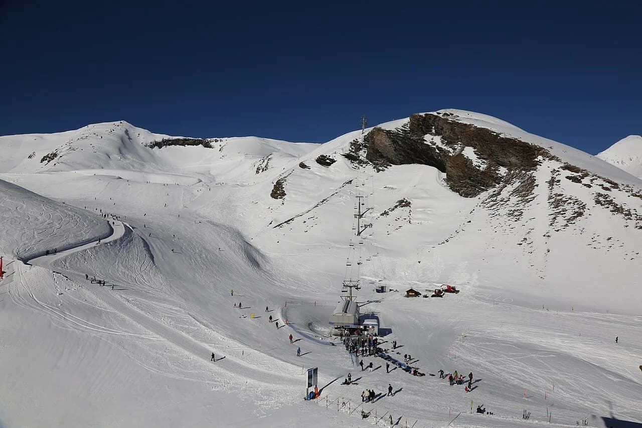
Männlichen is the hinge. It is wide, sunny and gentle enough to be genuinely useful for improvers, and it is where the Grindelwald and Wengen sides meet. Learn to recognise it on the map first, because almost every route across the region passes through or near it.
Kleine Scheidegg is the high junction beneath the Eiger north face, where the terrain gets steeper and more varied. The Lauberhorn course drops from this area, and the runs fan out towards both Grindelwald and Wengen. Eigergletscher sits higher still, the launch point for the glacier terrain.
Wengen itself is the far side of the map, a car-free village on a sun terrace above the Lauterbrunnen Valley. WeSki describes access by parking in Lauterbrunnen and taking the 15-minute Wengernalpbahn cogwheel train up. On the piste map it appears as the end of the line rather than a separate resort, but it is a full sector of its own with village nursery slopes.
Altitude and scale: what the numbers tell you
Altitude is the best guide to what a sector will feel like in poor weather. WeSki puts the Grindelwald-Wengen ski area between 796 m and 2,500 m with 102 km of pistes, while the same source gives 213 km of piste across the three Jungfrau sectors and a snow range from 1,034 m to 2,970 m for the region as a whole. Read those as two different measurements, not a contradiction.
For day planning, the useful lesson is that low runs back to the village can be marginal while the upper mountain is fine. If the map shows a run finishing at village level, treat it as the first thing to lose in a thaw. Start high, work down, and use the lift lines to climb back out.
Snowmaking supports the picture. WeSki reports coverage of about 65% of pistes, which is why the main arteries down to Grindelwald and the Männlichen runs usually hold up better than the outlying links. The gridded figures on the map are worth reading alongside the live snow report rather than on their own.
Following the lift lines: gondolas, the Eiger Express and the Wengernalpbahn
The lift lines are the skeleton of the map, and they tell you more about how to move than the pistes do. From Grindelwald, gondolas climb to First on one side and to Männlichen on the other, giving two quite separate ways onto the mountain from the same village.
On the Wengen side, the Eiger Express and the Wengernalpbahn do the heavy lifting. The Eiger Express runs up towards Eigergletscher, and the cog railway links the valley with Wengen and continues towards Kleine Scheidegg. Wengen itself is reached by taking the Wengernalpbahn cogwheel train up from Lauterbrunnen, and from the top the pistes tie the two sides together.
Trace one lift line at a time with your finger before you ski it. Start at the village station, follow the cable to the top, and note which pistes fall away from that point. Doing this for three or four lines is enough to understand the whole network, and it takes less time than reading the legend.
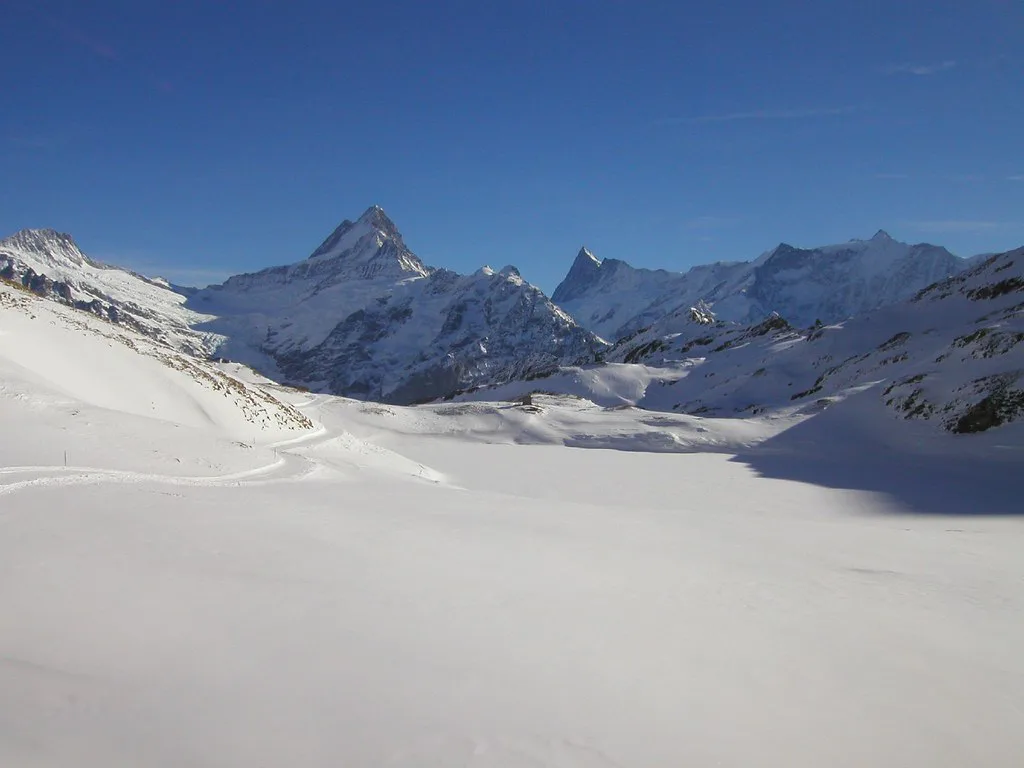
Reading the piste gradings: roughly 90% blue and red
Grindelwald-Wengen is overwhelmingly blue and red. WeSki describes almost 90% of the pistes as graded blue or red, with 24 easy runs, 35 intermediate and 22 expert across the wider Jungfrau region. That distribution is the single most useful fact on the map for anyone deciding where to base themselves.
If you are a confident intermediate, the map is effectively yours. The blue and red lines cover the Männlichen ridge, the Kleine Scheidegg flanks and the long descents towards Grindelwald, which means you can cross the region without ever being forced onto a black.
Beginners should look for the tight clusters rather than the long lines. WeSki identifies nursery slopes at Wengen and at Männlichen, with the gentle terrain at the top of the Männlichen gondola particularly good for building confidence. On the map these appear as short, dense webs of blue close to a lift station.
Experts get a thinner but sharper set of options. The black runs from Eigergletscher and the Lauberhorn line are the headline entries, and the vertical drop of more than 1,700 m that WeSki attributes to the area means those descents are long as well as steep. A full grindelwald ski pass gives you the run of them.
The classic map routes: Kleine Scheidegg to Grindelwald and the Lauberhorn
The route most people trace first is the long descent from Kleine Scheidegg down to Grindelwald. WeSki puts the longest at 10 km, a sustained run that builds in steepness as it drops, and it is the best single illustration of how much vertical the map covers.
The Lauberhorn course is the other set piece. WeSki describes it as the longest downhill on the World Cup circuit at 4.5 km, and it is open to the public after the January race. Look for it on the map between Kleine Scheidegg and Wengen, and expect the Hundschopf jump and Kernen-S turn to be obvious features on the ground.
Beyond those two, the map rewards a bit of route-building. Linking Männlichen across to Kleine Scheidegg and down towards Grindelwald gives a full day of cruising without repeating a lift, and it works for any competent red-run skier.
Where the map stops making sense on snow
A piste map shows marked runs, not the terrain between them. The off-piste around Eigergletscher and the guided glacier descents from Jungfraujoch are genuinely committing, and WeSki is explicit that a guide is essential because crevasse risk is real and navigation needs local expertise.
That matters when you are reading the map at home and planning ambitions. The white space beyond the groomed lines is not a blank invitation; it is terrain with a different set of rules. Book a guide through the local ski school if you want it, and treat the map as an overview rather than a route plan.
The same applies to the Jungfraujoch railway, which climbs inside the Eiger to a station at 3,454 m. It is a sightseeing journey on the map's edge, not a ski lift, and it deserves its own day rather than a slot between runs.
Which pass matches which map
The Jungfrau pass is the broad option. WeSki describes it as covering the full Wengen-Grindelwald area, including Grindelwald-First, Kleine Scheidegg and Männlichen, with access to 213 km of pistes. If your plan involves skiing both halves of the map and crossing to Wengen, this is the product that matches it.
Local passes covering just the Wengen side also exist, according to the same source, and they suit anyone staying put on that half. The decision rule is simple: count how many days you will realistically cross between sectors, and buy the pass that covers those crossings rather than the biggest one on the list.
Prices are not published in the sources here, so check the current tariff on the official Jungfrau site before you budget. Our grindelwald ski pass guide walks through the product structure and how the tiers differ.
Paper, PDF or phone: practical formats
Take a paper map. Screens dim in cold, gloves come off, and battery life disappears faster on a mountain than anywhere else. The free version handed out at lift stations is usually the clearest, and folding it into a pocket costs nothing.
Download the PDF before you travel as a backup and keep it in your phone's offline storage. The official operator publishes the current version each season, and it is the one to trust; third-party reproductions go stale and sometimes show lifts that have been replaced.
A phone is genuinely useful for one thing on the mountain: checking live lift status. Use it for that, keep it warm in an inside pocket, and let the paper do the navigating.
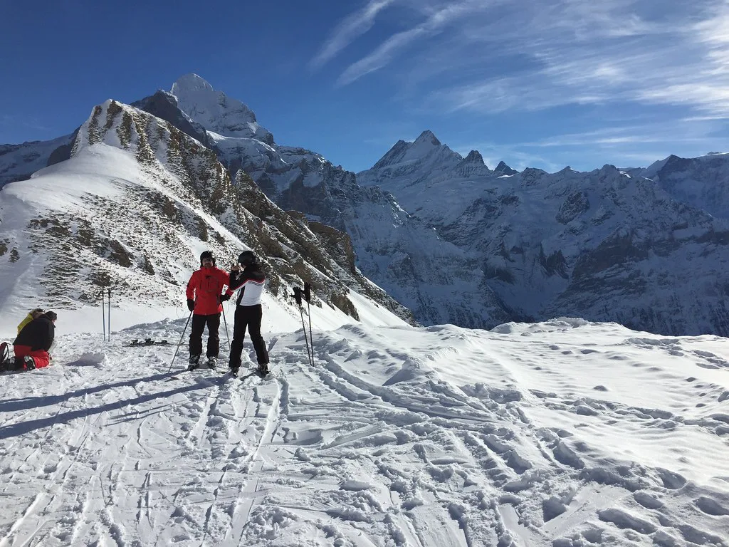
Live status beyond the map
The map tells you what exists; it does not tell you what is turning. Lift closures, wind holds and snow depths change daily, and a sector that looks straightforward on paper can be unreachable if the upper cable is stopped. Check the Jungfrau ski region's live status page and webcams before committing to a sector, particularly on a windy morning.
Snow depth matters most for the low runs. If the village-level pistes are thin, plan your day higher up and use the gondolas rather than the valley returns. WeSki's general indication of a season from late November to April is a planning guide, not a promise for any given winter, so treat it as a rough window rather than a fixed calendar.
Common map-reading mistakes
The first mistake is treating First as part of the Grindelwald-Wengen network. It is a separate summit with its own lift and its own character, and mixing it into a cruising plan wastes time on the wrong side of the village.
The second is underestimating the Kleine Scheidegg junction. It sits high, it links several sectors, and the runs back down are long enough to matter late in the day. Note the last lift times on the map and work backwards from them rather than forwards from lunch.
The third is reading altitude as difficulty. The highest terrain is not automatically the hardest; the Männlichen area is high, sunny and gentle, while some lower runs are steep. Match the colour of the line to your ability, not the number beside the summit.
If you want a comparison of how another resort lays out its map conventions, our Andermatt piste Map guide is a useful contrast, though the terrain is nothing alike.
Booking priorities before you arrive
Sort lessons and hire before you travel, especially in peak weeks. The Swiss Ski School Wengen and other local schools run group and private lessons for all ages, and equipment shops in Wengen and Grindelwald carry a full range of skis, boards and boots. Booking ahead means collecting gear on arrival rather than queueing at nine.
Passes can usually be bought in advance, which saves a morning stop. If your group is mixed, compare the cost of individual passes against family options before committing, and check whether your chosen product includes First and the Wengen side.
Accommodation is the other thing to lock in early. Wengen is compact and almost everything sits within a short walk of the Männlichen gondola and the railway station, so position matters less than availability. Our grindelwald ski lessons and grindelwald ski hire pages cover the on-the-ground logistics.
Making the Map Work for You
Read the Grindelwald piste map as two areas, not one. Grindelwald-Wengen is the long cruising half with the Eiger, the Lauberhorn and the Wengen connection; First is the high, freestyle side above the village. Between them, Männlichen and Kleine Scheidegg are the junctions that make the network function.
Decide which sectors you will actually ski, buy the pass that covers them, and use the lift lines rather than the pistes to understand how to move. Confirm current prices and opening dates on the official Jungfrau site before you book, and let the live status pages tell you what is running on the day.
Frequently Asked Questions
How many ski areas does the Grindelwald ski map cover?
The map you are handed in Grindelwald covers two distinct ski areas: Grindelwald-Wengen on the Eiger side and Grindelwald-First above the village. Both sit within the wider Jungfrau region, which also includes Mürren-Schilthorn and is reachable on the regional pass rather than on every local ticket.
What is the difference between the Grindelwald-Wengen and Grindelwald-First maps?
Grindelwald-Wengen is the larger, classic area running from the valley up through Männlichen and Kleine Scheidegg towards Wengen, with a predominance of blue and red pistes. Grindelwald-First is a separate summit sector served by its own lift from the village, higher, more open and home to the terrain park.
Can you ski from Grindelwald to Wengen on one lift pass?
Yes, provided you hold a pass that covers the full Grindelwald-Wengen area rather than a local Wengen-side product. The two are linked by lift and piste across Männlichen and Kleine Scheidegg, and a gondola connection between the villages makes the crossing straightforward.
Where is Männlichen on the Grindelwald piste map?
Männlichen sits on the ridge between the Grindelwald and Wengen sides, reached by gondola from Grindelwald. It is the hinge of the whole network, wide and sunny with gentle terrain at the summit, and almost every route between the two villages passes through or near it.
How much does a ski pass cost in Grindelwald?
The sources here do not give current prices, and they change by season and by product. Check the official Jungfrau ski region site for the tariff before you budget, and compare the full-area pass against the local options for the number of days you plan to cross between sectors.
What is the easiest way to get to Grindelwald?
Grindelwald is reached by rail from Interlaken, and the nearest major airports are Zurich, Basel and Geneva. WeSki gives transfer times of about 2 hours from Basel, 2 hours 20 minutes from Zurich and 2 hours 40 minutes from Geneva, so Zurich is usually the simplest arrival point for a short transfer.
Sources
Useful notes for your next ski trip
Optional updates to our Alpine resort guides.
You might also like
Continue reading
More guides you'll find useful