Sölden Ski Map: Reading the Pistes, Sectors and Lift Links
Use the Sölden piste map to plan your days: mountain sectors, lift bases in the village, how the map links terrain, and which version to carry.
On this page
Sölden sits at the head of the Ötztal in Tyrol, with the village spread along the valley floor and the ski terrain rising on both sides. The piste map looks busy at first glance because two separate lift bases serve the village, a mid-mountain hamlet interrupts the vertical, and the upper sectors reach glacier terrain. Read it in that order and the whole area falls into place.
This guide treats the map as a planning tool rather than a souvenir. It walks through the lift bases at Sölden and Hochsölden, groups the terrain into the Gaislachkogl, Giggijoch and glacier sides, and suggests an order for tracing lift sequences so you link sectors without repeating lifts.
What the Sölden Ski Map Covers and Where the Resort Sits
Sölden is the main resort of the Ötztal, roughly 80km southwest of Innsbruck, and the piste map covers the slopes on both sides of the valley above the village. The map also names the outlying settlements that hang off the ski area, including Hochsölden, Zwieselstein, Huben and Längenfeld, which helps you work out where your accommodation sits relative to a lift.
The terrain is genuinely two-sided: the Gaislachkogl and Giggijoch sectors rise on the village side, while the Rettenbach and Tiefenbach glacier sectors sit higher and further back. A quick piste map gives you the number and layout of lifts and slopes before you commit to a base, which matters more here than in a compact resort.
Village-to-Mountain Layout: The Lift Bases at Sölden
The most useful thing to learn first is that Sölden village has two principal access points. The Giggijochbahn climbs from the village centre, and the Gaislachkoglbahn has its own base station nearby; both are marked on the map with the valley station and the line of the lift. Choosing between them is your first decision of the day, and it determines which side you ski in the morning.
Trace each lift from its base to its top station before you leave the apartment. The map shows where the lines cross and where you can switch between them, so you can see whether a morning on one side lets you cross to the other without returning to the valley. A printed or on-screen map that shows lift lines, not just pistes, is the one worth carrying.
Hochsölden: The Mid-Mountain Hub That Changes the Map
Hochsölden is a small hamlet part-way up the mountain, and several lifts converge there, so it reads as a junction rather than a destination. On the map it sits between the village and the upper sectors, which is why so many routes pass through it. If you learn one node on the map, make it this one.
Treat Hochsölden as a place to change direction rather than a place to start. Because it is close to the ski area itself, accommodation here shortens the morning climb, but you trade village amenities for altitude. The map makes that trade-off visible: count the lift stages between your bed and the terrain you actually want to ski.
The Main Map Sectors and What Each Asks of You
Group the map into three working sectors: Gaislachkogl on one side, Giggijoch in the middle, and the Rettenbach and Tiefenbach glaciers at the top. Each sector has its own character and its own demand on your legs. Planning by sector beats planning by individual run, because it keeps you from yo-yoing across the whole map in a single morning.
A sensible reading order is village base, then the sector above it, then the connecting line to the next sector. Note where the map shows a return route to the valley; some sectors feed back down easily, and others funnel you towards a specific lift. Sketching that on paper takes two minutes and saves a wrong turn later.
Gaislachkogl Side: Long Descents and Big Vertical
The Gaislachkogl side gives the map its longest continuous vertical, with runs that drop from the upper mountain all the way towards the village. That makes it the sector for skiers who want sustained descending rather than short laps. The map shows the fall line clearly, and the length of the lift line beside it is a good proxy for how much skiing you get per ride.
The trade-off is exposure to weather and to tired legs. A long descent is unforgiving late in the day, and the return lift can be the busiest on the mountain at closing time. Plan this sector for the morning if you want the descent at its best, and use the map to check how many lifts stand between you and an easy exit.
Giggijoch Side: The Main Junction for Linking Sectors
The Giggijoch sector is where the map becomes a network rather than a set of separate runs. Lifts here connect the village side with routes towards Hochsölden, which makes it the natural place to start if you intend to move around the mountain rather than stay put. Skiers who want variety should base their morning here.
Expect company. Because Giggijoch serves as the crossroads, its key lifts carry traffic from several directions, and the map shows how many pistes converge on each one. If you want quiet, use Giggijoch to pass through early and spend the middle of the day elsewhere; if you want convenience, stay and lap the terrain around it.
Rettenbach and Tiefenbach Glaciers: The Top of the Map
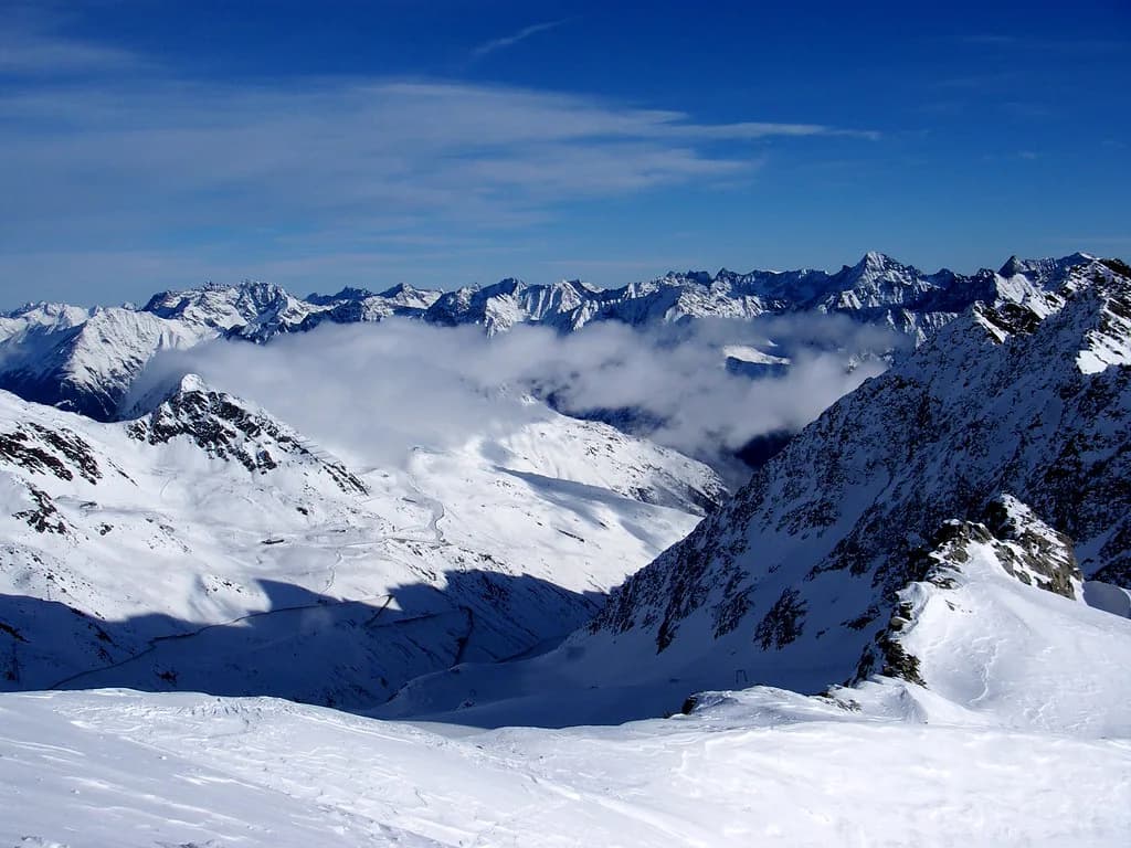
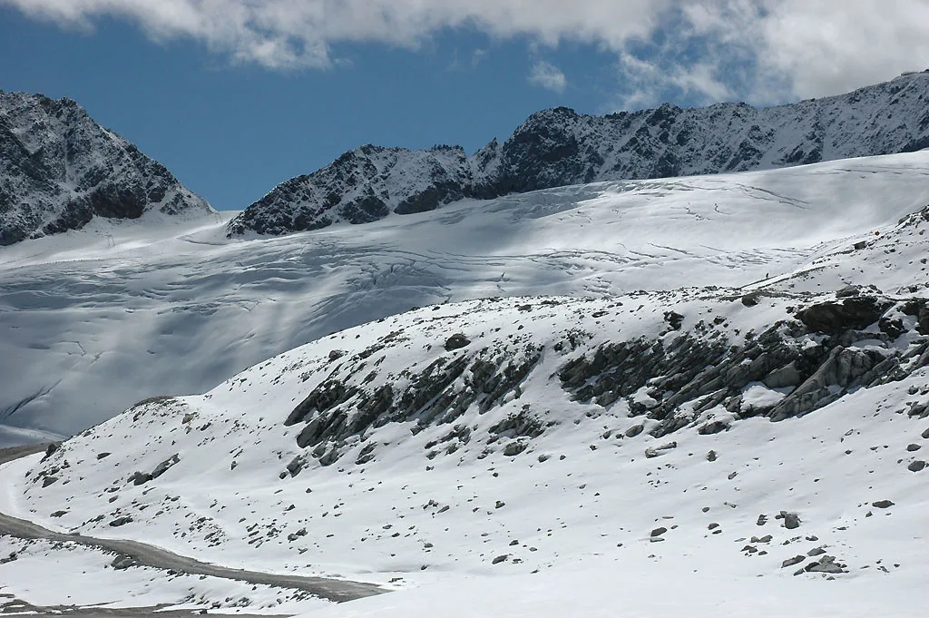
At the top of the map, the Rettenbach and Tiefenbach glacier sectors give Sölden its high-altitude terrain. The lifts here are the ones that keep the resort skiing when lower slopes soften, which is why the map shows a clear chain of lifts from the village up to the glacier. If your trip falls at the edges of the season, this is the part of the map to study hardest.
The glacier sectors ask more of you than the village-side slopes: the altitude is real, the weather can close lifts, and the journey up takes several stages. The map shows the sequence of lifts that gets you there, and the ski pass guide explains which products cover the whole area rather than a single sector.
Named Lift Sequences Worth Tracing Before You Ski Them
The map names every lift, and a handful of names recur in any conversation about Sölden. The Schwarze Schneid Bahn, the Tiefenbachbahn and the Seiterkarbahn appear across the glacier sectors, while the Giggijochbahn and Gaislachkoglbahn are your village access lifts. Learning those names before you arrive means you can follow signs on the mountain instead of stopping to consult the map.
The Tiefenbach area also hosts a small lift of its own, the Minilift Tiefenbach, which the map shows near the glacier infrastructure. Trace these sequences on screen before you travel: it is far easier to memorise a chain of three lifts at home than at a cold mid-mountain junction with gloves on.
Beginner Zones and Where They Sit on the Piste Map
Look for the short, gentle lifts near the valley floor and around Hochsölden rather than the long cable cars. Beginners do best where the map shows a cluster of easy pistes beside a slow lift, because that is where ski schools teach and where you can repeat a short run without committing to a full descent.
Book lessons and hire before you travel if your group is learning, because the beginner terrain is concentrated and the popular slots fill. The map helps you choose accommodation too: a base near the teaching area saves a long commute in ski boots. Sölden ski hire is widely available, and arranging it in advance leaves your first morning free for the slopes.
Which Map Sectors Suit Which Ability Level
Beginners should stay low and central, around the valley lifts and the gentle terrain near Hochsölden. Intermediates get the most from the Giggijoch junction, where they can link pistes without tackling the biggest vertical. Strong skiers and boarders should head for the Gaislachkogl long descents and the glacier sectors, where the map shows the most sustained and most high-altitude terrain respectively.
The map's difficulty colours translate the same way as elsewhere in Austria, so read the key before you read the slopes. Blue pistes are the easiest, red the middle band and black the steepest, with ski routes marked separately. Match the colour of your intended run to the colour of the lift serving it; the map is laid out so that easy pistes usually sit beside easy lifts.
Reading the Piste Map Key: Colours, Lifts and Connections
Every Sölden map carries a legend covering runs, lifts and the connections between them. The legend also distinguishes the types of lift, from gondolas and chairlifts to surface lifts, and shows where the map connects into neighbouring areas rather than ending at a lift.
Check that the map you use shows lift lines and not just coloured slopes; without the lift lines you cannot tell where a run ends and a ride begins. If you are comparing resorts, the Kaprun piste map guide covers how one Austrian area labels its terrain, which makes a useful contrast when you read Sölden's layout.
Paper Map, App or Both: What to Carry
Take both. Paper survives cold, wet gloves and a flat battery, and it lets you plan a day without unlocking a phone that will spend its charge on music and photos. A phone is better for live lift status and for pinch-zooming into a crowded junction where two lifts sit metres apart.
The practical answer is a paper map in the jacket for the mountain and the app for the morning decision. An interactive map lets you zoom into the glacier lift chain and check how long the climb would take before you commit, which is exactly the question paper cannot answer.
Planning a Day, a Morning and a Bad-Weather Fallback
For a morning, pick one sector and finish it before moving on. Start at Giggijoch if you want to link terrain, or at Gaislachkogl if you want the longest descent of the day. Leave the glacier for a full day rather than a couple of hours, because the lift sequence up and back eats time even when the mountain is working perfectly.
For a bad-weather fallback, favour the lower sectors and the slopes sheltered by the tree line, and check live status before you leave the apartment. The map helps you identify where those lower sectors sit relative to your accommodation, so you can shorten the journey and still get a morning's skiing when the upper mountain is closed.
Where to Get the Official Map and Current Lift Status
Use the Ötztal Bergbahnen map as your reference and the resort app or website for live lift status; the resort publishes both, and the interactive version is the one that updates. Check the official site for current lift pass prices and season dates, since these change year to year and no separate table here can keep up with them.
The browser-based Sölden map stays available without a download, so you can plan on a laptop before you travel and pull up the same view on your phone. Bookmark it alongside the Ötztal Bergbahnen status page rather than relying on social posts, which lag the lifts they describe.
Getting There and Orienting Yourself on Arrival
Sölden is reached by road along the Ötztal from the Inntal, with the valley running southwest from the Innsbruck area. Arriving by car gives you flexibility for the tributary villages, while the valley bus network links the villages to the lifts. Either way, orient yourself on the map by finding your accommodation and the nearest valley station before your first morning.
On arrival, walk or ride to both lift bases to see which suits you. The Gaislachkoglbahn and the Giggijochbahn are the two access points the map marks clearly in the village. Doing this on your arrival day saves a wrong decision at breakfast on your first proper ski day.
What the Map Cannot Tell You: Snow, Crowds and Closures
A piste map describes layout, not conditions. It cannot tell you about wind-hold on the glacier, rock showing through a red run, or which lift has a queue at half past nine. Treat it as the shape of the resort and look elsewhere for the state of the resort on the day.
Use live sources for the present tense: the lift company's status page for open lifts, the webcam for visibility, and the snow report for base depths. The map answers where you can go only after you have checked whether you can go there today.
Plan Your Visit
Read the Sölden map in three passes: village lift bases, Hochsölden as the junction, then the glacier sectors at the top. Choose your sector by ability and by the time you have, and keep a paper copy for the mountain and an interactive one for the decision before you leave the apartment.
Everything else, from pass products to lessons and hire, you can sort before you travel. Check the official site for current prices and dates, then plan your days around the sectors that match your skiing rather than the ones that look boldest on the page.
Frequently Asked Questions
Where is the Sölden ski area?
Sölden sits at the head of the Ötztal in Tyrol, Austria, southwest of Innsbruck. The ski area rises on both sides of the valley above the village, with the Gaislachkogl and Giggijoch sectors on the village side and the Rettenbach and Tiefenbach glacier sectors higher up.
What is the difference between Sölden and Hochsölden on the map?
Sölden is the main village on the valley floor with two lift bases, the Giggijochbahn and the Gaislachkoglbahn. Hochsölden is a smaller hamlet part-way up the mountain where several lifts meet. It is a junction on the map rather than a separate resort, and staying there shortens the morning climb.
Is Sölden a good ski area for beginners?
The beginner terrain sits low and central, near the valley lifts and on gentle slopes around Hochsölden. Look for short, slow lifts with clusters of easy blue pistes beside them on the map. Book lessons and hire in advance, since the teaching area is concentrated and popular slots fill.
How do I get the Sölden piste map?
Use the official piste map, printed or interactive, for planning; both show lift lines, named lifts and the glacier sectors. The resort also publishes a web app for live lift status. Paper copies are widely available in the village at lift stations and sports shops.
Can you ski between the glacier and the village on the map?
The map shows a chain of lifts linking the village to the glacier sectors, but the descent is a full-mountain run rather than a single piste. Plan the glacier for a whole day, and check live lift status before setting out, since the upper mountain is the first to close in wind or poor visibility.
What do the colours on the Sölden piste map mean?
They follow the standard Austrian convention: blue for the easiest pistes, red for intermediate, and black for the steepest. Ski routes are marked separately. Match the colour of a run to the lift that serves it, because easy pistes usually sit beside easy lifts.
Which lift base should I start from in Sölden?
Start at Giggijoch if you want to link sectors and move around the mountain, and at Gaislachkogl if you want the longest descent of the day. Both have valley stations in the village. Choose according to your ability and how much time you have before the lifts close.
Can the piste map tell me if pistes are open?
No. A piste map shows layout only, not conditions. For the day's situation, use the live lift status, the webcams and the snow report, since closures come from wind, visibility and snow cover rather than the map.
Sources
Useful notes for your next ski trip
Optional updates to our Alpine resort guides.
You might also like
Continue reading
More guides you'll find useful