Cortina Ski Map: How to Read the Piste Map and Link Sectors
Use the Cortina ski map to work out the Faloria, Tofana and Cinque Torri sectors, how they link, and where to base yourself for the lifts.
On this page
The first thing a Cortina ski map teaches you is that the resort is a collection of separate mountain groups rather than a single linked circuit. Faloria–Cristallo, Tofana and the western Cinque Torri, Col Gallina and Lagazuoi areas each have their own lift bases and their own map panels, and getting between them is part of the planning. Read the map alongside the official Cortina d'Ampezzo piste map before booking accommodation, and the resort starts to make sense.
This guide walks through each sector as it appears on the map, explains the symbols and connections that matter, and shows where Cortina sits inside the wider Dolomiti Superski network. The aim is to help you pick a base, choose the right lift pass and know which map tool to have on your phone before you travel.
What the Cortina ski map actually covers
Unlike a purpose-built resort where every lift is joined on one hillside, Cortina's skiing is spread across distinct groups on opposite sides of the valley. The map reflects that: you will see separate lift bases around town and out along the Falzarego road, with few continuous piste links between them. Treat each group as a day's outing rather than a sector you ski through.
The three principal groups are Tofana to the west of the centre, Faloria–Cristallo to the east, and the western sectors around Cinque Torri, Col Gallina and Lagazuoi beyond Passo Falzarego. Snowboarding and skiing between them usually means a short bus or car transfer, which the map marks as road connections rather than pistes.
Once you accept that layout, planning becomes straightforward: pick the sector that matches your ability and the weather, then build the day around its lift base. The rest of this guide takes each group in turn and explains what the map shows about it.
The four map areas at a glance
Faloria–Cristallo is the sector closest to the town centre and the one most visitors see first, with lifts rising from the eastern side of Cortina. Tofana is the largest local group, reached from the western edge of town, and includes the Freccia nel Cielo lift. The western sectors of Cinque Torri, Col Gallina and Lagazuoi sit out along the road to Passo Falzarego and feel quieter and more spread out.
The fourth layer is context rather than a sector: Cortina's place inside Dolomiti Superski, the umbrella organisation that covers the wider Dolomites. Its map shows Cortina alongside Alta Badia, Val Gardena, Val di Fassa and Arabba, which matters if you are considering a day further afield.
How to read the map symbols
Piste difficulty colours follow the standard European convention on Cortina's map: green and blue for gentle terrain, red for intermediate runs and black for the steepest. Because the sectors are separate, pay as much attention to the lift lines as the pistes — a sector with a single access lift funnels everyone through the same point at the start and end of the day.
Refuges and mountain restaurants are marked as symbols on the pistes, which helps you plan where to stop rather than simply skiing until you find one. Pass checkpoints at lift bases tell you where your ticket is read, so you can see whether a sector is covered on the map before you commit to the drive.
The map also shows the road links and bus stops between lift bases, and these are the connections you will actually use. If you are basing yourself in town without a car, look for the lifts within walking distance first and treat the rest as bus days.
Faloria–Cristallo: the sector closest to town
Faloria and Cristallo form the eastern group and are the most convenient sectors if you are staying in Cortina's centre. The map shows the lifts rising from near town, with a spread of blue and red terrain above and a return route back toward the base. That return matters: check it on the map before you commit to a late run, because the way down is not always obvious from the top.
For a first day, Faloria–Cristallo is the least logistically demanding choice if you are on foot. You can walk to the lifts, ski a full morning and be back in town without moving the car.
Tofana: the largest local sector
Tofana is the biggest of Cortina's local groups and sits on the western side of town, where the map shows a dense cluster of lifts and pistes. The Freccia nel Cielo lift is the landmark here, rising from the Cortina base toward the higher terrain, and it is the access point to look for when you are working out where to start.
Because Tofana covers more ground, it rewards a full day rather than a quick morning. Study the map's lift layout before you go so you know which runs feed back to the base lift and which ones leave you reliant on a lower connection.
The trade-off is that Tofana's base is not as central as Faloria's, so if you are staying in town you will likely drive or take the bus. That is a reasonable price for the extra terrain, particularly for confident intermediates.
Cinque Torri, Col Gallina and Lagazuoi
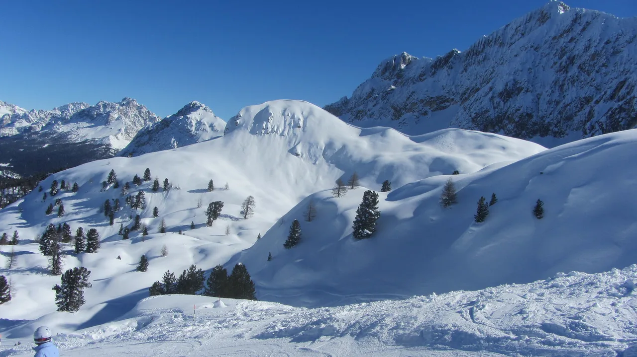
The western sectors around Cinque Torri, Col Gallina and Lagazuoi sit out along the Falzarego road and appear on the map as a separate cluster, not as an extension of Tofana. Lagazuoi is reached via Passo Falzarego, and the map shows the link between the pass and the surrounding lifts clearly enough to plan a day out there.
These sectors feel quieter and more scenic than the town-side groups, and they suit skiers who want to combine a drive with a varied day. If you are relying on public transport, check the map's bus links before committing, because the road out to the pass is not a walkable extension of town.
Where Cortina sits inside Dolomiti Superski
Cortina is one of the resorts covered by Dolomiti Superski, the umbrella organisation whose map also includes Alta Badia, Val Gardena, Val di Fassa and Arabba. The wider Dolomiti Superski area is enormous — over 1,200 km of piste and around 450 lifts — but those figures describe the whole network, not Cortina's own terrain.
The Sella Ronda is the long-distance circuit that loops around the Sella massif, linking Alta Badia, Val Gardena, Val di Fassa and Arabba rather than Cortina itself. If a Sella Ronda day is on your list, check the map and the pass coverage before you build your trip around it, because the drive from Cortina to the circuit is a substantial one. Reading a Canazei Ski Map helps here, since Val di Fassa is one of the Sella Ronda's four valleys.
For most Cortina trips, the local sectors are the main event and the wider network is a bonus for a day out. If you are weighing a Cortina trip against other Dolomites bases, the Cortina Skiing Guide covers how the resort fits into a wider itinerary.
Choosing a base by map
The town centre suits skiers who want to walk to the Faloria lifts and keep the car parked; you trade quick access to Tofana and the western sectors for convenience on foot. Staying near the Tofana base on the western edge puts you closer to the larger local terrain and the road out to Falzarego, at the price of a less central evening.
If you plan to split your days between sectors, a base with easy road access and parking matters more than a short walk to one lift. Look at how the map's lift bases sit relative to the main roads before you commit to accommodation, then decide whether walking distance or driving flexibility is worth more to you.
Beginner zones and gentle return runs
Beginners should read the map for green and blue terrain near each base rather than heading straight for the higher lifts. The town-side Faloria–Cristallo area and the lower slopes at Tofana both show gentle options within reach of the lift stations, which keeps a first day manageable.
The return runs matter as much as the beginner zones themselves: check that the easiest way back to the base is within your level before you ride up. If you are booking Cortina ski lessons, arrange them before you travel so you know which base your instructor uses on the map.
Equipment can be sorted once you arrive, but booking Cortina ski hire in advance saves time on the first morning and lets you pick up close to your sector's lift base.
Lift-pass products and where to buy
The Cortina area pass covers the local sectors, while the Dolomiti Superski pass extends your options across the wider network. Which one you need depends on your itinerary: a week of local skiing does not require the superski product, but a Sella Ronda day or a trip toward Alta Badia might.
Buy your pass before you travel through the official Cortina and Dolomiti Superski channels, where current products and prices are published. Compare the products against the sectors you actually plan to ski rather than buying the widest pass by default.
Downloading the map for the mountain
The Dolomiti Superski piste map is the version to carry: download it to your phone or print a copy, and check the Dolomiti Superski site for the current edition before you travel. A paper map in a jacket pocket still works when the phone battery dies on a cold day.
Live lift status is usually published online by the lift operator, so check it the morning you plan a sector out along the Falzarego road. If a link or lift is not running, the map's alternate lift bases make it easier to switch plans without wasting the day.
Practical next steps
Before you book, decide which sectors you actually want to ski and choose a base that reflects that. Book ski school and any hire you need early, particularly over peak weeks, and download the official map so you can plan each day on the ground.
The Cortina Skiing Guide pulls the resort together as a whole, and the Cortina Ski Season page explains how the winter is structured so you can time your trip with confidence.
Plan Your Visit
A Cortina ski trip goes more smoothly once you stop looking for one connected circuit and start treating the resort as a set of separate mountain groups. Pick your sectors from the map, match your pass to them, and choose a base that suits how you want to move between Faloria, Tofana and the western valleys.
Check the official maps and lift status before you travel, and have the map downloaded for the days you are on the mountain. With that groundwork done, the resort's layout stops being a puzzle and starts being an itinerary.
Frequently Asked Questions
Is Cortina's ski area all connected on one lift pass?
The local Cortina pass covers the resort's own sectors, which are grouped around Faloria–Cristallo, Tofana and the western areas near Passo Falzarego. The Dolomiti Superski pass extends coverage across the wider Dolomites network. Check the official product list before you buy to match the pass to the sectors you plan to ski.
What are the main ski sectors in Cortina d'Ampezzo?
The resort is usually divided into Faloria–Cristallo to the east, Tofana to the west and the western group around Cinque Torri, Col Gallina and Lagazuoi beyond Passo Falzarego. Each has its own lift base and road access, so they work as separate days rather than one continuous circuit.
Where should I stay in Cortina to be near the lifts?
Staying near the town centre puts the Faloria lifts within walking distance, while a base near Tofana or with good road access suits skiers planning to drive to the western sectors. Decide whether walking distance or driving flexibility matters more to you.
Do I need a car to ski the different Cortina sectors?
A car makes it easier to reach Tofana and the western sectors around Passo Falzarego, but the town-side Faloria lifts are accessible on foot from the centre. Public bus links between lift bases are shown on the piste map, so check those before deciding whether to hire a car.
Is Cortina part of the Dolomiti Superski pass?
Yes. Cortina is one of the resorts included in the Dolomiti Superski network, alongside Alta Badia, Val Gardena, Val di Fassa and Arabba. The wider pass gives access to the Sella Ronda and other Dolomites areas, but check coverage against your itinerary before buying.
Which Cortina sector is best for beginners?
The town-side Faloria–Cristallo area and the lower slopes at Tofana both offer gentle terrain near the lift bases. Read the map's green and blue runs and confirm the easiest return to the base before heading up, and book ski lessons in advance so you know which base your instructor uses.
Where can I download the Cortina piste map?
Download the piste map from the official Cortina and Dolomiti Superski channels, and keep a printed copy as a backup for cold days when a phone battery drains. Live lift status is usually published by the lift operator, so check it before travelling out to a sector.
Sources
Useful notes for your next ski trip
Optional updates to our Alpine resort guides.
You might also like
Continue reading
More guides you'll find useful